|
REFINE
Browse All : H2004-135, Bishop of Wyoming and Natrona County
1-2 of 2
Title
Casper Area Topographic Map Township 24-Township 25, Range 77-Range 94
Date
1955
Description
Casper Area Topographic Map by US Geological Survey, includes Township 24-Township 35, Range 77-Range 94
Category - Type
Map-Topo
Title
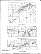
Fort Caspar, Independence Rock & South Pass Map
Date
1959
Description
02 Fort Casper, Independence Rock & South Pass Map by LC Bishop, includes townships, ranges, rivers, creeks, roads, trails, pony express stations, graves, 2 paper copies
Category - Type
Military-Fort Caspar
1-2 of 2
|

