|
REFINE
Browse All : Historical of AS Shelf 9099 and Wyoming
1-6 of 6
Title
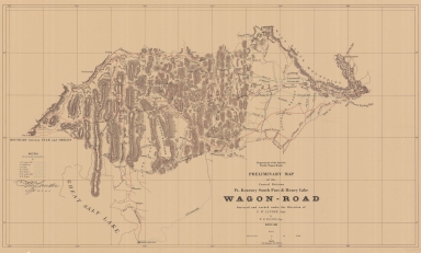
Fort Kearney, South Pass, and Honey Lake Wagon Road Preliminary Map (Lander's Cut-off)
Date
1857-1858
Description
Fort Kearney, South Pass, and Honey Lake Wagon Road Preliminary Map (Lander's Cut-off) 1857-by FW Lander and WH Wagner, includes roads, rivers, creeks, passes, gaps, railroads, cities, towns, mountains, 3 copies, paper
Category - Type
Map-Trail or Road
Title
Wyoming Map
Date
Undated
Description
WY Map by Works Projects Administration (WPA),, paper
Category - Type
Map-State
Title
FE Warren Air Force Base Plan
Date
1964
Description
FE Warren Air Force Base Plan, paper
Category - Type
Military-Fort Warren
Title
Fort Bridger Plan
Date
Undated
Description
Fort Bridger Plan, Paper
Category - Type
Military-Fort Bridger
Title
Albany County Mining Map, Spring Creek & Lake Creek Placers
Date
Undated
Description
Albany County Mining Map, Spring Creek & Lake Creek Placers, linen
Category - Type
Map-Mineral
1-6 of 6
|


