|
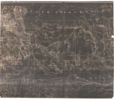
Title
Wyoming Map
Date
1900
Description
WY Map by US Dept of Interior, General Land Office includes surveyor general's office, US Land offices, townships, ranges, Indian reservations, military reservations, forest reserves 3 copies ( 1 reverse positive)-not colored map?
Category - Type
Map-State
Title
Johnson's Nebraska, Dakota, Idaho, Montana (includes Wyoming) map
Date
1868 Circa
Description
Johnson's Nebraska, Dakota, Idaho, Montana (includes WY) includes creeks, rivers, roads pages 62-63 1 original, 1 transparency, 1 blue line
Category - Type
Map-State
Title
Johnson's Nebraska, Dakota, Idaho, Montana (includes Wyoming) map
Date
1868 Circa
Description
Johnson's Nebraska, Dakota, Idaho, Montana (includes WY) includes creeks, rivers, roads pages 62-63 2 copies
Category - Type
Map-State
Title
Wyoming Map
Date
1868 Circa
Description
WY Map, includes portions of Nebraska, Dakota, Montana, Idaho, Colorado, Utah, cities, towns, forts, railroads, rivers, creeks, mountains, Indians, 1 partial map, negative, paper
Category - Type
Map-State
Title
Wyoming Map
Date
1868 Circa
Description
WY Map, includes portions of Nebraska, Dakota, Montana, Idaho, Colorado, Utah, cities, towns, forts, railroads, rivers, creeks, mountains, Indians, 1 partial map, negative, paper
Category - Type
Map-State
Title
Wyoming Map
Date
1869
Description
WY Map (accompanied the annual report of the commissioner of the general land office) 2 copies 1 partial-negative, 1 copy
Category - Type
Map-State
Title
Colorado, Wyoming, Dakota, Montana County map
Date
1869 Circa
Description
County map of Colorado, WY, Dakota, Montana includes rivers, creeks, forts, pony express route pages 88, 89
Category - Type
Map-State
Title
Colton's map of Dakota & Wyoming
Date
1869 Circa
Description
Colton's map of Dakota & WY includes cities, towns, trails, forts, mountains, railroads, rivers and creeks, (Indian tribes along the trails), 1 set with 1sheet colored paper
Category - Type
Map-State
Title
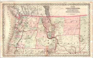
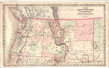
Colton's Oregon, Washington, Idaho, Montana & British Columbia (includes Wyoming) map
Date
1869 Circa
Description
Colton's Oregon, Washington, Idaho, Montana & British Columbia (includes WY) includes creeks, rivers, railroads, cities, towns, trails, forts pages 82, 83
Category - Type
Map-State
Title
Kansas, Nebraska, Colorado & Dacotah (includes Wyoming) map
Date
1869 Circa
Description
Map of Kansas, Nebraska, Colorado & Dacotah (includes WY) includes rivers, creeks, cities, towns, forts page 52
Category - Type
Map-State
Title
Wyoming, Washington, Montana, Oregon, California, Nevada, Utah Map
Date
1872
Description
WY, Washington, Montana, Oregon, California, Nevada, Utah Map from Steiler's Hand Atlas page 81 by H Habenicht, Metzeroth, Eberhardt, Kramer, includes cities, towns, mountains, rivers, natl park, passes, forts, trails, stations, lakes, ocean, deserts , colored
Category - Type
Map-State
Title
Asher & Adams' Map of Wyoming (mislabeled 1874)
Date
1872 Circa
Description
Asher & Adams' Map of WY (mislabeled 1874) includes townships, ranges, cities, towns, railroads, rivers, creeks
Category - Type
Map-State
Title
Asher & Adams' Map of Wyoming (mislabeled 1874)
Date
1872 Circa
Description
Asher & Adams' Map of WY (mislabeled 1874) includes townships, ranges, cities, towns, railroads, rivers, creeks
Category - Type
Map-State
Title
Johnson's Nebraska, Dakota, Idaho, Montana & Wyoming Map
Date
1873 Circa
Description
Johnson's Nebraska, Dakota, Idaho, Montana & WY Map includes north Colorado, Kansas & Utah; northeast Nevada;east Washington & Oregon, west Minnesota & Iowa, cities, towns, rivers, railroads, Pease County pages 76, 77, colored map
Category - Type
Map-State
Title
Wyoming Map
Date
1875 Circa
Description
WY Map includes townships, ranges, rivers, 20 mile limit, Indian reservations page 86 (5 County Map)
Category - Type
Map-State
Title
Wyoming Map
Date
1875 Circa
Description
WY Map drawn by WM Masi for JH Triggs' History of Cheyenne & Northern WY includes rivers, creeks, railroads, forts, wagon roads and trails, mountains
Category - Type
Map-State
Title
Wyoming Map
Date
1876
Description
WY Map by US Dept of Interior, General Land Office Includes Surveyor general's office, Land offices, townships, ranges, military reservations, Indian reservations, cities, towns, railroad, forts, rivers, creeks, 3 copies, 2 Negative, 2 Positive - cites National Archives
Category - Type
Map-State
Title
Post Route Map (Preliminary) Wyoming
Date
1878-1879
Description
Preliminary Post Route Map by US Postmaster General DM Key, topographer WL Nicholson, includes Post Routes, counties, rivers, creeks, mountains, national park, 3 pages color coded linen
Category - Type
Map-State
Title
Post Route Map (Preliminary) Wyoming
Date
1878-1879
Description
Preliminary Post Route Map by US Postmaster General DM Key, topographer WL Nicholson, includes Post Routes, counties, rivers, creeks, mountains, national park, 3 pages color coded linen
Category - Type
Map-State
Title
Post Route Map (Preliminary) Wyoming
Date
1878-1879
Description
Preliminary Post Route Map by US Postmaster General DM Key, topographer WL Nicholson, includes Post Routes, counties, rivers, creeks, mountains, national park, 3 pages color coded linen
Category - Type
Map-State
Title
Wyoming Map
Date
1879
Description
WY Map by US Dept of Interior, General Land Office includes Surveyor General's office, Land offices, townships, ranges, cities, towns, rivers, creeks, railroad, 20 mile limit, forts, military reservations, Indian reservations, includes Pease County 2 copies, 1 Mylar
Category - Type
Map-State
Title
Colton's Montana, Idaho & Wyoming Map
Date
1879 Circa
Description
Colton's Montana, Idaho & WY Map includes townships, ranges, rivers, creeks, mountains, cities, towns, railroad, counties (Pease County), west Dakota, NE, north Utah, east WA & OR. Narrative regarding Russian Empire printed on back of map, pages 84, 85
Category - Type
Map-State
Title
Wyoming Map
Date
1879 Circa
Description
WY Map, No Citation Information includes townships, ranges, rivers, camps, 20 mile limits 2 copies page 86
Category - Type
Map-State
Title
New Railroad & County Map of Wyoming, Montana and Idaho
Date
1882 Circa
Description
New Railroad & County Map of WY, MT and ID maps on other sides, includes counties, cities, forts, rivers, creeks, colored, paper (1882 handwritten on map, since it includes Pease County rather than Johnson County, it's probably ca1880). Note: Uinta County is misspelled on map (It shows Uintah County)
Category - Type
Map-State
Title
Holts New Map of Wyoming, 1978 reprint of 1883 map
Date
1883
Description
Holts New Map of WY, reprint of 1883 map at 2/3's scale
Category - Type
Map-State
Title
Holts New Map of Wyoming, reprint of 1883
Date
1883
Description
Holts New Map of WY, 1985 reprint of 1883 map at 2/3's scale
Category - Type
Map-State
Title
Wyoming Map
Date
1883
Description
WY Map, Holts, linen
Category - Type
Map-State
Title
Wyoming Map 1936 reproduction of 1883 Holt's map
Date
1883
Description
WY Map 1936 reproduction of 1883 Holt's map "Map of trails, ranches, cattle roundup districts, etc "
Category - Type
Map-State
Title
Holts New Map of Wyoming
Date
1883 Circa
Description
Holts New Map of WY includes townships, ranges, rivers, creeks, cities, towns, trails, 20 mile limit, railroad, ranches, forts, roads--4 copies, 1 on cardboard, 1 linen backed, 1 negative in 4 pieces (We have a reduced copy which we have printed - do not duplicate original)
Category - Type
Map-State
Title
Holts New Map of Wyoming
Date
1884
Description
Holts New Map of WY includes townships, ranges, rivers, creeks, cities, towns, mining districts 3 copies
Category - Type
Map-State
Title
Holts New Map of Wyoming
Date
1885
Description
Holts New Map of WY COPIES
Category - Type
Map-State
Title
Holts New Map of Wyoming
Date
1885
Description
Holts New Map of WY COPIES
Category - Type
Map-State
Title
Colton's Map of Wyoming
Date
1886
Description
Colton's Map of WY, Colorado & Utah includes townships, ranges, railroads, creeks, rivers, mountains, forts, number 86
Category - Type
Map-State
Title
Wyoming Map
Date
1886
Description
WY Map by George Cram includes cities, towns, reserves, rivers, creeks page 73
Category - Type
Map-State
Title
Wyoming Map
Date
1886
Description
WY Map by George Cram includes cities, towns, reserves, rivers, creeks page 73
Category - Type
Map-State
Title
Wyoming Map
Date
1886
Description
WY Map by George Cram includes cities, towns, reserves, rivers, creeks page 73
Category - Type
Map-State
Title
Wyoming Map
Date
1886
Description
WY Map by George Cram includes cities, towns, reserves, rivers, creeks page 73
Category - Type
Map-State
Title
Holts New Map of Wyoming
Date
1886 Circa
Description
Holts New Map of WY includes cities, towns, rivers, creeks, mountains, railroads, roads, 20 mile limit
Category - Type
Map-State
Title
Holts New Map of Wyoming
Date
1886 Circa
Description
Holts New Map of WY includes cities, towns, rivers, creeks, mountains, railroads, roads, 20 mile limit
Category - Type
Map-State
Title
Holts New Map of Wyoming
Date
1887 Circa
Description
Holts New Map of WY includes cities, towns, rivers, creeks, mountains, railroads, roads, 20 mile limit
Category - Type
Map-State
Title
Holts New Map of Wyoming
Date
1887 Circa
Description
Holts New Map of WY includes cities, towns, rivers, creeks, mountains, railroads, roads, 20 mile limit
Category - Type
Map-State
Title
Montana, Idaho & Wyoming County & Township Map
Date
1887 Circa
Description
County & Township Map of Montana, Idaho & WY includes cities, towns, townships, ranges, rivers, creeks, mountains, roads, proposed roads page 86, 87
Category - Type
Map-State
Title
Wyoming Map
Date
1888
Description
WY Map by US Dept of Interior, General Land Office includes surveyor generals office, land office, Indian & military, townships, ranges, railroad land grant, oil & coal fields, geological features from survey by Gilbert Barney, 1 linen backed colored map
Category - Type
Map-State
Title
Wyoming Map
Date
1888
Description
WY Map by US Dept of Interior, General Land Office includes surveyor generals office, land office, Indian and military, townships, ranges, railroad land grant, oil & coal fields, geological features from survey by Gilbert Barney, colored map, 3 copies
Category - Type
Map-State
Title
Wyoming Map
Date
1890
Description
WY Map includes townships, ranges, index, cities, towns, rivers, creeks, mountains pages 236, 237
Category - Type
Map-State
Title
Holts New Map of Wyoming
Date
1890 Circa
Description
Holts New Map of WY (mislabeled 1883) includes cities, towns, rivers, creeks, mountains, railroads, roads, forts, mining districts, 20 mile limit (cannot copy)
Category - Type
Map-State
|


