|
REFINE
Browse All : Map-State and Wyoming Map and Still Image of 1
1-8 of 8
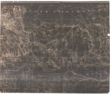
Title
Wyoming Map
Date
1868 Circa
Description
WY Map, includes portions of Nebraska, Dakota, Montana, Idaho, Colorado, Utah, cities, towns, forts, railroads, rivers, creeks, mountains, Indians, 1 partial map, negative, paper
Category - Type
Map-State
Title
Wyoming Map
Date
1868 Circa
Description
WY Map, includes portions of Nebraska, Dakota, Montana, Idaho, Colorado, Utah, cities, towns, forts, railroads, rivers, creeks, mountains, Indians, 1 partial map, negative, paper
Category - Type
Map-State
Title
Wyoming Map
Date
1869
Description
WY Map (accompanied the annual report of the commissioner of the general land office) 2 copies 1 partial-negative, 1 copy
Category - Type
Map-State
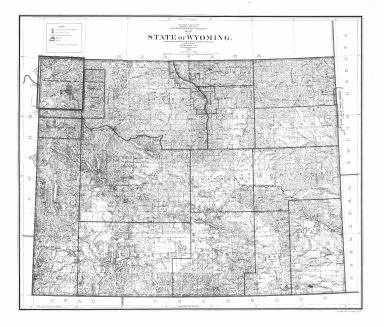
Title
Wyoming Map
Date
1900
Description
WY Map by US Dept of Interior, General Land Office includes surveyor general's office, US Land offices, townships, ranges, Indian reservations, military reservations, forest reserves 3 copies ( 1 reverse positive)-not colored map?
Category - Type
Map-State
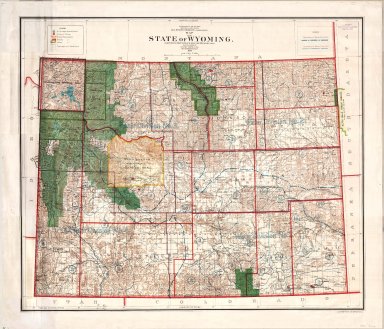
Title
Wyoming Map
Date
1900
Description
WY Map by US Dept of Interior, General Land Office includes surveyor general's office, US Land offices, townships, ranges, Water Divisions & Districts, Indian reservations, military reservations, forest reserves, 1 linen backed paper copy
Category - Type
Map-State
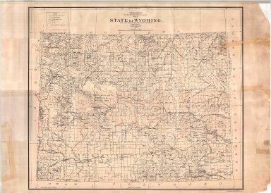
Title
Wyoming Map
Date
1900
Description
WY Map by US Dept of Interior, General Land Office includes surveyor general's office, US Land offices, townships, ranges, Indian reservations, military reservations, forest reserves, 2 copies
Category - Type
Map-State
Title
Wyoming Map
Date
1906
Description
WY Map by Kenyon Printing & Manufacturing Co. copyrighted in 1906 by George F Cram index to towns, counties and railroads on back, Stockgrowers National Bank stamped on front Xerox copy. Map includes townships & ranges, counties, cities & towns, railroads, mountains & hills, rivers and lakes, 1 set with 1 sheet xerox paper
Category - Type
Map-State
1-8 of 8
|