|
REFINE
Browse All : Map-Survey and H2007-3 and Still Image of 2 from 1892
1-6 of 6
Title
Survey Map Township 40, Range 105, Sections1 - 36
Date
1892
Description
Survey Map by Wm A. Richards, surveyed-Carpenter & Warner, US Surveyor General's Office, Township 40, Range 105, Sections1 - 36, incl topo info, Indian Trail, Wind River, Shoshone/Wind River Indian Reservation, Initial Monument, Bonneville National Forest , road, creeks, No. 4374, 1 set with 1 sheet negative paper
Category - Type
Map-Survey
Title
Survey Map Township 41, Range 105, Sections 1 - 36
Date
1892
Description
Survey Map by Wm A. Richards, surveyed by Carpenter & Warner, US Surveyor General's Office, Township 41, Range 105, Sections 1 - 36, includes topo info, Wind River, Shoshone/Wind River Indian Reservation, bad lands, road, creeks, 1 set with 1 sheet negative paper
Category - Type
Map-Survey
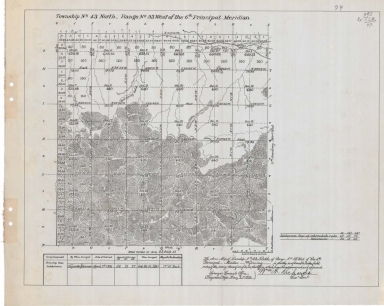
Title
Survey Map Township 43, Range 93, Sections 1 - 36
Date
1892
Description
Survey Map by Wm A. Richards, surveyed by Carpenter & Warner, US Surveyor General's Office, printed-A Gast & Co, Township 43, Range 93, Sections 1 - 36, includes topo info, road, spring, creeks, total number of acres, dates of contracts, amount of surveys , magnetic declination, No 4396, 1 set with 1 sheet negative paper
Category - Type
Map-Survey
Title
Survey Map Township 43, Range 95, Sections 1 - 12, 15 - 21
Date
1892
Description
Survey Map surveyed by Carpenter & Warner, US Surveyor General's Office, Township 43, Range 95, Sections 1 - 12, 15 - 21, includes Wind River or Shoshone Indian Reservation Boundary, topo info, roads, creeks, total acres surveyed, No. 1972, 1 set with 1 sheet negative paper
Category - Type
Map-Survey
Title
Survey Map Township 44, Range 95, Sections 13, 18 - 36
Date
1892
Description
Survey Map by Wm A. Richards, surveyed by Carpenter & Warner, US Surveyor General's Office, printed-A Gast & Co, Township 44, Range 95, Sections 13, 18 - 36, includes topo info, creeks, total number of acres, dates of contracts, amount of surveys, magnetic declination, No 4418, 1 set with 1 sheet negative paper
Category - Type
Map-Survey
Title
Survey Map, Township 44, Range 93, Sections 1 - 36
Date
1892
Description
Survey Map, surveyed by Carpenter & Warner, US Surveyor General's Office, Township 44, Range 93, Sections 1 - 36, includes topo info, road, cliffs, coal croppings, creeks, total number of acres, dates of contracts, amount of surveys magnetic declination, No 4398, 1 set with 1 sheet negative paper
Category - Type
Map-Survey
1-6 of 6
|