|
REFINE
Browse All : Map-Trail or Road of Fremont County
1-9 of 9
Title
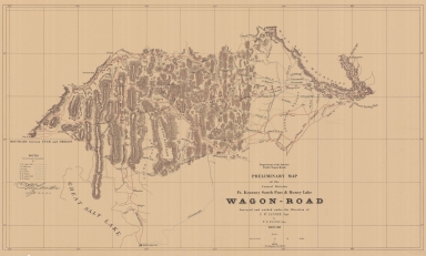
Fort Kearney, South Pass, and Honey Lake Wagon Road Preliminary Map (Lander's Cut-off)
Date
1857-1858
Description
Fort Kearney, South Pass, and Honey Lake Wagon Road Preliminary Map (Lander's Cut-off) 1857-by FW Lander and WH Wagner, includes roads, rivers, creeks, passes, gaps, railroads, cities, towns, mountains, photostatic copy
Category - Type
Map-Trail or Road
Title
Fort Kearney, South Pass, and Honey Lake Wagon Road Preliminary Map (Lander's Cut-off)
Date
1857-1858
Description
Fort Kearney, South Pass, and Honey Lake Wagon Road Preliminary Map (Lander's Cut-off) 1857-by FW Lander and WH Wagner, includes roads, rivers, creeks, passes, gaps, railroads, cities, towns, mountains 2 copies, paper
Category - Type
Map-Trail or Road
Title
Fort Kearney, South Pass, and Honey Lake Wagon Road Preliminary Map (Lander's Cut-off)
Date
1857-1858
Description
Fort Kearney, South Pass, and Honey Lake Wagon Road Preliminary Map (Lander's Cut-off) 1857-by FW Lander and WH Wagner, includes roads, rivers, creeks, passes, gaps, railroads, cities, towns, mountains, 3 copies, paper
Category - Type
Map-Trail or Road
Title
Fort Kearney, South Pass, and Honey Lake Wagon Road Preliminary Map (Lander's Cut-off)
Date
1858
Description
Preliminary map Fort Kearney Wagon Road, 1857-1858 4 copies
Category - Type
Map-Trail or Road
Title
Parting of the Ways Map
Date
1959
Description
03 Parting of the Ways Map by LC Bishop, includes townships, ranges, rivers, creeks, roads, trails, pony express stations, stage stations, graves, 1 sheet vellum, 4 paper copies
Category - Type
Map-Trail or Road
Title
Landers Cut Off, East & West Section Map
Date
1959-1960
Description
05 Landers Cut Off, East & West Section Map by LC Bishop, includes townships, ranges, rivers, creeks, roads, trails, pony express stations, graves, 2 copies
Category - Type
Map-Trail or Road
Title
Landers Cut Off, East & West Section Map
Date
1959-1960
Description
05 Landers Cut Off, East & West Section Map by LC Bishop, includes townships, ranges, rivers, creeks, roads, trails, pony express stations, graves, 1 sheet vellum, 6 paper copies
Category - Type
Map-Trail or Road
Title
Oregon Trail map/South Pass to Big Sandy
Date
1973
Description
Map Oregon Trail/South Pass to Big Sandy blueprint
Category - Type
Map-Trail or Road
Title
Wyoming State Training School Maghee Park
Date
1912
Description
WY State Training School Maghee Park, by NH Grown includes public road, ditch, irrigation pipe, school, water main, old sewer, telephone line, water pipe, cellar, barn, light line, topographic information, 1 set with 1 sheet blueprint, laminated
Category - Type
Map-Trail or Road
1-9 of 9
|


