|
Title
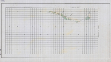
Wyoming State Engineer Streams & Diversions Map of Little Camp Creek, Muddy Creek, Whiskey Creek, Mahoney Ditch, Muddy Creek Ditch, Speyer Ditch, Hays Ditch
Date
Undated
Description
WY State Engineer Streams & Diversions Map of Little Camp Creek, Muddy Creek, Whiskey Creek, Mahoney Ditch, Muddy Creek Ditch, Speyer Ditch, Hays Ditch in Township 27, Range 89-Range 90, Map 8102, 1 set with 1 sheet paper
Category - Type
Map-Water
Title
Wyoming State Engineer Streams & Diversions Map of Muddy Creek, Cottonwood Creek, June Creek, Marsh Ditch in Township 26, Range 88-Range 89
Date
Undated
Description
WY State Engineer Streams & Diversions Map of Muddy Creek, Cottonwood Creek, June Creek, Marsh Ditch in Township 26, Range 88-Range 89, Map 8102, 1 set with 1 sheet paper
Category - Type
Map-Water
Title
Wyoming State Hospital Water System Profile & Design
Date
1905
Description
WY State Hospital Water System Profile & Design by W Newbrought, 1 set with 2 sheets blueprint
Category - Type
Map-Water
Title
Wyoming State Hospital Water Plat of Township 15, Range 120
Date
1906
Description
WY State Hospital Water Plat of Township 15, Range 120 by Clarence Johnson-WY State Engineer, includes river, city canal, land to be irrigated, railroad, 1 set with 1 sheet blueprint
Category - Type
Map-Water
Title
Wyoming State Penitentiary Water Supply Pipeline & Reservoir Map
Date
1909
Description
WY State Penitentiary Water Supply Pipeline & Reservoir Map by NA Patton, 1 set with sheet blueprint
Category - Type
Map-Water
Title
Wyoming State Boys School/Industrial Institute Bluff Canal Enlargement Plat
Date
1911
Description
WY State Boys School/Industrial Institute Bluff Canal Enlargement Plat, 1 set with 1 sheet blueprint (creased & torn)
Category - Type
Map-Water
Title
Wyoming State Penitentiary, Honor Farm Map Showing Location of Construction Drains & Affected Areas
Date
1931
Description
WY State Penitentiary, Honor Farm Map Showing Location of Construction Drains & Affected Areas based on State Engineers map, 1 set with 1 sheet color-coded blueline paper
Category - Type
Map-Water
Title
Wyoming State Girls School Field Drainage System Plan & Profile
Date
1932
Description
WY State Girls School Field Drainage System Plan & Profile by EC Gwillam, 1 set with 1 sheet blueprint
Category - Type
Map-Water
Title
Wyoming State Girls School Proposed Sewage Distribution Field Plan
Date
1937
Description
WY State Girls School Proposed Sewage Distribution Field Plan by JR Ellis, 1 set with 1 sheet blueline paper
Category - Type
Map-Water
Title
Wyoming State Childrens Home Irrigation & Water Supply Layout & Profile
Date
1949
Description
WY State Childrens Home Irrigation & Water Supply Layout & Profile by Robert L Streeter, job 4901, 1 set 5 sheets paper
Category - Type
Map-Water
Title
Wyoming State Childrens Home Irrigation Water Supply
Date
1951
Description
WY State Childrens Home Irrigation Water Supply by Robert L. Streeter, job 4902, 1 set with 5 sheets paper
Category - Type
Map-Water
Title
LaPrele Dam Rehab, contract drawings
Date
1977
Description
LaPrele Dam Rehab, contract drawings
Category - Type
Map-Water
Title
Wyoming Hot Springs State Park Extension of Hot & Cold Water Works
Date
Undated
Description
Wyoming Hot Springs State Park Extension of Hot & Cold Water Works by MD Woolery, 1 set with 1 sheet blueprint
Category - Type
Map-Water
Title
Wyoming State Boys School/Industrial Institute Colter Drainage District Plat
Date
Undated
Description
WY State Boys School/Industrial Institute Colter Drainage District Plat, 1 set with 1 sheet blueprint
Category - Type
Map-Water
Title
Wyoming State Boys School/Industrial Institute Colter Drainage District Plat-Detail
Date
Undated
Description
WY State Boys School/Industrial Institute Colter Drainage District Plat-Detail, 1 set with 1 sheet blueprint
Category - Type
Map-Water
Title
Wyoming State Penitentiary, Honor Farm Drainage System Map
Date
Undated
Description
WY State Penitentiary, Honor Farm Drainage System Map, includes boundary of seeped land & existing draws, 1 set with 1 sheet color-coded paper
Category - Type
Map-Water
Title
Wyoming State Penitentiary, Honor Farm Drainage System Map
Date
Undated
Description
WY State Penitentiary, Honor Farm Drainage System Map, includes existing drains, natural water courses, proposed drain, 3 sets, 1 sheet paper (1 map color-coded)
Category - Type
Map-Water
Title
Sptted Trail Creek drawing, showing water tank locations, center of dam, notation-Mineral City, WY via Tinton, SD
Date
Undated
Description
Sptted Trail Creek drawing, showing water tank locations, center of dam, notation-Mineral City, WY via Tinton, SD
Category - Type
Map-Water
Title
Sherman Quadrangle-Hartville, Fort Steele, Laramie
Date
1891-1903
Description
Sherman Quadrangle-Hartville, Fort Steele, Laramie, WY State Engineer by US Geological Survey including streams, forests & lands, 1891, 19031 set with 2 sheets paper
Category - Type
Map-Water
Title
Wyoming State Engineer Streams & Diversions Map of Crazy Woman Creek, etc, in Township 46-Township 47, Range 83-Range 84
Date
Undated
Description
WY State Engineer Streams & Diversions Map of Crazy Woman Creek, Steele Creek, Poison Creek, Mattox Creek, Pole Creek, Beaver Creek, Mayflower Ditch, North Side Ditch, Freeman Ditch in Township 46-Township 47, Range 83-Range 84, Map 8052, 1 set with 1 sheet paper
Category - Type
Map-Water
Title
Wyoming State Engineer Streams & Diversions Map of Steele Creek, etc
Date
Undated
Description
WY State Engineer Streams & Diversions Map of Steele Creek, Poison Creek, Crazy Woman Creek, Horn Creek, Poison Creek Ditch, Mitchell Ditch, Long Ditch, Teddy Miller Ditch, Steele Creek Ditch, John P Smith Ditch, Moreton Ditch, Harris Ditch, Spang Ditch in Township 46-Township 47, Range 81-Range 82, Map 8052, 1 set with 1 sheet paper
Category - Type
Map-Water
Title
Kendrick Project, Seminoe Dam to Cheyenne Plat of Transmission Line Across Land of PH Lorenz & Lorenz Livestock Co
Date
1939
Description
Kendrick Project, Seminoe Dam to Cheyenne Plat of Transmission Line Across Land of PH Lorenz & Lorenz Livestock Co by US Dept of Interior, Bureau of Reclamation, Submitted by SK Wagner, Recommended by IJ Matthews, includes Township, Range, Section, Land Owners Names, Location of Transmission Line, County Boundaries, 4 copies blueline paper
Category - Type
Map-Water
Title
Periods of Records of Stream Gages in WY
Date
1962
Description
Periods of Records of Stream Gages in WY by Natural Resources Research Institute, UW College of Engineering, includes designations of gage records kept (?), 1 set with 1 sheet blueline paper
Category - Type
Map-Water
Title
Gage Rod Standard Plan map
Date
Undated
Description
Map Standard Plan for Gage Rod blueprint
Category - Type
Map-Water
Title
Streams & Diversions Map of Clark's Fork River, Doctor Ditch, Ream Thompson Ditch, Clarence Extension, Foust Extension, Simpson Extension-Spring Ditch
Date
Undated
Description
WY State Engineer Streams & Diversions Map of Clark's Fork River, Doctor Ditch, Ream Thompson Ditch, Clarence Extension, Foust Extension, Simpson Extension-Spring Ditch, in Township 57, Range 101, 1 set with 1 sheet paper
Category - Type
Map-Water
Title
Wyoming State Engineer Streams & Diversions Map of Clark's Fork River, etc
Date
Undated
Description
WY State Engineer Streams & Diversions Map of Clark's Fork River, McWilliams Ditch, Little Rockey Creek & Ditch, Bennette Creek & Ditch, Owens Ditche, Grace Ditch, Englebright Ditch, Shannon Ditch, Nuttling Ditches, Huniger Ditch, , Mary Francis Ditch Kelly Ditch,Olive May Ditch,Herdserabble Ditch, Richards Ditch, Dorothy Ditch, Arnett Ditch, Frye Ditch, Wood Ditch, Davis Ditch, Berry S. Side Ditch, Simpson Extension, Spring Ditch, Ream Thompson Ditch, Curlip Ditch, Last Chance Ditch T57, R102-103
Category - Type
Map-Water
Title
Wyoming Exploration Company Pine Dome Controversy/Carter Ditches No. 2 & 3 Showing Lands Irrigated under Ditch Map
Date
Undated
Description
WY Exploration Company Pine Dome Controversy/Carter Ditches #2 & 3 Showing Lands Irrigated under Ditch Map, Water Permits #1051 & 160, 1 set with 1 sheet vellum
Category - Type
Map-Water
|