|
REFINE
Browse All : Still Image and Historical and Map-State of Wyoming
1-17 of 17
Title
Wyoming Map 1936 reproduction of 1883 Holt's map
Date
1883
Description
WY Map 1936 reproduction of 1883 Holt's map "Map of trails, ranches, cattle roundup districts, etc "
Category - Type
Map-State
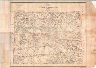
Title
Wyoming Map
Date
1888
Description
WY Map by US Dept of Interior, General Land Office includes surveyor generals office, land office, Indian & military, townships, ranges, railroad land grant, oil & coal fields, geological features from survey by Gilbert Barney, 1 linen backed colored map
Category - Type
Map-State
Title
Wyoming Map
Date
1892
Description
WY Map by US Dept of Interior, General Land Office includes surveyor general's office, US Land offices, townships, ranges, incomplete railroads, stage stations, 1 sheet colored linen backed paper
Category - Type
Map-State
Title
Wyoming Map
Date
1892
Description
WY Map by US Dept of Interior, General Land Office includes surveyor general's office, US Land offices, townships, ranges, incomplete railroads, stage stations, 1 sheet colored linen backed paper
Category - Type
Map-State
Title
Wyoming Map
Date
1900
Description
WY Map by US Dept of Interior, General Land Office includes surveyor general's office, US Land offices, townships, ranges, Water Divisions & Districts, Indian reservations, military reservations, forest reserves, 1 linen backed paper copy
Category - Type
Map-State
Title
Wyoming Map
Date
1905
Description
WY Map by US Dept of Interior includes US surveyor general's office, US land offices, townships, ranges, Indian reservations, military reservations, forest reserves, national parks & monuments, bird reserves, land district boundaries
Category - Type
Map-State
Title
Wyoming Map
Date
1916
Description
WY Map by US Geological Survey, IP Berthrong, includes townships, ranges, cities, towns, counties, index to gauging stations, principal drainage basin boundaries, railroads, national forests, mountains, rivers, creeks, US Land Offices, 1 sheet linen backed colored paper
Category - Type
Map-State
Title
Wyoming Map
Date
1916
Description
WY Map by US Department of Interior, IP Berthrong, includes townships, ranges, cities, towns, counties, railroads, national forests, mountains, rivers, creeks, US Land Offices, colored
Category - Type
Map-State
Title
Railroad Map of Wyoming
Date
1918
Description
Railroad Map of WY by Classon Map Co, for the public service commission includes cities, towns, townships, ranges, rivers, creeks, railroads, roads, highways, index to cities, towns with population figures, national forests, paper, colored, 2 copies
Category - Type
Map-State
Title
Wyoming Map
Date
1937
Description
WY Map by US Dept of Interior, US Geological Survey, cartographer AF Hassan includes townships, ranges, counties, rivers, creeks, cities, towns, railroads, national forests, reservoirs, color coding of plant types (penciled on map), 1 map, linen backed
Category - Type
Map-State
Title
Wyoming Map
Date
1941
Description
WY Map by WPA includes tours of historic sites, cities, towns, rivers, creeks, mountains, highways, roads, paper, blueline 3 copies
Category - Type
Map-State
Title
Wyoming Map
Date
1941
Description
WY Map by WPA includes tours of historic sites, cities, towns, rivers, creeks, mountains, highways, roads, paper, blueline 3 copies
Category - Type
Map-State
Title
Wyoming Map
Date
1950 Circa
Description
WY Map showing Radioactive Anomalous by Cheyenne Photo Print, includes townships, ranges, cities, towns, counties, rivers, creeks, railroads, highways, national forests, Indian reservation, paper
Category - Type
Map-State
Title
Wyoming Land Status Map
Date
1967
Description
WY Land Status Map, Paper
Category - Type
Map-State
Title
Wyoming Map
Date
Undated
Description
WY Map by Works Projects Administration (WPA),, paper
Category - Type
Map-State
Title
Wyoming Resources Map
Date
1942
Description
WY Resources Map by WY Dept of Commerce & Industry from US Geological Survey base map includes townships, ranges, rivers, creeks, oil & gas fields, mineral locations, airfields, cities, towns, forests, counties, lakes, gas lines, paper, color coded 1 sheet paper-negative
Category - Type
Map-State
1-17 of 17
|