|
REFINE
Browse All : Still Image and Historical of Cheyenne
1-6 of 6
Title
Cheyenne Map
Date
1956
Description
Cheyenne Map by R Coggeshall compliments of Burke Moving and Storage, North American Van Lines, includes streets, avenues, parks, lakes, railroad, airport, highways, hospitals, refinery, state buildings, schools, post office, street index, paper
Category - Type
Map-City/Cheyenne
Title
Cheyenne Zoning Map
Date
1957-1958
Description
Cheyenne Zoning Map by AG Van Eman, 1958, rev 1957 includes lots, blocks, streets, avenues, parks, lakes, cemeteries, railroad, airport, military reservation, some building locators, zoning type and legend
Category - Type
Map-City/Cheyenne
Title
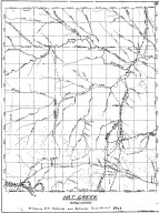
Hat Creek, Cheyenne Deadwood Stage Road Map
Date
1960
Description
10 Hat Creek, Cheyenne Deadwood Stage Road Map by LC Bishop, includes townships, ranges, rivers, creeks, roads, trails, pony express stations, graves, 1 sheet vellum, 15 paper copies
Category - Type
Map-Trail or Road
Title
Cheyenne Map
Date
1970 Circa
Description
Cheyenne Map by Western States Publish Co, compliments of Grand Central Texaco, includes photo of DePaul Hospital, various ads, streets, avenues, lakes, creek, airport, air force base, interstates, highways, country club, VA hospital, parks street and avenue index, paper, blueline
Category - Type
Map-City/Cheyenne
Title
Cheyenne Map
Date
Undated
Description
Cheyenne Map, Points of Interest, Home of Frontier Days, published by Cheyenne Chamber of Commerce by SL Hull, includes mail roads, location and drawings of points of interest, 1 undersized color map
Category - Type
Map-City/Cheyenne
1-6 of 6
|


