|
REFINE
Browse All : Still Image and Map-City/Cheyenne of Laramie County and CheyenneTitle
Cheyenne Plat
Date
1868
Description
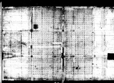
Cheyenne Plat by Cheyenne City Council & SH Winsor, surveyor includes lots, blocks, streets, drawings of some buildings, railroad, creek, 1 set with 1 sheet negative paper
Category - Type
Map-City/Cheyenne
Title
Dodge Plat of Cheyenne
Date
1868 Circa
Description
Dodge Plat of Cheyenne, poor quality original
Category - Type
Map-City/Cheyenne
Title
Cheyenne Plat
Date
1870
Description
Cheyenne Plat by August Koch includes lots, blocks, creeks, dedication 1 Xerox copy
Category - Type
Map-City/Cheyenne
Title
Cheyenne Plat
Date
1870
Description
Cheyenne Plat by August Koch includes lots, blocks, creeks, dedication 1 Xerox copy
Category - Type
Map-City/Cheyenne
Title
Cheyenne Plat
Date
1882
Description
Cheyenne Plat by William G Provines, Cheyenne City Engineer includes lots, blocks, streets, railroad, lake, building indicators, creek, business advertisements, blueline
Category - Type
Map-City/Cheyenne
Title
Cheyenne Plat
Date
1883
Description
Cheyenne Plat of Property Abutting 17th Street Sewer, includes proposed sewer location, alley , streets, owners names, oversized linen
Category - Type
Map-City/Cheyenne
Title
Cheyenne City Cemetery Plat
Date
1884
Description
Cheyenne City Cemetery Plat by W.G. Provines, Cheyenne City Engineer includes lot numbers Xerox copy, lost color coding
Category - Type
Map-City/Cheyenne
Title
Cheyenne Plat
Date
1885
Description
Cheyenne Plat Cheyenne yard & tracks to Fort Russell, Union Pacific Railroad, Paper
Category - Type
Map-City/Cheyenne
Title
Cheyenne Guide Map
Date
1887
Description
Cheyenne Guide Map by Riner & Johnson includes lots, blocks, streets, avenues, some building drawings, general information 6 original maps, 1 blueprint, 1 original, 2 copies
Category - Type
Map-City/Cheyenne
Title
Cheyenne Guide Map
Date
1887
Description
Cheyenne Guide Map by Riner & Johnson includes lots, blocks, streets, avenues, some building drawings, general information 6 original maps, 1 blueprint, 1 original, 2 copies
Category - Type
Map-City/Cheyenne
Title
Cheyenne City Park Plat, 23rd & Central
Date
1888
Description
Cheyenne City Park Plat, 23rd & Central, by Henry Altman, Don Miller includes sidewalk plan ?, linen backed, colored
Category - Type
Map-City/Cheyenne
Title
Cheyenne Plat
Date
1888
Description
Cheyenne Plat includes lots, blocks, streets, railroad buildings, river (top portion of city not included) 1 Blueprint
Category - Type
Map-City/Cheyenne
Title
Cheyenne Plat
Date
1892 Circa
Description
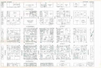
Cheyenne Plat of 15th Street through 19th Street, Central Avenue through Thomes Avenue, Blocks 100 through 400 includes addresses & owner/residence names; 2 paper copies, 1 negative copy
Category - Type
Map-City/Cheyenne
Title
Cheyenne Map
Date
1911
Description
Cheyenne Map bound in booklet. Pioneer Abstract Company.
Category - Type
Map-City/Cheyenne
Title
Cheyenne Map of Union Pacific Railroad Tracks
Date
1911
Description
Cheyenne Map of Union Pacific Railroad Tracks (also has Colorado & Southern Railroad Tracks) includes railroad track routes, buildings, lots, blocks; 1 paper copy
Category - Type
Map-City/Cheyenne
Title
Cheyenne Map of Union Pacific Railroad Tracks
Date
1911
Description
Cheyenne Map of Union Pacific Railroad Tracks (also has Colorado & Southern Railroad Tracks) includes railroad track routes, buildings, lots, blocks; 1 paper copy
Category - Type
Map-City/Cheyenne
Title
Cheyenne Map
Date
1919
Description
Cheyenne Map includes streets, avenues, lakes, post office, railroad, creek, cemetery, numerical location index, 1 Xerox, 1 Blueprint
Category - Type
Map-City/Cheyenne
Title
Map of City of Cheyenne and Adjacent Subdivisions
Date
1922, revised May 1936
Description
City of Cheyenne and Adjacent Subdivisions probably by Cheyenne City Engineer for Zoning Commission, includes streets & avenues, parks, cemetery, airport, city limits & zoning types, 1 sheet, negative
Category - Type
Map-City/Cheyenne
Title
Cheyenne Map
Date
1927
Description
Cheyenne Map by PR Revis, Cheyenne City Engineer includes lots, blocks, streets, avenues, cemeteries, lakes, airport/aviation field, railroad, creek 1 incomplete Xerox
Category - Type
Map-City/Cheyenne
Title
Cheyenne Map
Date
1930
Description
Cheyenne Map includes military reservation, street names, lakes, airport, railroad yard & track alignments, Crow Creek, Hammond Packing, cemeteries, school locations, parks, government boundary line, Dodge boundary line
Category - Type
Map-City/Cheyenne
Title
Cheyenne Map
Date
1930
Description
Cheyenne Map by PR Revis, Cheyenne City Engineer includes lots, blocks, streets, avenues, cemeteries, lakes, airport/aviation field, railroad, creek (Appears to be an election district map) with red lines and blue numbers written on map
Category - Type
Map-City/Cheyenne
Title
Cheyenne Zoning District Map
Date
1936-1937
Description
Cheyenne Zoning District Map by Cheyenne City Engineer for Zoning Commission, includes streets & avenues, parks, cemetery, airport, city limits & zoning types, 3 sets with 1 sheet paper, several of the sheets include pencil notations about infrastructure plans, or upgrades to the athletic field
Category - Type
Map-City/Cheyenne
Title
Cheyenne Map
Date
1940
Description
Cheyenne Map includes major streets, avenues, lakes, railroads, parks, creek, highway, sites are numbered-but no corresponding index, vellum
Category - Type
Map-City/Cheyenne
Title
Cheyenne & Adjacent Additions Map
Date
1947
Description
Cheyenne & Adjacent Additions Map by Cheyenne Abstract & Title Company, inlcudes streets & roads, lots & blocks, railroads, highways, Fort Warren military reservation, airport, parks, lakes, VA Hospital, cemetaries, city limits, some building designations blueprint scan
Category - Type
Map-City/Cheyenne
Title
Cheyenne Map/Plat of business section
Date
1955 Circa
Description
Cheyenne Map/Plat of business section by Nirensteins National Realty Map Co. includes business names, landowners, two aerial views, business information, images 2 copies (may be duplicates of ca1960 map)
Category - Type
Map-City/Cheyenne
Title
Cheyenne Map
Date
1956
Description
Cheyenne Map by R Coggeshall compliments of Burke Moving and Storage, North American Van Lines, includes streets, avenues, parks, lakes, railroad, airport, highways, hospitals, refinery, state buildings, schools, post office, street index, paper
Category - Type
Map-City/Cheyenne
Title
Cheyenne Map/Zoning Map
Date
1956
Description
Cheyenne Map/Zoning Map includes lots, blocks, streets, avenues, residence types, ordinance number index, railroad, creek, parks, lakes, Veterans' Administration 1956, revised 1952, 1953, 1954
Category - Type
Map-City/Cheyenne
Title
Cheyenne Zoning Map
Date
1957-1958
Description
Cheyenne Zoning Map by AG Van Eman, 1958, rev 1957 includes lots, blocks, streets, avenues, parks, lakes, cemeteries, railroad, airport, military reservation, some building locators, zoning type and legend
Category - Type
Map-City/Cheyenne
Title
Cheyenne Map
Date
1958 Circa
Description
Cheyenne Map by Burke Moving & Storage, North American Van Lines includes streets, avenues, parks, lakes, public building indicators, Orchard Valley, street index, railroad, creek, airport, paper,
Category - Type
Map-City/Cheyenne
Title
Cheyenne Map
Date
1959
Description
Cheyenne Map by WY Highway Dept, Planning & Research Div, US Dept of Commerce, Bureau of Public Roads includes streets, avenues, railroad, lakes, public buildings, highway & creek from 1950 census, 1958 aerial photographs
Category - Type
Map-City/Cheyenne
Title
Cheyenne Map/Zoning Map
Date
1959
Description
Cheyenne Map/Zoning Map by AG VanEman includes lots, blocks, streets, avenues, type of residence, public building indicators, highway, railroad, lakes, park 1959, revised 1958, revised 1957
Category - Type
Map-City/Cheyenne
Title
Cheyenne/Nirensteins Real Estate Atlas of the Far Western States plat
Date
1960 Circa
Description
Cheyenne/Nirensteins Real Estate Atlas of the Far Western States plat includes only the Cheyenne business section, lots, blocks, store names, on back descriptive info regarding state, city with photos of sites, flower, animals, flag, Green Ink, 2 copies
Category - Type
Map-City/Cheyenne
Title
Cheyenne Map
Date
1970 Circa
Description
Cheyenne Map by Western States Publish Co, compliments of Grand Central Texaco, includes photo of DePaul Hospital, various ads, streets, avenues, lakes, creek, airport, air force base, interstates, highways, country club, VA hospital, parks street and avenue index, paper, blueline
Category - Type
Map-City/Cheyenne
Title
Cheyenne Map
Date
1977
Description
Cheyenne Map by Johnson Publishing Co. includes streets, avenues, highways, interstates, index to streets, avenues, school locators, railroad, creek, business advertisements, FE Warren Air Force Base
Category - Type
Map-City/Cheyenne
Title
Cheyenne Map
Date
1977
Description
Cheyenne Map by Johnson Publishing Co. includes streets, avenues, highways, interstates, index to streets, avenues, school locators, railroad, creek, business advertisements, FE Warren Air Force Base
Category - Type
Map-City/Cheyenne
Title
Cheyenne Map
Date
1978
Description
Cheyenne Map includes streets, avenues, building drawings, locators, business advertisements, highways, interstates, building index, railroad, street index, map of FE Warren Air Force Base (Souvenir Map) courtesy of Mountain Bell, 2 copies
Category - Type
Map-City/Cheyenne
Title
Downtown Cheyenne Shopping, Dining & Services Map
Date
1998
Description
Downtown Cheyenne Shopping, Dining & Services Map. Side 1 reference map inc roads and streets, airport, Cheyenne area attractions. Side 2 inc downtown street map, index of attractions, business by location on street, parking facility, automated teller, place to worship, public phones, public restrooms, mailbox, bus stop, trolley stop
Category - Type
Map-City/Cheyenne
Title
Cheyenne City Street Index
Date
1999
Description
Cheyenne City Street Index, includes street name, address hundred block and the map location
Category - Type
Map-City/Cheyenne
Title
Cheyenne Map-east portion of City from Woodhouse Drive area to, Dell Range to Cherry Wine Drive, Dell Range to Campstool Road
Date
1999
Description
Cheyenne Map-east portion of City from Woodhouse Drive area to, Dell Range to Cherry Wine Drive, Dell Range to Campstool Road, includes streets & raods, addresses, Interstate 80 (I-80), railroad tracks, Dry Creek Wastewater Treatment Plan, Dry Creek
Category - Type
Map-City/Cheyenne
Title
Cheyenne Map-Middle east portion of City from Airport runways/Holliday Park to Whitney Road area, and Dell Range area to Crow Creek Wastewater Treatment Plant area
Date
1999
Description
Cheyenne Map-Middle east portion of City from Airport runways/Holliday Park to Whitney Road area, and Dell Range area to Crow Creek Wastewater Treatment Plant area, includes streets & roads, addresses, Highway 30, Schools, Priarie View Golf Course, Brimmer Park, Cahill Park Soccar Complex, Baseball Complexes, United Medical Center-East, railroad tracks, Norris Viaduct, Fire Station No 5, Crow Creek & Dry Creek
Category - Type
Map-City/Cheyenne
Title
Cheyenne Map-Northeast portion of City from Dell Range to Wrangler Road, and James Drive to Astronaut Drive
Date
1999
Description
Cheyenne Map-Northest portion of City from Dell Range to Wrangler Road, and James Drive to Astronaut Drive, includes streets & roads, addresses, water tank, Fire Station No 5, Anderson School, Childs Creek and Dry Creek
Category - Type
Map-City/Cheyenne
Title
Cheyenne Map
Date
2002
Description
Cheyenne Map, dated 2002-2003 front of map includes streets & avenues, some business & building locations, Interstates & Highways, hospitals, railroad, parks, schools, housing developments, airport, lakes, golf courses, museum, civic center, air force base & advertisements, back of map includes street index, business directory, County map with towns, roads, railroad, creeks, Interstates & Highways, 1 set with 1 sheet paper-colored
Category - Type
Map-City/Cheyenne
Title
Cheyenne and Vicinity Map
Date
Undated
Description
Cheyenne and Vicinity Map, by Mark A Chapman Fire Insurance, 1 sheet creased paper
Category - Type
Map-City/Cheyenne
Title
Cheyenne Map
Date
Undated
Description
Cheyenne Map, Points of Interest, Home of Frontier Days, published by Cheyenne Chamber of Commerce by SL Hull, includes mail roads, location and drawings of points of interest, 1 undersized color map
Category - Type
Map-City/Cheyenne
Title
Cheyenne Plat, Holdredge Addition, 2nd Filing
Date
Undated
Description
Cheyenne Plat, Holdredge Addition, 2nd Filing, includes lots & blocks, blvds, county road, 24th Street Extension, annotation-Wyoming Fair Association, Kenwood Place, 1 set with 1 sheet creased vellum
Category - Type
Map-City/Cheyenne
|


