|
REFINE
Browse All : Still Image and Map-Forest/Washakie of Wyoming and 6
1-8 of 8
Title
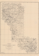
Washakie National Forest Map
Date
1919
Description
Washakie National Forest Map by US Agriculture Dept, Forest Service, HE Sealing, traced by HF Hedge, includes boundaries, townships, ranges, rivers, creeks, lakes, reservoirs, mountains, passes, ranches, 2 copies, 1 oversized (same as map 124)
Category - Type
Map-Forest/Washakie
Title
Washakie National Forest Map
Date
1919
Description
Washakie National Forest Map by US Agriculture Dept, Forest Service, HE Sealing, traced by HF Hedge, includes boundaries, townships, ranges, rivers, creeks, lakes, reservoirs, mountains, passes, ranches, 2 copies, 1 oversized (same as map 126)
Category - Type
Map-Forest/Washakie
Title
Washakie National Forest Map
Date
1926
Description
Washakie National Forest Map by US Dept of Agriculture, Forest Service, WB Greeley, includes townships, ranges, cities, towns, rivers, creeks, railroad, highways, roads, ranger stations, mines, campgrounds, picnic areas, landmarks, cabins, buildings, power lines, trails, 1 oversized copy & 1 blueline paper copy
Category - Type
Map-Forest/Washakie
Title
Washakie National Forest Map
Date
1927
Description
Washakie National Forest Map by US Forest Service, includes boundaries, townships, ranges, rivers, creeks, mountains, cities, towns, mileage chart, houses, buildings, glaciers, headquarters, on back---photos, history, rules & description, 1 colored copy
Category - Type
Map-Forest/Washakie
Title
Washakie National Forest Map
Date
1933
Description
Washakie National Forest Map by US Forest Service, includes boundaries, townships, ranges, rivers, creeks, mountains, cities, towns, mileage chart, houses, buildings, game preserve, headquarters, on back---photos, history, rules & description, 1 set with 1 sheet color coded paper
Category - Type
Map-Forest/Washakie
1-8 of 8
|


