|
REFINE
Browse All : Still Image and Map-Survey and MCDB_1924791169
1-1 of 1
Title
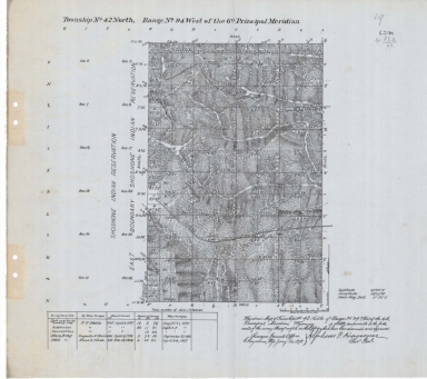
Survey Map Township 42, Range 94, Sections 5 - 8, 17 - 20
Date
1898
Description
Survey Map by Alpheus P. Hanson, surveyed-EF Stahle, Frank S. Wood, US Surveyor General's Office, printed-The Norris Peters Co., Township 42, Range 94, Sections 5 - 8, 17 - 20, includes Shoshone Indian Reservation North Boundary, Lander & Thermopolis Road roads, Old East Boundary Shoshoni Indian Reservation, topo info, Big Horn River, creeks, total number of acres, date of contracts, amount of surveys, No. 4684, 2 sets with 1 sheet negative paper
Category - Type
Map-Survey
1-1 of 1
|