|
REFINE
Browse All : Still Image and Sweetwater County Map of Sweetwater County
1-18 of 18
Title
Sweetwater County Map
Date
1937
Description
Sweetwater County Map by State Mineral Supervisor Pierre LaFleiche, Drafted by HG Lowman includes oil & gas fields, drainage, township, range, state land, primary & secondary roads WPA Project 6/1937 Blueline, 2 sets, 1 set is taped & cracking
Category - Type
Map-County/Sweetwater
Title
Sweetwater County Map
Date
1947
Description
Sweetwater County Map by WY Highway Dept, Planning Division & Public Roads Administration, includes cultural & topo features, 30"X18", 1 set with 1 sheet black line print on paper
Category - Type
Map-County/Sweetwater
Title
Sweetwater County Map
Date
1947
Description
Sweetwater County Map by WY Highway Dept Planning & Research Div, US Dept of Commerce, Bureau of Public Roads includes buildings, air routes, township, range, roads, natural features, drainage, railroads, towns 2 sheets, 2 sets, 1 incomplete
Category - Type
Map-County/Sweetwater
Title
Sweetwater County Map
Date
1965
Description
Sweetwater County Map by WY Highway Dept, Planning & Research Div, with US Dept of Commence, Bureau of Public Roads includes township, range, roads, drainage, railroads, post office, schools, Ag exp station, pipe lines, dwellings, towns, 1950 Co population, 1959 aerial photo 9 sheets 11X17
Category - Type
Map-County/Sweetwater
Title
Sweetwater County Map
Date
Undated
Description
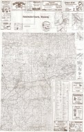
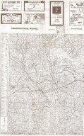
Sweetwater County Map. Advertisers, includes roads & roadway features, structures, railroads, drainages, natural features, boundaries, city & town centers, airways, public service & educational facilities, farm units, dwellings, forts, armory, pack or foot trail historic trail with name, coordinate points, triangulation stations, industrial sites, conservation & recreations sites, water bodies, river/stream drainages, 1/2 county map on each side.
Category - Type
Map-County/Sweetwater
Title
Sweetwater County Map
Date
1937-1946
Description
Sweetwater County Map by State Mineral Supervisor Pierre LaFleiche, Drafted by H.G. Lowman includes oil & gas fields, drainage, township, range, state Land, primary & secondary roads WPA Project 1937, 1946, Blueline
Category - Type
Map-County/Sweetwater
Title
Sweetwater County Map
Date
1937-1951
Description
Sweetwater County Map by State Mineral Supervisor Pierre LaFleiche, Drafted by H.G. Lowman includes oil & gas fields, drainage, township, range, state Land, primary & secondary roads WPA Project 1937, 1946, 1951, 2 sets vellum
Category - Type
Map-County/Sweetwater
1-18 of 18
|


