|
REFINE
Browse All : Still Image and WY State Engineer of 1
1-20 of 20
Title
Laramie River & Tributaries Tabulations of Adjudicated Water
Date
1869-1911
Description
Laramie River & Tributaries Tabulations of Adjudicated Water Rights, WY State Engineer, includes priority number, ditch name, name of appropriator, Post Office address, use, amount appropriated, number of acres irrigated & description of lands irrigated, 2 bundles with 36 sheets paper
Category - Type
Map-Water
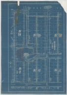
Title
Casper Zoning Map
Date
1904
Description
Casper Map, includes lots & blocks, streets & avenues, North Platte River, railroad tracks, Depot Grounds-Wyoming Central Railway, 1 set with 1 sheet blueprint
Category - Type
Map-City/Casper
Title
Laramie County-Public Roads Administration-Highway Planning Survey
Date
1940
Description
Laramie County-Public Roads Administration-Highway Planning Survey, WY State Engineer Highway Map, may include forests, trails, railroads, geology, improvements & industry, 1 set with 1 sheet paper
Category - Type
Map-County/Laramie
Title
Wyoming State Capitol lawn sprinkling system, Cheyenne Wyoming plan
Date
1934
Description
WY State Capitol lawn sprinkling system, Cheyenne Wyoming, 1 set with 4 sheets blueprint
Category - Type
Plan/Specification
Title
Cody, William F (and others)-Quarry & Timber Claims in Township 50, Range 103
Date
1895
Description
Cody, William F (and others)-Quarry & Timber Claims in Township 50, Range 103, WY State Engineer General Subject Map, may include forests, trails, railroads, geology, improvements & industry, 1 set with 1 sheet paper
Category - Type
Map-Mineral
Title
Mineral Resources Map of the Burlington (Railroad) Lines
Date
1940
Description
Mineral Resources Map of the Burlington (Railroad) Lines, WY State Engineer Highway Map, may include forests, trails, railroads, geology, improvements & industry, 1 set with 1 sheet paper
Category - Type
Map-Railroad
Title
Guernsey, WY-Primary Types of Mineral Deposits for Magnesium Reduction Industry
Date
1942
Description
Guernsey, WY-Primary Types of Mineral Deposits for Magnesium Reduction Industry, WY State Engineer General Subject Map, may include forests, trails, railroads, geology, improvements & industry, 1 set with 1 sheet paper
Category - Type
Map-Mineral
Title
FMC Corp, LaBarge Natural Gas Pipeline, Opal Extension
Date
1973
Description
FMC Corp, LaBarge Natural Gas Pipeline, Opal Extension, WY State Engineer General Subject Map, may include forests, trails, railroads, geology, improvements & industry, 1 set with 1 sheet paper
Category - Type
Map-Mineral
Title
Black Thunder Mine Plant-Sewage Treatment Lagoon Earthwork
Date
1975
Description
Black Thunder Mine Plant-Sewage Treatment Lagoon Earthwork, WY State Engineer General Subject Map, may include forests, trails, railroads, geology, improvements & industry, 1 set with 1 sheet paper
Category - Type
Map-Mineral
Title
Black Thunder Mine Plant-Water Storage Lagoon Earthwork
Date
1975
Description
Black Thunder Mine Plant-Water Storage Lagoon Earthwork, WY State Engineer General Subject Map, may include forests, trails, railroads, geology, improvements & industry, 1 set with 1 sheet paper
Category - Type
Map-Mineral
Title
Big Horn Coal Company Proposed Railroad Load-Out Track & Haul Truck Crossing Location
Date
1976
Description
Big Horn Coal Company Proposed Railroad Load-Out Track & Haul Truck Crossing Location, WY State Engineer General Subject Map, may include forests, trails, railroads, geology, improvements & industry, 1 set with 1 sheet paper
Category - Type
Map-Mineral
Title
Black Thunder Mine Plant-Settling Pond
Date
1976
Description
Black Thunder Mine Plant-Settling Pond, WY State Engineer General Subject Map, may include forests, trails, railroads, geology, improvements & industry, 1 set with 1 sheet paper
Category - Type
Map-Mineral
Title
Black Thunder Mine Plant-Site Plan
Date
1976
Description
Black Thunder Mine Plant-Site Plan, WY State Engineer General Subject Map, may include forests, trails, railroads, geology, improvements & industry, 1 set with 1 sheet paper
Category - Type
Map-Mineral
Title
Federal-American Partners, FAP Gas Hills No. 1, Before Mining Contour
Date
1977
Description
Federal-American Partners, FAP Gas Hills No. 1, Before Mining Contour, WY State Engineer General Subject Map, may include forests, trails, railroads, geology, improvements & industry, 1 set with 1 sheet paper
Category - Type
Map-Mineral
Title
Federal-American Partners, FAP Gas Hills No. 1, Final Contour After Reclamation
Date
1977
Description
Federal-American Partners, FAP Gas Hills No. 1, Final Contour After Reclamation, WY State Engineer General Subject Map, may include forests, trails, railroads, geology, improvements & industry, 1 set with 1 sheet paper
Category - Type
Map-Mineral
Title
Black Thunder Mine, Campbell County, WY map
Date
Undated
Description
Black Thunder Mine, Campbell County, WY State Engineer General Subject Map, may include forests, trails, railroads, geology, improvements & industry, 1 set with 1 sheet paper
Category - Type
Map-Mineral
Title
Federal Bentonite Company, Geisinger Claim
Date
Undated
Description
Federal Bentonite Company, Geisinger Claim, WY State Engineer General Subject Map, may include forests, trails, railroads, geology, improvements & industry, 1 set with 2 sheets paper
Category - Type
Map-Mineral
Title
Mineral Hill Gold Properties, Owned & Controlled
Date
Undated
Description
Mineral Hill Gold Properties, Owned & Controlled, WY State Engineer Highway Map, may include forests, trails, railroads, geology, improvements & industry, 1 set with 1 sheet paper
Category - Type
Map-Mineral
Title
Daley's Ranch to Fort Steele road
Date
1912
Description
Daley's Ranch to Fort Steele, Carbon County, WY State Engineer Highway Map, may include forests, trails, railroads, geology, improvements & industry, 1 set with 1 sheet paper
Category - Type
Map-Trail or Road
Title
Carbon County-Trans-Continental Highway from East County Line to Fort Steele
Date
Undated
Description
Carbon County-Trans-Continental Highway from East County Line to Fort Steele, WY State Engineer Highway Map, may include forests, trails, railroads, geology, improvements & industry, 1 set with 1 sheet paper
Category - Type
Map-Trail or Road
1-20 of 20
|