|
Title
CHEYENNE, WYOMING AERIAL PHOTO, LOOKING SOUTH--DOWNTOWN CHEYENNE
Date
1936
Description
CITIES AND TOWNS--CHEYENNE, WYOMING--AERIAL VIEW--LOOKING SOUTH--DOWNTOWN CHEYENNE INCLUDING THE RAILROAD DEPOT AND ROUND HOUSE.
Rights
Copyright not evaluated, https://rightsstatements.org/page/CNE/1.0/?language=en
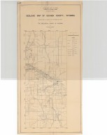
Title
Campbell County Map
Date
1936
Description
Campbell County Map by State Mineral Supervisor Pierre LaFleiche, Drafted by H.G. Lowman includes oil & gas fields, drainage, township, range, state Land, primary & secondary roads WPA Project#109, Blueline, 2 sets, 1 set taped & cracking
Category - Type
Map-County/Campbell
Title
Caribou National Forest Map, Idaho (includes part of Wyoming)
Date
1936
Description
Caribou National Forest Map, Idaho (includes part of WY) by US Department of Agriculture, Forest Service, includes townships & ranges, rivers & creeks, mountains, cities & towns, forest boundaries, 1 sheet
Category - Type
Map-Forest/Caribou
Title
Cheyenne Frontier Days, Frontier Park Steel Grandstand extension detail plans, Cheyenne, WY
Date
1936
Description
Cheyenne Frontier Days, Frontier Park Steel Grandstand extension detail plans, Cheyenne, WY, by Frederic Hutchinson Port, Robert W. Postin Collection, 1 set with 3 sheets blueline paper
Category - Type
Plan/Specification
Title
Converse County Map
Date
1936
Description
Converse County Map by State Mineral Supervisor Pierre LaFleiche, drafted by HG Lowman includes oil & gas fields, drainage, township, range, state land, primary & secondary roads WPA Project #109, 3 sets, 2 sets are taped & cracking
Category - Type
Map-County/Converse
Title
Gibson Ranch Map
Date
1936
Description
Gibson Ranch Map by LC Bishop manager CJ Saul, LaBonte Livestock Co. vellum, 1 chronar
Category - Type
Map-Ranch
Title
Gibson Ranch Map
Date
1936
Description
Gibson Ranch Map by LC Bishop manager CJ Saul, LaBonte Livestock Co. vellum, 1 chronar
Category - Type
Map-Ranch
Title
Goshen County Geologic Map
Date
1936
Description
Goshen County Geologic Map by Geological Survey of WY, Arthur M Morgan, from WY State Planning Board/WY State Planning & Water Conservation Board records, includes townships & ranges, cities & towns, rivers & creeks, highway, railroad, formations, 1 set with 1 sheet blueline paper
Category - Type
Map-County/Goshen
Title
Hartville Plat
Date
1936
Description
Hartville Plat includes lots, blocks, streets, city reserve (1 vellum copy)
Category - Type
Map-City/Hartville
Title
Park County Map
Date
1936
Description
Park County Map by WY Highway Dept in cooperation with US Agriculture Dept, Bureau of Roads, includes townships, ranges, sections, cities, towns, rivers, creeks, highways, roads, railroads, buildings, schools, campgrounds, oil & gas wells, post offices, 1 set, 2 sheets blueline paper
Category - Type
Map-County/Park
Title
Targhee & Teton National Forest Map
Date
1936
Description
Targhee & Teton National Forest Map by US Forest Service, includes boundaries, townships, ranges, highways, roads, trails, railroads, campgrounds, telephone lines, ranger stations, landing fields, houses, buildings, history, 3 copies
Category - Type
Map-Forest/Targhee
Title
Targhee & Teton National Forest Map
Date
1936
Description
Targhee & Teton National Forest Map by US Forest Service, includes boundaries, townships, ranges, highways, roads, trails, railroads, campgrounds, telephone lines, ranger stations, landing fields, houses, buildings, history, 3 copies
Category - Type
Map-Forest/Teton
Title
Uinta County Map
Date
1936
Description
Uinta County Map by State Mineral Supervisor Pierre LaFleiche, drafted by H.G. Lowman includes oil & gas fields, drainage, township, range, state land, primary & secondary roads WPA Project #109 1936, Blueline, 3 sets
Category - Type
Map-County/Uinta
Title
Wyoming Highway Map
Date
1936
Description
Highway Map by WY State Highway Dept 3 copies
Category - Type
Map-State
Title
Wyoming Highway Map
Date
1936
Description
Highway Map by WY State Highway Dept 3 copies
Category - Type
Map-State
Title
Wyoming National Forest Map
Date
1936
Description
WY National Forest Map by US Dept of Agriculture, US Forest Service, includes boundaries, townships, ranges, sections, roads, trails, railroads, telephone lines, ranger stations, building, rivers, creeks
Category - Type
Map-Forest/WY
Title
Home for the Aged plan, Casper, WY
Date
1936
Description
Home for the Aged, PWA Project 1041D by Goodrich & Krusmark, Casper, WY, 1 set with 10 pages
Category - Type
Plan/Specification
Title
Supreme Court Grounds Plan, Cheyenne, WY
Date
1936
Description
Supreme Court Grounds Plan, Cheyenne, WY, by RWB, includes building exterior, sprinkler heads & valves, pipe lines, street wash hydrants, detail drawings of pipe layout, manhole, valves, 1 set with 2 sheets vellum
Category - Type
Plan/Specification
Title
Wyoming State Boys School/Industrial Institute Stair Plan
Date
1936
Description
WY State Boys School/Industrial Institute Stair Plan by D DeWald, maintenance supervisor, 1 set with 2 sheets blueprint
Category - Type
Plan/Specification
Title
Wyoming State Childrens Home Garage & Utility Building Plan
Date
1936
Description
WY State Childrens Home Garage & Utility Building Plan by Goodrich & Krusmark, 1 set with 1 sheet blueline paper
Category - Type
Plan/Specification
Title
Wyoming State Childrens Home/WPA Administrative Offices Plan
Date
1936
Description
WY State Childrens Home/WPA Administrative Offices Plan by Frank Strong, consulting engineer & Allan Tufford, drafting engineer, 1 set with 7 sheets blueline paper
Category - Type
Plan/Specification
Title
Wyoming State Girls School Pumphouse Plan
Date
1936
Description
WY State Girls School Pumphouse Plan, 2 sets ??
Category - Type
Plan/Specification
Title
Wyoming State Girls School Waterworks Improvements & Extensions Plan
Date
1936
Description
WY State Girls School Waterworks Improvements & Extensions Plan by Dan J McQuaid Engineering Service, 2 sets with 2 sheets blueprint
Category - Type
Plan/Specification
Title
Wyoming State Hospital Building Map
Date
1936
Description
WY State Hospital Building Map, includes building designations & names, fire hydrants, ditches, trees, pole lines, lawns, fence lines, section line, highway & roads, 1 set with 1 sheet blueline paper
Category - Type
Plan/Specification
Title
Wyoming State Penitentiary Execution Chamber plan
Date
1936
Description
WY State Penitentiary Execution Chamber by William Dubois, 1 set with 3 sheets tissue paper
Category - Type
Plan/Specification
Title
Wyoming State Penitentiary Factory Layout Plan
Date
1936
Description
WY State Penitentiary Factory Layout Plan by D DeWald, 1 set with 1 sheet tissue paper
Category - Type
Plan/Specification
Title
Wyoming State Penitentiary Woolen Mill Floor Plan Showing Location of Equipment
Date
1936
Description
WY State Penitentiary Woolen Mill Floor Plan Showing Location of Equipment, 1 set with 1 sheet vellum
Category - Type
Plan/Specification
Title
Hot Springs County Map
Date
1936
Description
Hot Springs County Map by State Mineral Supervisor Pierre LaFleiche, drafted by HG Lowman includes oil & gas fields, drainage, township, range, state land, primary & secondary roads WPA Project #109, 1 set
Category - Type
Map-County/Hot Springs
Title
Johnson County Map
Date
1936
Description
Johnson County Map by State Mineral Supervisor Pierre LaFleiche, drafted by H.G. Lowman includes oil & gas fields, drainage, township, range, state land, primary & secondary roads WPA Project #109, 2 sets, 1 set is taped & cracking
Category - Type
Map-County/Johnson
Title
Natrona County Map
Date
1936
Description
Natrona County Map by State Mineral Supervisor Pierre LaFleiche, Drafted by H.G. Lowman includes oil & gas fields, drainage, township, range, state land, primary & secondary roads WPA Project #109, 1 set
Category - Type
Map-County/Natrona
Title
Niobrara County Map
Date
1936
Description
Niobrara County Map by State Mineral Supervisor Pierre LaFleiche, Drafted by HG Lowman includes oil & gas fields, township, range, state land, primary & secondary roads WPA Project #6008, 2 sets, 1 set is taped & cracking
Category - Type
Map-County/Niobrara
Title
Platte County Map
Date
1936
Description
Platte County Map by State Mineral Supervisor Pierre LaFleiche, Drafted by HG Lowman includes oil & gas fields, drainage, township, range, state land, primary & secondary roads WPA Project #109, 2 sets, 1 set is taped & cracking
Category - Type
Map-County/Platte
Title
Allison Tracts Plat, 2nd Filing
Date
1936
Description
Allison Tracts Plat, 2nd Filing
Category - Type
Map-City/Cheyenne
Title
Bethel Cemetery Plat, Replat
Date
1936
Description
Bethel Cemetery Plat, Replat
Category - Type
Map-City/Cheyenne
Title
Briney Tracts 2nd Filing Plat
Date
1936
Description
Briney Tracts 2nd Filing Plat (196b)
Category - Type
Map-City/Cheyenne
Title
Briney Tracts Plat
Date
1936
Description
Briney Tracts Plat (196a)
Category - Type
Map-City/Cheyenne
Title
Cheyenne Block 390 (Woolworth) plat
Date
1936
Description
Cheyenne Block 390, West 44' Lot 2 and South 44' Lots 3 and 4 (Woolworth)
Category - Type
Map-City/Cheyenne
Title
Cheyenne Block 390 (Woolworth) plat
Date
1936
Description
Cheyenne Block 390, West 44' Lot 2 and South 44' Lots 3 and 4 (Woolworth)
Category - Type
Map-City/Cheyenne
Title
Wallick and Murray Gardens plat
Date
1936
Description
Wallick and Murray Gardens plat
Category - Type
Map-City/Cheyenne
Title
Garrett Addition, Replat Lots 3-8 Blocks 1-3
Date
1936
Description
Garrett Addition, Replat Lots 3-8 Blocks 1-3
Category - Type
Map-City/Cheyenne
Title
Lewandowski Group, Placer Mining Claim nos. 1,2 and 3
Date
1936
Description
Lewandowski Group, Placer Mining Claim nos. 1,2 and 3. Section 8 Township 13 Range 69
Category - Type
Map-City/Cheyenne
Title
Mohatt, Lot 28 of Avalon Acres plat
Date
1936
Description
Mohatt Lot 28 of Avalon Acres plat
Category - Type
Map-City/Cheyenne
Title
Survey Map Township 13 Range 66, Sec.5 E/2 SW/4 Subdivision plat (Warren Livestock)
Date
1936
Description
Township 13 Range 66, Sec.5 E/2 SW/4 Subdivision (Warren Livestock)
Category - Type
Map-City/Cheyenne
Title
Survey Map Township 13 Range 68, Section 13 plat Amerada Petroleum
Date
1936
Description
Township 13 Range 68,Section 13 Amerada Petroleum
Category - Type
Map-City/Cheyenne
Title
Capitol Heights Addition Plat, Replat
Date
1936
Description
Capitol Heights Addition Plat, Replat Lots 10-15, Block 1030 & Block 1031
Category - Type
Map-City/Cheyenne
Title
Capitol Heights Addition Plat, Replat
Date
1936
Description
Capitol Heights Addition Plat, Replat Lots 10-15, Block 1030 & Block 1031
Category - Type
Map-City/Cheyenne
|