|
REFINE
Browse All : Still Image from 1982
1-26 of 26
Title
Fetterman Fight Map
Date
1982
Description
Fetterman Fight Map 3 copies
Category - Type
Military-Fort Fetterman
Title
Fetterman Fight Map
Date
1982
Description
Fetterman Fight Map 3 copies
Category - Type
Military-Fort Fetterman
Title
Pictorial Map of Wyoming
Date
1982
Description
Map-Pictorial of WY by Maureen McAteer & Bruce Ericksen colored map
Category - Type
Map-Pictorial
Title
Pole Mountain Travel Map, Medicine Bow National Forest, Laramie Ranger District
Date
1982
Description
Pole Mountain Travel Map, Medicine Bow National Forest, Laramie Ranger District by the US Forest Service, US Dept of Agriculture, includes township, range, section, campgrounds, picnic grounds, forest service station, rivers, creeks, hills, mountains, trails, descriptive info, recreation directory, policy and rules, vicinity maps, paper, colored
Category - Type
Map-Forest/Medicine Bow/Pole Mountain
Title
Wyoming Highway Map
Date
1982
Description
Highway Map by WY State Highway Dept, 3 copies
Category - Type
Map-State
Title
Wyoming Highway Map
Date
1982
Description
Highway Map by WY State Highway Dept, 3 copies
Category - Type
Map-State
Title
Wyoming Map Showing Traffic Flow
Date
1982
Description
WY Map Showing Traffic Flow, by WY Highway Dept, Planning Div, in cooperation with US Dept of Transportation, Federal Highway Admin, includes average daily traffic counts, counties, cities, highways, 1 sheet color coded paper
Category - Type
Map-State
Title
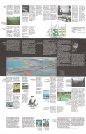
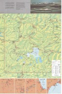
Yellowstone National Park brochure
Date
1982
Description
Yellowstone National Park brochure, includes vicinity maps, colored topo info, roads, trails, lakes, rivers, visitor use facilities, geographic descriptions, continental divide, elevations, legend, boundary, state lines; Reverse side-interpretive & educational info re. what to do, safety, visitor services, wildlife, thermal features, general ecology. Double-sided.
Category - Type
Map-Nat'l Park
Title
Corlett Elementary School Re-Roofing Plan
Date
1982
Description
Corlett Elementary School Re-Roofing Plan, Laramie County School District 1/District Engineer, 2 sets with 1 sheet (1 set-paper, 1 set-blueline paper) (32-132)
Category - Type
Plan/Specification
Title
Emerson Building plans, Cheyenne, WY
Date
1982
Description
Emerson Building, Cheyenne, WY, by EFCO Corp, sent to Robert W. Postin for review, drawing 3-0524, 1 set with 12 sheets blueline paper
Category - Type
Plan/Specification
Title
Fort Phil Kearny Blockhouse Plan
Date
1982
Description
Fort Phil Kearny Blockhouse Plan
Category - Type
Military-Fort Kearny
Title
Fort Phil Kearny Plan
Date
1982
Description
Fort Phil Kearny Plan
Category - Type
Military-Fort Kearny
Title
Fort Phil Kearny Side Elevation Blockhouse Plan
Date
1982
Description
Fort Phil Kearny Side Elevation Blockhouse Plan
Category - Type
Military-Fort Kearny
Title
Fort Phil Kearny Stockade wall & related structures Plan
Date
1982
Description
Fort Phil Kearny Stockade wall & related structures Plan
Category - Type
Military-Fort Kearny
Title
Laramie County Fair metal building at Frontier Park, Cheyenne, WY
Date
1982
Description
Laramie County Fair metal building at Frontier Park, Cheyenne, WY, plan 675, by Morris D. Kemper, 1 set with 3 sheets (2 sheets mylar & 1 shee blueline paper)
Category - Type
Plan/Specification
Title
Law Enforcement Academy, Phase I plan
Date
1982
Description
Law Enforcement Academy, Phase I by Kemper & Pappas, file 671, 9 sheets vellum (brown)
Category - Type
Plan/Specification
Title
Powell Municipal Airport General Plan
Date
1982
Description
Powell Municipal Airport General Plan by Graham, Dietz & Assoc, Project 458, 3 sheets blueline paper
Category - Type
Plan/Specification
Title
South Big Horn County Airport, Greybull Administrative Area Layout Plan
Date
1982
Description
South Big Horn County Airport, Greybull Administrative Area Layout Plan by Graham, Dietz & Assoc, Project 420, 2 sheets paper
Category - Type
Plan/Specification
Title
South Big Horn County Airport, Greybull Administrative Area Layout Plan
Date
1982
Description
South Big Horn County Airport, Greybull Administrative Area Layout Plan by Graham, Dietz & Assoc, Project 560, 1 sheet paper
Category - Type
Plan/Specification
Title
Wyoming Highway Department-Laboratory Building modification plan, Cheyenne, WY
Date
1982
Description
WY Highway Department-Laboratory Building modification plan, Cheyenne, WY, plan 620.15 (sheet A-2), by Morris D. Kemper, 1 incomplete set with 1 sheet mylar
Category - Type
Plan/Specification
Title
Wyoming Highway Dept-Headquarters Laboratory Building modification plans, Cheyenne, WY
Date
1982
Description
WY Highway Dept-Headquarters Laboratory Building modification plans, Cheyenne, WY, plan 632.15, by Morris D. Kemper, 1 set with 3 sheets mylar
Category - Type
Plan/Specification
Title
Wyoming State Fair Girls Dormitory & Cafeteria Plan
Date
1982
Description
WY State Fair Girls Dormitory & Cafeteria Plan by HNTB (Howard, Needles, Tammen & Bergendoff), project 7532, 1 set with 37 sheets vellum
Category - Type
Plan/Specification
Title
Wyoming State Parks, Remodeling for the Physically Handicapped of WY State Parks plans
Date
1982
Description
WY State Parks, Remodeling for the Physically Handicapped of WY State Parks by Noel Griffith Jr. & Assoc, Gust Johnson, includes Curt Gowdy State Park, Seminoe State Park, Guernsey State Park, Fort Fetterman State Park & Waterless Restroom Plans, bid #0411-N, 1 set 17 sheets blueline paper
Category - Type
Plan/Specification
Title
Survey Map Township 14 Range 60, Section 29 NW/4 (CR 61-4 80' R/W)
Date
1982
Description
Survey Map Township 14 Range 60, Section 29 NW/4 (CR 61-4 80' R/W)
Category - Type
Map-City/Cheyenne
1-26 of 26
|


