|
Title
Laramie County Map
Date
1938
Description
Laramie County Map by WY Highway Dept Planning & Research Div, US Dept of Commerce, Bureau of Public Roads includes buildings, air routes, township, range, roads, natural features, drainage, railroads, towns, 1936 revised in 1938
Category - Type
Map-County/Laramie
Title
Wyoming Highway Map
Date
1938
Description
Highway Map by WY State Highway Dept 3 copies
Category - Type
Map-State
Title
Wyoming Highway Map
Date
1938
Description
Highway Map by WY State Highway Dept 3 copies
Category - Type
Map-State
Title
Wyoming Highway Map
Date
1939
Description
Highway Map by WY State Highway Dept, (Horse Photo) 2 copies
Category - Type
Map-State
Title
Wyoming Highway Map
Date
1939
Description
Highway Map by WY State Highway Dept, (Horse Photo) 2 copies
Category - Type
Map-State
Title
Wyoming Map
Date
1939
Description
WY Map by the National Map Company includes townships, ranges, rivers, creeks, cities, towns, airports, index OVERSIZED
Category - Type
Map-State
Title
Conoco Road Map of Wyoming
Date
1940
Description
Conoco Road Map of WY by Rand McNally & Co, two-sided map, includes portions of UT, ID, mileage chart for West US, City & Town index, Conoco ads, highways & interstates, cities & towns, radio stations, national parks, fish hatcheries, lakes & reservoirs, mountains, airports, camping, recreational & historical sites, rivers, 1 set with 1 sheet colored paper
Category - Type
Map-State
Title
Post Route Map of Wyoming
Date
1940
Description
Post Route Map of WY by the US Postmaster includes post offices with intermediate distances on mail routes, summer post offices, mail messenger services, contract services, air mail route, counties, cities, railroad, rivers & creeks, Yellowstone National Park, reservoirs & lakes, 1 set with 1 sheet color-coded paper
Category - Type
Map-State
Title
Wyoming, Standard Map by Rand, McNally & Co
Date
1940 Circa
Description
Rand, McNally Standard Map of WY includes townships, ranges, road map on back, index #456
Category - Type
Map-State
Title
Wyoming, Standard Map by Rand, McNally & Co
Date
1940 Circa
Description
Rand, McNally Standard Map of WY includes townships, ranges, road map on back, index #456
Category - Type
Map-State
Title
Niobrara County Map
Date
1941
Description
Niobrara County Map by WY Highway Dept Planning & Research Div, US Dept of Commerce, Bureau of Public Roads includes buildings, air routes, township, range, roads, natural features, drainage, railroads, towns
Category - Type
Map-County/Niobrara
Title
Wyoming Map
Date
1941
Description
WY Map by WPA includes tours of historic sites, cities, towns, rivers, creeks, mountains, highways, roads, paper, blueline 3 copies
Category - Type
Map-State
Title
Wyoming Map
Date
1941
Description
WY Map by WPA includes tours of historic sites, cities, towns, rivers, creeks, mountains, highways, roads, paper, blueline 3 copies
Category - Type
Map-State
Title
Big Horn County Map
Date
1946
Description
Big Horn County Map by WY Highway Dept, Planning & Research Div, US Dept of Commerce, Bureau of Public Roads includes buildings, air routes, township, range, roads, natural features, drainage, railroads, towns 2 copies
Category - Type
Map-County/Big Horn
Title
Laramie County Map
Date
1946 Circa
Description
Laramie County Map by Murphy Map Company, Missouri includes township, range, roads, highways, interstates, towns, land owners 1 large Xerox Note: Reference only cannot be duplicated
Category - Type
Map-County/Laramie
Title
Wyoming Map
Date
1947
Description
WY Map by US Dept of Interior includes public survey office, district land offices, grazing districts, national forests, Indian reservations, military reservations, bureau of reclamation projects, national parks, monuments, wildlife refuges
Category - Type
Map-State
Title
Laramie County Map
Date
1949
Description
Laramie County Map by WY Highway Dept Research Div, with US Dept of Commence, Bureau of Public Roads includes township, range, roads, drainage, railroads, post offices, schools, Ag exp station, pipe lines, dwellings, towns, 1 complete set with 4 sheets
Category - Type
Map-County/Laramie
Title
Laramie County Map
Date
1949-1951
Description
Laramie County Map by TH Baldwin, includes townships, ranges, sections, cities & towns, rivers & creeks, railroad, highways, 1 set with 1 sheet brown tone vellum
Category - Type
Map-County/Laramie
Title
Laramie County Map
Date
1950
Description
Laramie County Map includes business ads, building indicators, township, range, roads, highways, creeks, towns, railroads, reservoirs, building photos, photograph of airport, key to road types, etc
Category - Type
Map-County/Laramie
Title
Laramie County Map
Date
1950
Description
Laramie County Map includes business ads, building indicators, township, range, roads, highways, creeks, towns, railroads, reservoirs, building photos, photograph of airport, key to road types, etc
Category - Type
Map-County/Laramie
Title
Historic Site Map of Wyoming
Date
1950 Circa
Description
Historic Site Map of WY includes historic sites, towns cities, towns & historic markers
Category - Type
Map-State
Title
Wyoming Map
Date
1950 Circa
Description
WY Map showing Radioactive Anomalous by Cheyenne Photo Print, includes townships, ranges, cities, towns, counties, rivers, creeks, railroads, highways, national forests, Indian reservation, paper
Category - Type
Map-State
Title
Niobrara County Map
Date
1953
Description
Niobrara County Map by WY Highway Dept, Planning & Research Div, with US Dept of Commence, Bureau of Public Roads includes township, range, roads, drainage, railroads, post offices, schools, Ag exp station. pipe lines, dwellings, towns, 1950 Co Population, 1949 aerial photo 2 sheets
Category - Type
Map-County/Niobrara
Title
Casper Area Topographic Map Township 24-Township 25, Range 77-Range 94
Date
1955
Description
Casper Area Topographic Map by US Geological Survey, includes Township 24-Township 35, Range 77-Range 94
Category - Type
Map-Topo
Title
Big Horn County Map
Date
1958
Description
Big Horn County Map by WY Highway Dept, Planning & Research Div, US Dept of Commence, Bureau of Public Roads includes township, range, roads, drainage, railroads, post offices, schools, Ag exp stations, pipe lines, dwellings, towns, 1950 County population, 1954 aerial photo 2 complete sets with 3 sheets & 1 incomplete set with 1 sheet
Category - Type
Map-County/Big Horn
Title
Wyoming Map
Date
1958
Description
WY Map by US Geological Survey, Emigrant Road. Key Map by LC Bishop, 2 copies
Category - Type
Map-State
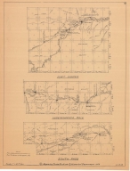
Title
Fort Caspar, Independence Rock & South Pass Map
Date
1959
Description
02 Fort Casper, Independence Rock & South Pass Map by LC Bishop, includes townships, ranges, rivers, creeks, roads, trails, pony express stations, graves, 2 paper copies
Category - Type
Military-Fort Caspar
Title
Fort Caspar, Independence Rock & South Pass Map
Date
1959
Description
02 Fort Casper, Independence Rock & South Pass Map by LC Bishop, includes townships, ranges, rivers, creeks, roads, trails, pony express stations, graves, 1 sheet vellum, 2 paper copies
Category - Type
Military-Fort Caspar
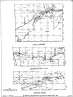
Title
Fort Laramie & Fort Fetterman Map
Date
1959
Description
01 Fort Laramie & Fort Fetterman Map, by LC Bishop, includes townships, ranges, rivers, creeks, roads, trails, pony express stations, graves
Category - Type
Military-Fort Laramie
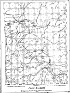
Title
Fort Halleck Map
Date
1959-1960
Description
08 Fort Halleck Map, by LC Bishop, includes townships, ranges, rivers, creeks, roads, trails, pony express stations, graves, stage stations, abandoned railroad stations, 2 copies-1 sheet vellum, 1 sheet paper
Category - Type
Military-Fort Halleck
Title
Fort Sanders Map
Date
1959-1960
Description
07 Fort Sanders Map by LC Bishop, includes townships, ranges, rivers, creeks, roads, trails, pony express stations, graves, stage stations, abandoned railroad stations
Category - Type
Military-Fort Sanders
Title
Landers Cut Off, East & West Section Map
Date
1959-1960
Description
05 Landers Cut Off, East & West Section Map by LC Bishop, includes townships, ranges, rivers, creeks, roads, trails, pony express stations, graves, 2 copies
Category - Type
Map-Trail or Road
Title
Cheyenne Birds Eye View Map
Date
1974
Description
Cheyenne Birds Eye View Map by Beck & Pauli, JJ Stoner includes streets, avenues, buildings, railroads, 4 building images, index to some buildings 4 copies of a 1974 reprint of 1882 map by Historic Urban Plans from a Library of Congress lithograph #1,
Category - Type
Map-Birds Eye View/Cheyenne
Title
Laramie County Map
Date
1975-1984
Description
Laramie County Map by RH Whitney, Laramie County Engineer, drafted by Shields includes township, range, roads, zoning boundaries, rivers, County subdivisions, reservoirs & railroads 1984, 10/1978, 2/1978, 7/1975 1 original & 1 Xerox
Category - Type
Map-County/Laramie
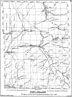
Title
Fort Laramie area map, includes Township 23 - Township 30, Range 60 - Range 69
Date
Undated
Description
Fort Laramie area map, includes Township 23 - Township 30, Range 60 - Range 69. Shows roads and locations of events
Category - Type
Military-Fort Laramie
Title
Wyoming State Childrens Home Residence Plan
Date
1923
Description
WY State Childrens Home Residence Plan by William Dubois, 1 set with 8 sheets blueprint
Category - Type
Plan/Specification
Title
Wyoming State Childrens Home Hot Water Heating Plant Revised Piping Plan
Date
1925
Description
WY State Childrens Home Hot Water Heating Plant Revised Piping Plan by AS Meyring, 1 set with 1 sheet blueprint
Category - Type
Plan/Specification
Title
Wyoming State Childrens Home Residence Addition Plan
Date
1929 Circa
Description
WY State Childrens Home Residence Addition Plan by William Dubois, 1 set with 9 sheets blueprint
Category - Type
Plan/Specification
Title
Wyoming State Soldiers & Sailors Home/Veterans Home Administration Building Boiler Room Plan
Date
1933
Description
WY State Soldiers & Sailors Home/Veterans Home Administration Building Boiler Room Plan by Fred W Ambrose, 1 set with 2 sheets blueprint (undersized)
Category - Type
Plan/Specification
Title
Wyoming State Soldiers & Sailors Home/Veterans Home Sewage Disposal Plan & Root Cellar
Date
1933
Description
WY State Soldiers & Sailors Home/Veterans Home Sewage Disposal Plan & Root Cellar by EC Gwillim, 1 set with 9 sheets blueprint
Category - Type
Plan/Specification
Title
Natrona County Home for Dependent Old People plan
Date
1935
Description
Natrona County Home for Dependent Old People, by Goodrich & Krusmark, Casper, WY, 1 set with 2 pages
Category - Type
Plan/Specification
Title
Wyoming State Childrens Home Building Plan
Date
1935
Description
WY State Childrens Home Building Plan by Goodrich & Krusmark, PWA Project 6300-3, 1 set with 11 sheets blueprints
Category - Type
Plan/Specification
Title
Wyoming State Childrens Home Contour Plat
Date
1935
Description
WY State Childrens Home Contour Plat by Cleary, includes lots & blocks, building designations, 1 set with 1 sheet blueprint
Category - Type
Plan/Specification
|