|
REFINE
Browse All : Still Image of Wyoming and Casper and 1
1-14 of 14
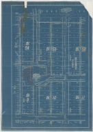
Title
Casper Zoning Map
Date
1904
Description
Casper Map, includes lots & blocks, streets & avenues, North Platte River, railroad tracks, Depot Grounds-Wyoming Central Railway, 1 set with 1 sheet blueprint
Category - Type
Map-City/Casper
Title
Casper Plat
Date
1922
Description
Casper Plat by Casper City Engineering Dept includes lots, blocks, streets, railroad, river, refineries, portion of map color coded-with no explanation 1 vellum
Category - Type
Map-City/Casper
Title
Casper Map
Date
1940
Description
Casper Map includes streets, cemetery, railroad, river, parks, highway Vellum
Category - Type
Map-City/Casper
Title
Casper Area Topographic Map Township 24-Township 25, Range 77-Range 94
Date
1955
Description
Casper Area Topographic Map by US Geological Survey, includes Township 24-Township 35, Range 77-Range 94
Category - Type
Map-Topo
Title
Casper city map and environs
Date
Undated
Description
Casper city map and environs, includes public buildings, points of interest, recreational areas & facilities, school index, advertisers index, North Platte River, railroad lines, small map of State with-counties, highways, cities, geographic locations, State lines, Wardwell Extension & Bar Nunn, Airport Extension. Double sided.
Category - Type
Map-City/Casper
Title
Casper Plat includes blocks 54 through 56, Blocks 9 though 10
Date
Undated
Description
Casper Plat includes blocks 54 through 56, Blocks 9 though 10, corresponding lots, Market to North Wolcott, West G to Firs; location of courthouse, CB & Q depot, drawing of building across from courthouse (West B Street), storm sewer info, 1 Blueprint
Category - Type
Map-City/Casper
Title
Home for the Aged plan, Casper, WY
Date
1936
Description
Home for the Aged, PWA Project 1041D by Goodrich & Krusmark, Casper, WY, 1 set with 10 pages
Category - Type
Plan/Specification
Title
Wyoming State Childrens Home/WPA Administrative Offices Plan
Date
1936
Description
WY State Childrens Home/WPA Administrative Offices Plan by Frank Strong, consulting engineer & Allan Tufford, drafting engineer, 1 set with 7 sheets blueline paper
Category - Type
Plan/Specification
Title
Natrona County International Airport, Casper, Exhibit A
Date
1974
Description
Natrona County International Airport, Casper, Exhibit A by Isbill Assoc, Project #220, 1 sheet blueline paper
Category - Type
Plan/Specification
Title
Natrona County International Airport, Casper, Exhibit A
Date
1977
Description
Natrona County International Airport, Casper, Exhibit A by Isbill Assoc, Project #256, 1 sheet blueline paper
Category - Type
Plan/Specification
Title
Natrona County International Airport, Casper plan
Date
1979
Description
Natrona County International Airport, Casper, 1979-1980 by Isbill Assoc, Project #279, 2 sheets blueline paper
Category - Type
Plan/Specification
Title
Natrona County International Airport, Casper Proposed Addition to Fire, Crash & Rescue Building
Date
1981
Description
Natrona County International Airport, Casper Proposed Addition to Fire, Crash & Rescue Building, Project 309, 1 sheet blueline paper
Category - Type
Plan/Specification
Title
Natrona County International Airport, Casper Exhibit A
Date
1984
Description
Natrona County International Airport, Casper Exhibit A by Isbill Assoc, AIP 6-56-0004-07, 1 sheet blueline paper
Category - Type
Plan/Specification
1-14 of 14
|