1869-1911
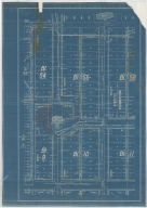
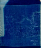
Map-Water
Laramie River & Tributaries
…
Laramie River & Tributaries
…
|

1903
Map-Water
Pathfinder Reservoir Site, C
…
Pathfinder Reservoir Site, C
…
|

1903
Map-Water
Pathfinder Reservoir Site, C
…
Pathfinder Reservoir Site, C
…
|

1903
Map-Water
Pathfinder Reservoir Site, C
…
Pathfinder Reservoir Site, C
…
|

1903
Map-Water
Pathfinder Reservoir Site, C
…
Pathfinder Reservoir Site, C
…
|

1903
Map-Water
Pathfinder Reservoir Site, C
…
Pathfinder Reservoir Site, C
…
|

1903
Map-Water
Pathfinder Reservoir Site, C
…
Pathfinder Reservoir Site, C
…
|

1903
Map-Water
Pathfinder Reservoir Site, C
…
Pathfinder Reservoir Site, C
…
|

1903
Map-Water
Pathfinder Reservoir Site, C
…
Pathfinder Reservoir Site, C
…
|

1903
Map-Water
Pathfinder Reservoir Site, C
…
Pathfinder Reservoir Site, C
…
|

1904
Map-City/Casper
Casper Map, includes lots &
…
Casper Zoning Map
|

1905
Map-Water
North Platte Project, Pathfi
…
North Platte Project, Pathfi
…
|

1905
Map-Water
North Platte Project, Pathfi
…
North Platte Project, Pathfi
…
|

1905
Map-Water
North Platte Project, Pathfi
…
North Platte Project, Pathfi
…
|

1907
Map-Site
Cheyenne Experiment Farm Map
…
Cheyenne Experiment Farm Map
|

1910
Military-Fort DA Russell
Fort DA Russell Partial Plat
…
Fort DA Russell Partial Plat
…
|

1915
Map-Water
Lovell Canal, Lands for Pate
…
Lovell Canal, Lands for Pate
…
|

1916
Map-Water
Lovell Canal, WY State Engin
…
Lovell Canal
|

1923
Map-Water
Big Bend Drainage District,
…
Big Bend Drainage District,
…
|

1923 March 16, revised
Map-Water
Y-3578.04, Frannie Division
…
Frannie Division Settlers-Sh
…
|

1925
Map-Water
Horse Creek & Tributaries, D
…
Horse Creek & Tributaries, D
…
|

1929
Map-Geological
Index to Topographic Maps &
…
Index to Topographic Maps &
…
|

1929
Map-Geological
Index to Topographic Maps &
…
Index to Topographic Maps &
…
|

1929
Map-Topo
Index to Topographic Maps &
…
Index to Topographic Maps &
…
|

1929
Map-Topo
Index to Topographic Maps &
…
Index to Topographic Maps &
…
|

1930
Map-Water
French Creek & Johnson Creek
…
French Creek & Johnson Creek
…
|

1932
Map-Water
Yellowstone River-Missouri R
…
Yellowstone River-Missouri R
…
|

1940
Map-County/Laramie
Laramie County-Public Roads
…
Laramie County-Public Roads
…
|

1943
Map-Topo
Fossil & Vicinity, WY-Topogr
…
Fossil & Vicinity, WY-Topogr
…
|

1943
Map-Geological
Index to Topographic Maps &
…
Index to Topographic Maps &
…
|

1943
Map-Geological
Index to Topographic Maps &
…
Index to Topographic Maps &
…
|

1943
Map-Topo
Index to Topographic Maps &
…
Index to Topographic Maps &
…
|

1943
Map-Topo
Index to Topographic Maps &
…
Index to Topographic Maps &
…
|

Undated
Map-Water
Delfelder Drainage District,
…
Delfelder Drainage District,
…
|

Undated
Map-Water
Delfelder Drainage District,
…
Delfelder Drainage District,
…
|

Undated
Map-Water
Green River & Tributaries, S
…
Green River & Tributaries, S
…
|

Undated
Map-Water
Lovell Bench Drainage Distri
…
Lovell Bench Drainage Distri
…
|

Undated
Map-Water
Lovell Bench Drainage Distri
…
Lovell Bench Drainage Distri
…
|

Undated
Map-Water
Lovell Drainage District, Ma
…
Lovell Drainage District, Ma
…
|

Undated
Military-Fort McKinney
Post/Fort McKinney Plat, inc
…
Post/Fort McKinney Plat
|

Undated
Map-Water
Riverton Valley Drainage Dis
…
Riverton Valley Drainage Dis
…
|

Undated
Map-Water
WY State Engineer Streams &
…
Wyoming State Engineer Strea
…
|

Undated
Map-Water
WY State Engineer Streams &
…
Wyoming State Engineer Strea
…
|

1922
Plan/Specification
WY State Training School/Sch
…
Wyoming State Training Schoo
…
|

1922-1925
Plan/Specification
WY State Training School/Sch
…
Wyoming State Training Schoo
…
|

1923
Plan/Specification
Laramie Sanitary Sewers & Se
…
Laramie Sanitary Sewers & Se
…
|

1925
Plan/Specification
WY State Training School-Wat
…
Wyoming State Training Schoo
…
|

1929
Plan/Specification
WY State Training School Sep
…
Wyoming State Training Schoo
…
|

1931
Plan/Specification
WY State Engineer Office-Rep
…
Wyoming State Capitol Buildi
…
|

1934
Plan/Specification
WY State Capitol lawn sprink
…
Wyoming State Capitol lawn s
…
|