|
REFINE
Browse All : WY State Planning Board of Wyoming
1-3 of 3
Title
Albany County Geologic Map
Date
1935
Description
Albany County Geologic Map by Geological Survey of WY, David Love, from WY State Planning Board/WY State Planning & Water Conservation Board records, includes townships & ranges, cities & towns, rivers & creeks, highway, railroad, formations, 1 set with 1 sheet blueline paper
Category - Type
Map-County/Albany
Title
Goshen County Geologic Map
Date
1936
Description
Goshen County Geologic Map by Geological Survey of WY, Arthur M Morgan, from WY State Planning Board/WY State Planning & Water Conservation Board records, includes townships & ranges, cities & towns, rivers & creeks, highway, railroad, formations, 1 set with 1 sheet blueline paper
Category - Type
Map-County/Goshen
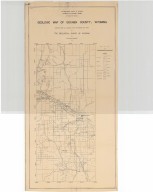
Title
Platte County Geologic Map
Date
1937
Description
Platte County Geologic Map by Geological Survey of WY, from WY State Planning Board/WY State Planning & Water Conservation Board records, includes townships & ranges, cities & towns, rivers & creeks, highway, railroad, formations, 1 set with 1 sheet blueline paper
Category - Type
Map-County/Platte
1-3 of 3
|