1938
Map-County/Laramie
Laramie County Map by WY Hig
…
Laramie County Map
|

1938
Map-State
Highway Map by WY State High
…
Wyoming Highway Map
|

1938
Map-State
Highway Map by WY State High
…
Wyoming Highway Map
|

1939
Map-State
Highway Map by WY State High
…
Wyoming Highway Map
|

1939
Map-State
Highway Map by WY State High
…
Wyoming Highway Map
|

1939
Map-State
WY Map by the National Map C
…
Wyoming Map
|

1940
Map-State
Conoco Road Map of WY by Ran
…
Conoco Road Map of Wyoming
|

1940
Map-State
Conoco Road Map of WY by Ran
…
Conoco Road Map of Wyoming
|

1940
Map-State
Post Route Map of WY by the
…
Post Route Map of Wyoming
|

1940 Circa
Map-State
Rand, McNally Standard Map o
…
Wyoming, Standard Map by Ra
…
|

1940 Circa
Map-State
Rand, McNally Standard Map o
…
Wyoming, Standard Map by Ra
…
|

1941
Map-County/Niobrara
Niobrara County Map by WY Hi
…
Niobrara County Map
|

1941
Map-State
WY Map by WPA includes tours
…
Wyoming Map
|

1941
Map-State
WY Map by WPA includes tours
…
Wyoming Map
|

1946
Map-County/Big Horn
Big Horn County Map by WY Hi
…
Big Horn County Map
|

1946 Circa
Map-County/Laramie
Laramie County Map by Murphy
…
Laramie County Map
|

1947
Map-State
WY Map by US Dept of Interio
…
Wyoming Map
|

1949
Map-County/Laramie
Laramie County Map by WY Hig
…
Laramie County Map
|

1949
Map-County/Laramie
Laramie County Map by WY Hig
…
Laramie County Map
|

1949
Map-County/Laramie
Laramie County Map by WY Hig
…
Laramie County Map
|

1949
Map-County/Laramie
Laramie County Map by WY Hig
…
Laramie County Map
|

1949-1951
Map-County/Laramie
Laramie County Map by TH Bal
…
Laramie County Map
|

1950
Map-County/Laramie
Laramie County Map includes
…
Laramie County Map
|

1950
Map-County/Laramie
Laramie County Map includes
…
Laramie County Map
|

1950 Circa
Map-State
Historic Site Map of WY incl
…
Historic Site Map of Wyoming
|

1950 Circa
Map-State
WY Map showing Radioactive A
…
Wyoming Map
|

1953
Map-County/Niobrara
Niobrara County Map by WY Hi
…
Niobrara County Map
|

1953
Map-County/Niobrara
Niobrara County Map by WY Hi
…
Niobrara County Map
|

1955
Map-Topo
Casper Area Topographic Map
…
Casper Area Topographic Map
…
|

1958
Map-County/Big Horn
Big Horn County Map by WY Hi
…
Big Horn County Map
|

1958
Map-County/Big Horn
Big Horn County Map by WY Hi
…
Big Horn County Map
|

1958
Map-County/Big Horn
Big Horn County Map by WY Hi
…
Big Horn County Map
|

1958
Map-State
WY Map by US Geological Surv
…
Wyoming Map
|

1959
Military-Fort Caspar
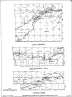
02 Fort Casper, Independence
…
Fort Caspar, Independence Ro
…
|

1959
Military-Fort Caspar
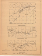
02 Fort Casper, Independence
…
Fort Caspar, Independence Ro
…
|

1959
Military-Fort Laramie
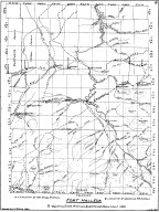
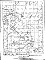
01 Fort Laramie & Fort Fette
…
Fort Laramie & Fort Fetterma
…
|

1959-1960
Military-Fort Halleck
08 Fort Halleck Map, by LC B
…
Fort Halleck Map
|

1959-1960
Military-Fort Sanders
07 Fort Sanders Map by LC Bi
…
Fort Sanders Map
|

1959-1960
Map-Trail or Road
05 Landers Cut Off, East & W
…
Landers Cut Off, East & West
…
|

1974
Map-Birds Eye View/Cheyenne
Cheyenne Birds Eye View Map
…
Cheyenne Birds Eye View Map
|

1975-1984
Map-County/Laramie
Laramie County Map by RH Whi
…
Laramie County Map
|

Undated
Military-Fort Laramie
Fort Laramie area map, inclu
…
Fort Laramie area map, inclu
…
|

1923
Plan/Specification
WY State Childrens Home Resi
…
Wyoming State Childrens Home
…
|

1925
Plan/Specification
WY State Childrens Home Hot
…
Wyoming State Childrens Home
…
|

1929 Circa
Plan/Specification
WY State Childrens Home Resi
…
Wyoming State Childrens Home
…
|

1933
Plan/Specification
WY State Soldiers & Sailors
…
Wyoming State Soldiers & Sai
…
|

1933
Plan/Specification
WY State Soldiers & Sailors
…
Wyoming State Soldiers & Sai
…
|

1935
Plan/Specification
Natrona County Home for Depe
…
Natrona County Home for Depe
…
|

1935
Plan/Specification
WY State Childrens Home Buil
…
Wyoming State Childrens Home
…
|

1935
Plan/Specification
WY State Childrens Home Cont
…
Wyoming State Childrens Home
…
|