REFINE


Who What Where When


REMOVE

  1. 3

WHAT

  1. 03 Parting of the Ways Ma … (1)
  2. APCO Petroleum Products R … (2)
  3. APCO Petroleum Products R … (2)
  4. Atlas of the World byRand … (1)
  5. B649, Historical (1)
  6. C1615 (2)
  7. Campbell County Map (8)
  8. Campbell County Map by St … (1)
  9. Campbell County Map by St … (2)
  10. Campbell County Map by WY … (1)
  11. Campbell County Map by WY … (4)
  12. Carbon County Map (1)
  13. Carbon County Map by JW W … (1)
  14. Cheyenne City Cemetery Pl … (1)
  15. Cheyenne City Cemetery Pl … (1)
  16. Cheyenne City Park Plat, … (1)
  17. Cheyenne City Park Plat, … (1)
  18. Cheyenne Guide Map (2)
  19. Cheyenne Guide Map by Rin … (2)
  20. Cheyenne Plat (4)
  21. Cheyenne Plat by William … (1)
  22. Cheyenne Plat includes lo … (1)
  23. Cheyenne Plat of 15th Str … (1)
  24. Cheyenne Plat of Property … (1)
  25. Cheyenne Sanborn Map (1)
  26. Cheyenne Sandborn Map by … (1)
  27. Chugwater Plat (1)
  28. Chugwater Plat of town li … (1)
  29. Chugwater Plat of town li … (1)
  30. Chugwater, Plat of includ … (1)
  31. Clason's Guide Map of WY … (2)
  32. Clason's Guide Map of Wyo … (2)
  33. Clason's Industrial Map o … (1)
  34. Clason's Industrial Map o … (1)
  35. Clason's Industrial Map o … (1)
  36. Clason's Industrial Map o … (1)
  37. Clason's Industrial Map o … (4)
  38. Close-up USA, the Northwe … (2)
  39. Close-up USA, the Northwe … (2)
  40. Cody Map (2)
  41. Cody Map & vicinity (2)
  42. Cody Map & vicinity by Wi … (2)
  43. Cody Map by Provident Fed … (2)
  44. Cody Municipal Airport La … (1)
  45. Cody Municipal Airport La … (1)
  46. Colton's Montana, Idaho & … (2)
  47. Colton's Montana, Idaho & … (2)
  48. Cowley Map (1)
  49. Cowley Map by Mark Partri … (1)
  50. Dubois Collection MA6736 (1)
  51. Evanston Sanborn Map (11)
  52. Evanston Sandborn Map in … (11)
  53. French Creek & Johnson Cr … (1)
  54. French Creek & Johnson Cr … (1)
  55. Frontier Park Grandstand … (2)
  56. Frontier Road Map of WY & … (2)
  57. H2002-129 (4)
  58. H2003-57 (1)
  59. H2006-36 (2)
  60. H2006-69 (6)
  61. H2007-3 (11)
  62. H2007-3 Atherly-Baldwin (1)
  63. H2009-39 (1)
  64. H2010-58 (1)
  65. H58-74 (2)
  66. H62-60 (1)
  67. H63-152 (1)
  68. H65-195 (1)
  69. H66-155/12, Historical (2)
  70. H76-17, Historical (1)
  71. H79-25 (2)
  72. H89-46 WY State Land Dept (1)
  73. H93-1/6 (1)
  74. H93-1/7 (1)
  75. Highway Map by WY State … (20)
  76. Highway Map by WY State … (12)
  77. Historic Sites of Wyoming … (1)
  78. Historical (9)
  79. Hot Springs State Park Wa … (1)
  80. Hot Springs State Park Wa … (1)
  81. Land Status Map of WY by … (1)
  82. Land Status Map of Wyomin … (1)
  83. Laramie County Clerk (1)
  84. Laramie County Courthouse … (1)
  85. Laramie County Courthouse … (1)
  86. Lincoln County Map (8)
  87. Lincoln County Map by Sta … (2)
  88. Lincoln County Map by WY … (2)
  89. Lincoln County Map by WY … (4)
  90. Map of Historic Sites of … (1)
  91. Map-City/Cheyenne (8)
  92. Map-City/Chugwater (2)
  93. Map-City/Cody (4)
  94. Map-City/Cowley (1)
  95. Map-County/Campbell (8)
  96. Map-County/Carbon (1)
  97. Map-County/Lincoln (8)
  98. Map-County/Park (17)
  99. Map-County/Weston (1)
  100. Map-Forest/Medicine Bow (6)
  101. Map-Forest/Medicine Bow/J … (1)
  102. Map-Forest/Medicine Bow/L … (2)
  103. Map-Forest/Medicine Bow/P … (2)
  104. Map-Forest/Medicine Bow/T … (1)
  105. Map-Mineral (2)
  106. Map-Railroad, Map-State (1)
  107. Map-Sandborn/Cheyenne (1)
  108. Map-Sandborn/Evanston (11)
  109. Map-State (80)
  110. Map-Survey (12)
  111. Map-Trail or Road (1)
  112. Map-Water (1)
  113. MCDB_-1107090397 (1)
  114. MCDB_-111847452 (1)
  115. MCDB_-1240986952 (1)
  116. MCDB_-1343162640 (1)
  117. MCDB_-1613665520 (1)
  118. MCDB_-1767460399 (1)
  119. MCDB_-1810708626 (1)
  120. MCDB_-1842249156 (1)
  121. MCDB_-1871267925 (1)
  122. MCDB_-1913045878 (1)
  123. MCDB_-1929433019 (1)
  124. MCDB_-2100529839 (1)
  125. MCDB_-2113242478 (1)
  126. MCDB_-322333337 (2)
  127. MCDB_-401530677 (1)
  128. MCDB_-509482224 (1)
  129. MCDB_-609240375 (1)
  130. MCDB_-741552453 (1)
  131. MCDB_-787822029 (1)
  132. MCDB_-841438783 (1)
  133. MCDB_100 (1)
  134. MCDB_101 (1)
  135. MCDB_104 (1)
  136. MCDB_105 (2)
  137. MCDB_1055455536 (1)
  138. MCDB_1085687014 (2)
  139. MCDB_110 (2)
  140. MCDB_1108 (2)
  141. MCDB_1109 (2)
  142. MCDB_111 (1)
  143. MCDB_1110 (2)
  144. MCDB_1111 (2)
  145. MCDB_1112 (2)
  146. MCDB_1113 (2)
  147. MCDB_1114 (2)
  148. MCDB_1115 (2)
  149. MCDB_1116 (2)
  150. MCDB_1117 (2)
  151. MCDB_1125951502 (1)
  152. MCDB_112913968 (1)
  153. MCDB_1147 (1)
  154. MCDB_115 (1)
  155. MCDB_1151 (2)
  156. MCDB_1168531343 (2)
  157. MCDB_1181 (1)
  158. MCDB_1277765824 (1)
  159. MCDB_1301 (2)
  160. MCDB_1312 (2)
  161. MCDB_1315 (2)
  162. MCDB_1349 (2)
  163. MCDB_1358 (1)
  164. MCDB_1359 (1)
  165. MCDB_145 (1)
  166. MCDB_1451281670 (1)
  167. MCDB_146 (1)
  168. MCDB_147 (4)
  169. MCDB_1491 (1)
  170. MCDB_1493 (1)
  171. MCDB_1536044536 (1)
  172. MCDB_1567670383 (2)
  173. MCDB_191 (2)
  174. MCDB_192 (4)
  175. MCDB_2025613838 (1)
  176. MCDB_204 (4)
  177. MCDB_206 (6)
  178. MCDB_2311 (1)
  179. MCDB_2426 (1)
  180. MCDB_2427 (1)
  181. MCDB_2428 (1)
  182. MCDB_2429 (1)
  183. MCDB_2458 (2)
  184. MCDB_2459 (2)
  185. MCDB_2460 (2)
  186. MCDB_2461 (2)
  187. MCDB_2462 (2)
  188. MCDB_2463 (2)
  189. MCDB_2508 (1)
  190. MCDB_2511 (2)
  191. MCDB_258 (1)
  192. MCDB_259 (1)
  193. MCDB_260 (1)
  194. MCDB_261 (1)
  195. MCDB_262 (2)
  196. MCDB_263 (1)
  197. MCDB_264 (1)
  198. MCDB_282 (1)
  199. MCDB_282674724 (2)
  200. MCDB_283 (1)
  201. MCDB_285 (2)
  202. MCDB_286 (2)
  203. MCDB_288 (1)
  204. MCDB_292 (11)
  205. MCDB_3 (1)
  206. MCDB_350 (3)
  207. MCDB_3517525 (2)
  208. MCDB_4 (2)
  209. MCDB_40 (1)
  210. MCDB_41 (2)
  211. MCDB_42 (2)
  212. MCDB_43 (1)
  213. MCDB_44 (2)
  214. MCDB_45 (1)
  215. MCDB_466764454 (1)
  216. MCDB_565409391 (1)
  217. MCDB_567 (4)
  218. MCDB_605922637 (1)
  219. MCDB_61 (1)
  220. MCDB_64 (2)
  221. MCDB_66 (1)
  222. MCDB_7 (1)
  223. MCDB_834 (1)
  224. MCDB_94 (1)
  225. Medicine Bow National For … (6)
  226. Medicine Bow National For … (1)
  227. Medicine Bow National For … (1)
  228. Medicine Bow National For … (2)
  229. Medicine Bow National For … (2)
  230. Medicine Bow National For … (1)
  231. Medicine Bow National For … (1)
  232. Medicine Bow National For … (1)
  233. Medicine Bow National For … (1)
  234. Medicine Bow National For … (1)
  235. Medicine Bow National For … (1)
  236. Medicine Bow National For … (1)
  237. Medicine Bow National For … (1)
  238. Natrona County Airport Cr … (1)
  239. Natrona County Airport Cr … (1)
  240. New Railroad & County Map … (1)
  241. New Railroad & County Map … (1)
  242. Park County Map (17)
  243. Park County Map by Howard … (1)
  244. Park County Map by State … (2)
  245. Park County Map by WY Hig … (4)
  246. Park County Map by WY Hig … (4)
  247. Park County Map by WY Hig … (6)
  248. Parting of the Ways Map (1)
  249. Petroleum Ownership Maps … (1)
  250. Petroleum Ownership Maps/ … (1)
  251. Plan/Specification (9)
  252. Pole Mountain Travel Map, … (2)
  253. Pole Mountain Travel Map, … (2)
  254. Post Route Map (Prelimina … (3)
  255. Post Route Map of WY by t … (4)
  256. Post Route Map of Wyoming (4)
  257. Preliminary Post Route Ma … (3)
  258. Rand, McNally & CO's Inde … (1)
  259. Reduced Fort Bridger Mili … (1)
  260. Reduced Fort Bridger Mili … (1)
  261. Resurvey Map by Alpheus P … (1)
  262. Resurvey Map by Clyde W. … (1)
  263. Resurvey Map Sheet 1 by C … (1)
  264. Resurvey Map Sheet 1 Town … (1)
  265. Resurvey Map Township 13, … (1)
  266. Resurvey Map Township 55, … (1)
  267. RG 0135 (1)
  268. Riverton Municipal Airpor … (1)
  269. Riverton Municipal Airpor … (1)
  270. Riverton Municipal Airpor … (1)
  271. Riverton Municipal Airpor … (1)
  272. Silver Crown Mining Distr … (1)
  273. Silver Crown Mining Distr … (1)
  274. Standard Oil Co Road Map … (2)
  275. Standard Oil Co Road Map … (2)
  276. Still Image (180)
  277. Survey Map by Alpheus P. … (1)
  278. Survey Map by Alpheus P. … (1)
  279. Survey Map by Edw C. Davi … (1)
  280. Survey Map by Edw. C Davi … (1)
  281. Survey Map by Edw. C Davi … (1)
  282. Survey Map by Perry Birkf … (1)
  283. Survey Map by Perry Birkf … (1)
  284. Survey Map by Wm A. Richa … (1)
  285. Survey Map Township 15, R … (1)
  286. Survey Map Township 23, R … (1)
  287. Survey Map Township 24, R … (1)
  288. Survey Map Township 36, R … (1)
  289. Survey Map Township 38, R … (1)
  290. Survey Map Township 39, R … (1)
  291. Survey Map Township 39, R … (1)
  292. Survey Map Township 41, R … (1)
  293. Touraide Map of Wyoming (2)
  294. Touraide Map of Wyoming b … (2)
  295. Traffic Flow Map of WY by … (1)
  296. Traffic Flow Map of Wyomi … (1)
  297. University of WY Gymnasiu … (1)
  298. University of Wyoming Gym … (1)
  299. Wildlife & Recreation on … (2)
  300. Wildlife & Recreation on … (2)
  301. WY Aeronautics Commission (4)
  302. WY Charities & Reform Bd (1)
  303. WY Highway Map by Skelly … (2)
  304. WY Highway Map, includes … (2)
  305. WY Land Dept, Historical (4)
  306. WY Land Office (4)
  307. WY Land Status, US Dept o … (1)
  308. WY Map by the US Dept of … (1)
  309. WY Map by the US Dept of … (1)
  310. WY Map by the US Geologic … (1)
  311. WY Map by US Dept of Inte … (1)
  312. WY Map by US Dept of Inte … (2)
  313. WY Map by US Dept of Inte … (1)
  314. WY Map Showing Traffic Fl … (1)
  315. WY Map,by Standard Oil, m … (2)
  316. WY Oil & Gas Map by WY Oi … (1)
  317. WY State Engineer (2)
  318. WY State Map by WY Highwa … (1)
  319. WY State Railroad Map by … (1)
  320. WY State Training School … (1)
  321. WY Territorial Penitentia … (1)
  322. Wyoming Highway Map (36)
  323. Wyoming Land Status Map (1)
  324. Wyoming Map (9)
  325. Wyoming Map Showing Traff … (1)
  326. Wyoming Oil & Gas Map (1)
  327. Wyoming State Map (1)
  328. Wyoming State Prison Farm … (1)
  329. Wyoming State Training Sc … (1)
  330. Wyoming Territorial Penit … (1)
Less
REFINE 

Browse All : Images of 3

151-180 of 180
1 2 3 4
MCDB_111
1980
Wyoming Map
WY Map by the US Geolog...
Map-State
 
Title
Wyoming Map
Date
1980
Description
WY Map by the US Geological Survey includes cities, towns, airports, recreation areas, forests, highways, interstates OVERSIZED
Category - Type
Map-State
MCDB_1493
1982
Pole Mountain Travel Ma...
Map-Forest/Medicine Bow...
 
Title
Pole Mountain Travel Map, Medicine Bow National Forest, Laramie Ranger District
Date
1982
Description
Pole Mountain Travel Map, Medicine Bow National Forest, Laramie Ranger District by the US Forest Service, US Dept of Agriculture, includes township, range, section, campgrounds, picnic grounds, forest service station, rivers, creeks, hills, mountains, trails, descriptive info, recreation directory, policy and rules, vicinity maps, paper, colored
Category - Type
Map-Forest/Medicine Bow/Pole Mountain
MCDB_834
1982
Wyoming Map Showing Tra...
WY Map Showing Traffic ...
Map-State
 
Title
Wyoming Map Showing Traffic Flow
Date
1982
Description
WY Map Showing Traffic Flow, by WY Highway Dept, Planning Div, in cooperation with US Dept of Transportation, Federal Highway Admin, includes average daily traffic counts, counties, cities, highways, 1 sheet color coded paper
Category - Type
Map-State
MCDB_1147
1983
Pole Mountain Travel Ma...
Map-Forest/Medicine Bow...
 
Title
Pole Mountain Travel Map, Medicine Bow National Forest, Laramie Ranger District
Date
1983
Description
Pole Mountain Travel Map, Medicine Bow National Forest, Laramie Ranger District by the US Forest Service, US Dept of Agriculture, includes township, range, section, campgrounds, picnic grounds, forest service station, rivers, creeks, hills, mountains, trails, descriptive info, recreation directory, policy and rules, vicinity maps, paper, colored
Category - Type
Map-Forest/Medicine Bow/Pole Mountain
MCDB_1055455536
1983
Wyoming State Prison Fa...
WY State Railroad Map b...
Map-State
 
Title
Wyoming State Prison Farm, Riverton Topo Map
Date
1983
Description
WY State Railroad Map by Burlington Northern Railroad Co, includes townships & ranges, cities & towns, rivers & creeks, counties, forests, railroad routes are color-coded based on company, county and district (?) lines have been highlighted. 1 set with 1 sheet color-coded paper
Category - Type
Map-State
MCDB_115
1984
Land Status Map of Wyom...
Land Status Map of WY b...
Map-State
 
Title
Land Status Map of Wyoming
Date
1984
Description
Land Status Map of WY by US Dept Of Interior includes district offices, townships, ranges, Indian reservations, military land, reserves
Category - Type
Map-State
MCDB_1125951502
1991
Wyoming Land Status Map
WY Land Status, US Dept...
Map-State
 
Title
Wyoming Land Status Map
Date
1991
Description
WY Land Status, US Dept of Interior, BLM, published by Geological Survey in 1991. Map includes scale, BLM state & district offices, cities & county seats, airports, highways; federal, state, military, Indian Reservation, private lands, miscellaneous administrative boundaries, county lines, water bodies, river courses; latitude, longitude, township, parallel & meridian lines; railroads, elevation lines
Category - Type
Map-State
MCDB_-322333337
2005
Wyoming Highway Map
WY Highway Map, include...
Map-State
 
Title
Wyoming Highway Map
Date
2005
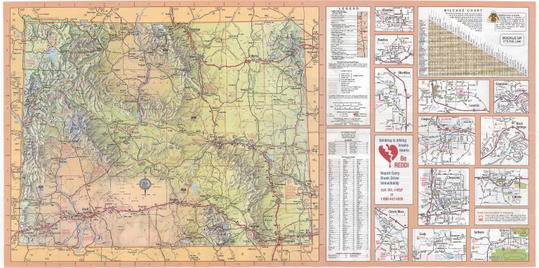
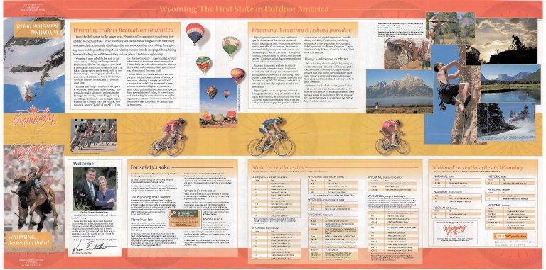
Description
WY Highway Map, includes Highways, State Parks, graded and earth roads, info centers, points of interest, rest areas, intermittent streams county seats, railroads, rivers & streams, scenic byways, National Forests & Grasslands, National Park Service areas historic trails, map scale, map relief, cities & towns, city enlargements, Wyoming city & town index, mileage chart. Reverse: safety message, State & National recreation site listings, general recreation info. 3 sets with 1 sheet paper
Category - Type
Map-State
MCDB_286
Undated
Cody Map
Cody Map by Provident F...
Map-City/Cody
 
Title
Cody Map
Date
Undated
Description
Cody Map by Provident Federal Savings & Loan includes streets, index to building markers, highway, lakes, general information on back
Category - Type
Map-City/Cody
MCDB_286
Undated
Cody Map
Cody Map by Provident F...
Map-City/Cody
 
Title
Cody Map
Date
Undated
Description
Cody Map by Provident Federal Savings & Loan includes streets, index to building markers, highway, lakes, general information on back
Category - Type
Map-City/Cody
MCDB_101
Undated
Wyoming Map
WY Map by US Dept of In...
Map-State
 
Title
Wyoming Map
Date
Undated
Description
WY Map by US Dept of Interior Geological Survey includes townships, ranges, counties, cities, towns, highways & interstates 1 reverse positive
Category - Type
Map-State
MCDB_1451281670
1923
University of Wyoming G...
University of WY Gymnas...
Plan/Specification
 
Title
University of Wyoming Gymnasium Building, Laramie, WY plan
Date
1923
Description
University of WY Gymnasium Building, Laramie, WY, 3 sheets vellum
Category - Type
Plan/Specification
MCDB_565409391
1946
Wyoming State Training ...
WY State Training Schoo...
Plan/Specification
 
Title
Wyoming State Training School Infirmary Addition Hearing Plan
Date
1946
Description
WY State Training School Infirmary Addition Hearing Plan, by North Central Gas Company, 1 set with 1 sheet blueprint (undersized)
Category - Type
Plan/Specification
MCDB_-2100529839
1954
Natrona County Airport ...
Plan/Specification
 
Title
Natrona County Airport Crash Station Remodeling Plan
Date
1954
Description
Natrona County Airport Crash Station Remodeling Plan by Robert Wehrli, job 5463, project #3, 3 sheets blueprint
Category - Type
Plan/Specification
MCDB_-1240986952
1964
Hot Springs State Park ...
Plan/Specification
 
Title
Hot Springs State Park Water & Storm Sewer Improvements (As Built)
Date
1964
Description
Hot Springs State Park Water & Storm Sewer Improvements (As Built), by TR Musinger & Sons-contractor, Engineering Services Inc, 1 set with 8 sheets blueline paper
Category - Type
Plan/Specification
MCDB_-1913045878
1973
Riverton Municipal Airp...
Plan/Specification
 
Title
Riverton Municipal Airport Aircraft Fuel Storage Airport Master Plan
Date
1973
Description
Riverton Municipal Airport Aircraft Fuel Storage Airport Master Plan by DE Whitehead, 1 sheet blueline paper
Category - Type
Plan/Specification
MCDB_-1343162640
1977
Cody Municipal Airport ...
Plan/Specification
 
Title
Cody Municipal Airport Layout Plan
Date
1977
Description
Cody Municipal Airport Layout Plan by Graham & Assoc, 3 sheets blueline paper
Category - Type
Plan/Specification
MCDB_-1613665520
1991
Wyoming Territorial Pen...
WY Territorial Penitent...
Plan/Specification
 
Title
Wyoming Territorial Penitentiary Horse Barn Renovation
Date
1991
Description
WY Territorial Penitentiary Horse Barn Renovation, Job No. 4400A by Curtis D. Summers Inc, Jan 1991, 1 set with 31 sheets blueline paper,
Category - Type
Plan/Specification
MCDB_1536044536
Undated
Laramie County Courthou...
Plan/Specification
 
Title
Laramie County Courthouse (unidentified building), front view, Cheyenne, WY plan
Date
Undated
Description
Laramie County Courthouse (unidentified building), front view, Cheyenne, WY by Robert W. Postin, 1 set with 1 sheet paper
Category - Type
Plan/Specification
MCDB_605922637
Undated
Riverton Municipal Airp...
Plan/Specification
 
Title
Riverton Municipal Airport Master Plan
Date
Undated
Description
Riverton Municipal Airport Master Plan by HNB Consulting Engineers, 3 sheets blueline paper
Category - Type
Plan/Specification
MCDB_-401530677
1886
Silver Crown Mining Dis...
Map-Mineral
 
Title
Silver Crown Mining District, Claims of James Adams & Company
Date
1886
Description
Silver Crown Mining District, Claims of James Adams & Company, includes mine locations, river, county road, 1 set with 1 sheet vellum
Category - Type
Map-Mineral
MCDB_45
1913 Circa
Clason's Industrial Map...
Map-State
 
Title
Clason's Industrial Map of Wyoming
Date
1913 Circa
Description
Clason's Industrial Map of WY by Classon Map Co. copyrighted 1911 includes mineral resources, agricultural land, townships, ranges, railroads, roads, trails, national forests, US Land districts, index for mountains, rivers, creeks, cities, towns
Category - Type
Map-State
MCDB_-741552453
1923
Resurvey Map Sheet 1 To...
Resurvey Map Sheet 1 by...
Map-Survey
 
Title
Resurvey Map Sheet 1 Township 12, Range 86, Sections 1 - 18
Date
1923
Description
Resurvey Map Sheet 1 by Clyde W. Atherly, US Surveyor General's Office, surveyed by Roy E. Chase & Alex Douglas AV Richards, includes Township 12, Range 86, Sections 1 - 18, Wyoming & Colorado border, tracts, topo info, sectional correction line, roads, creeks, land ownership, Index to Segregated Tracts with legal description, entry no. & status, entryman name; Patented Mineral Claim Table with survey no. & name; amount of surveys, No. 723, 2 sets-1 with 1 sheet neg paper & 1 with 1 sheet pos paper
Category - Type
Map-Survey
MCDB_2025613838
1923
Resurvey Map Township 1...
Resurvey Map by Clyde W...
Map-Survey
 
Title
Resurvey Map Township 13, Range 87, Sections 1 - 36
Date
1923
Description
Resurvey Map by Clyde W. Atherly, US Surveyor General's Office, surveyed by Adams & Schuch, Roy E. Chase, includes Township 13, Range 86, Sections 1 - 18, tracts, topo info, sectional correction line, roads, creeks, land ownership, Patented Mineral Patented Mineral Claim Table with survey no. & claim name; Areas of sub-tracts of Tract 39, amount of surveys, No. 924. 1 with 1 sheet negative paper
Category - Type
Map-Survey
MCDB_-1810708626
Undated
Wyoming Oil & Gas Map
WY Oil & Gas Map by WY ...
Map-Mineral
 
Title
Wyoming Oil & Gas Map
Date
Undated
Description
WY Oil & Gas Map by WY Oil & Gas Conservation Commission, includes cities & towns, oil fields, gas fields, pipe lines, paved roads, 1 set with 1 sheet blueline paper (extremely faded)
Category - Type
Map-Mineral
MCDB_-609240375
1880
Survey Map Township 15,...
Survey Map by Edw C. Da...
Map-Survey
 
Title
Survey Map Township 15, Range 83, Sections 1 - 36
Date
1880
Description
Survey Map by Edw C. David, surveyed by Wm O. Downey, US Surveyor General's Office, printed-A Gast & Co, Township 15, Range 83, Sections 1 - 36, includes topo info, Road to Fort Steele, Cherokee Road, roads, creeks, North Platte River landowner info-J Moody, A Baggott, Jas Parr, GH Nichols, E. Nichols, WS Perryam, McFales, total number of acres, date of contracts, amount of surveys, No. 643, 535, 1 set with 1 sheet negative paper
Category - Type
Map-Survey
MCDB_1277765824
1883
Survey Map Township 23,...
Survey Map by Edw. C Da...
Map-Survey
 
Title
Survey Map Township 23, Range 83, Sections 1 - 36
Date
1883
Description
Survey Map by Edw. C David, US Surveyor General's Office, surveyed by JB Shelby, Thomas B. Medary, printed-A Gast & Co, Township 23, Range 83, Sections 1 - 36, includes topo info, Austin's Ranch to Fort Steele Road, creeks, total number of acres, dates of contracts, amount of surveys, magnetic declination, 1 set with 1 sheet negative paper
Category - Type
Map-Survey
MCDB_-841438783
1883
Survey Map Township 24,...
Survey Map by Edw. C Da...
Map-Survey
 
Title
Survey Map Township 24, Range 83, Sections 1 - 36
Date
1883
Description
Survey Map by Edw. C David, US Surveyor General's Office, surveyed by JB Shelby, Downey & Grant, printed-A Gast & Co, Township 24, Range 83, Sections 1 - 36, includes topo info, Fort Steele Road, Medicine Bow River, coal outcropping, creeks, total number of acres, dates of contracts, amount of surveys, magnetic declination, No. 2196, 1 set with 1 sheet negative paper
Category - Type
Map-Survey
MCDB_-787822029
1892
Reduced Fort Bridger Mi...
Map-Survey
 
Title
Reduced Fort Bridger Military Reservation Survey Map Township 15 Range 115, Sections 27 - 34, Township 16, Range 115, Sections 3 - 5, 8 - 10, 15 - 17, 20 - 22
Date
1892
Description
Reduced Fort Bridger Military Reservation Survey Map by Wm A. Richards, surveyed by WM Gilcrest, US Surveyor General's Office, Township 15 , Range 115, Sections 27 - 34, Township 16, Range 115, Sections 3 - 5, 8 - 10, 15 - 17, 20 - 22, includes topo info, roads, ditch, National Cemetery, Carter, Sage Flat, Tank & Pumphouse, store, telephone line, total number of acres, dates of contracts, amount of surveys, magnetic declination, 1 set with 1 sheet negative paper
Category - Type
Map-Survey
151-180 of 180
1 2 3 4