|
REFINE
Browse All : Images of AS Map Case D, Drawer 10 and Wyoming
1-24 of 24
Title
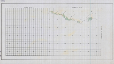
Laramie County-Public Roads Administration-Highway Planning Survey
Date
1940
Description
Laramie County-Public Roads Administration-Highway Planning Survey, WY State Engineer Highway Map, may include forests, trails, railroads, geology, improvements & industry, 1 set with 1 sheet paper
Category - Type
Map-County/Laramie
Title
Wyoming State Engineer Streams & Diversions Map of Little Camp Creek, Muddy Creek, Whiskey Creek, Mahoney Ditch, Muddy Creek Ditch, Speyer Ditch, Hays Ditch
Date
Undated
Description
WY State Engineer Streams & Diversions Map of Little Camp Creek, Muddy Creek, Whiskey Creek, Mahoney Ditch, Muddy Creek Ditch, Speyer Ditch, Hays Ditch in Township 27, Range 89-Range 90, Map 8102, 1 set with 1 sheet paper
Category - Type
Map-Water
Title
Wyoming State Engineer Streams & Diversions Map of Muddy Creek, Cottonwood Creek, June Creek, Marsh Ditch in Township 26, Range 88-Range 89
Date
Undated
Description
WY State Engineer Streams & Diversions Map of Muddy Creek, Cottonwood Creek, June Creek, Marsh Ditch in Township 26, Range 88-Range 89, Map 8102, 1 set with 1 sheet paper
Category - Type
Map-Water
Title
Cody, William F (and others)-Quarry & Timber Claims in Township 50, Range 103
Date
1895
Description
Cody, William F (and others)-Quarry & Timber Claims in Township 50, Range 103, WY State Engineer General Subject Map, may include forests, trails, railroads, geology, improvements & industry, 1 set with 1 sheet paper
Category - Type
Map-Mineral
Title
Wyoming-Inland Oil Index (Oil & Gas) highway map
Date
1937
Description
WY-Inland Oil Index (Oil & Gas), WY State Engineer Highway Map, may include forests, trails, railroads, geology, improvements & industry, 1 set with 1 sheet paper
Category - Type
Map-Mineral
Title
Mineral Resources Map of the Burlington (Railroad) Lines
Date
1940
Description
Mineral Resources Map of the Burlington (Railroad) Lines, WY State Engineer Highway Map, may include forests, trails, railroads, geology, improvements & industry, 1 set with 1 sheet paper
Category - Type
Map-Railroad
Title
Guernsey, WY-Primary Types of Mineral Deposits for Magnesium Reduction Industry
Date
1942
Description
Guernsey, WY-Primary Types of Mineral Deposits for Magnesium Reduction Industry, WY State Engineer General Subject Map, may include forests, trails, railroads, geology, improvements & industry, 1 set with 1 sheet paper
Category - Type
Map-Mineral
Title
FMC Corp, LaBarge Natural Gas Pipeline, Opal Extension
Date
1973
Description
FMC Corp, LaBarge Natural Gas Pipeline, Opal Extension, WY State Engineer General Subject Map, may include forests, trails, railroads, geology, improvements & industry, 1 set with 1 sheet paper
Category - Type
Map-Mineral
Title
Black Thunder Mine Plant-Sewage Treatment Lagoon Earthwork
Date
1975
Description
Black Thunder Mine Plant-Sewage Treatment Lagoon Earthwork, WY State Engineer General Subject Map, may include forests, trails, railroads, geology, improvements & industry, 1 set with 1 sheet paper
Category - Type
Map-Mineral
Title
Black Thunder Mine Plant-Water Storage Lagoon Earthwork
Date
1975
Description
Black Thunder Mine Plant-Water Storage Lagoon Earthwork, WY State Engineer General Subject Map, may include forests, trails, railroads, geology, improvements & industry, 1 set with 1 sheet paper
Category - Type
Map-Mineral
Title
Big Horn Coal Company Proposed Railroad Load-Out Track & Haul Truck Crossing Location
Date
1976
Description
Big Horn Coal Company Proposed Railroad Load-Out Track & Haul Truck Crossing Location, WY State Engineer General Subject Map, may include forests, trails, railroads, geology, improvements & industry, 1 set with 1 sheet paper
Category - Type
Map-Mineral
Title
Black Thunder Mine Plant-Settling Pond
Date
1976
Description
Black Thunder Mine Plant-Settling Pond, WY State Engineer General Subject Map, may include forests, trails, railroads, geology, improvements & industry, 1 set with 1 sheet paper
Category - Type
Map-Mineral
Title
Black Thunder Mine Plant-Site Plan
Date
1976
Description
Black Thunder Mine Plant-Site Plan, WY State Engineer General Subject Map, may include forests, trails, railroads, geology, improvements & industry, 1 set with 1 sheet paper
Category - Type
Map-Mineral
Title
Federal-American Partners, FAP Gas Hills No. 1, Before Mining Contour
Date
1977
Description
Federal-American Partners, FAP Gas Hills No. 1, Before Mining Contour, WY State Engineer General Subject Map, may include forests, trails, railroads, geology, improvements & industry, 1 set with 1 sheet paper
Category - Type
Map-Mineral
Title
Federal-American Partners, FAP Gas Hills No. 1, Final Contour After Reclamation
Date
1977
Description
Federal-American Partners, FAP Gas Hills No. 1, Final Contour After Reclamation, WY State Engineer General Subject Map, may include forests, trails, railroads, geology, improvements & industry, 1 set with 1 sheet paper
Category - Type
Map-Mineral
Title
Black Thunder Mine, Campbell County, WY map
Date
Undated
Description
Black Thunder Mine, Campbell County, WY State Engineer General Subject Map, may include forests, trails, railroads, geology, improvements & industry, 1 set with 1 sheet paper
Category - Type
Map-Mineral
Title
Federal Bentonite Company, Geisinger Claim
Date
Undated
Description
Federal Bentonite Company, Geisinger Claim, WY State Engineer General Subject Map, may include forests, trails, railroads, geology, improvements & industry, 1 set with 2 sheets paper
Category - Type
Map-Mineral
Title
Mineral Hill Gold Properties, Owned & Controlled
Date
Undated
Description
Mineral Hill Gold Properties, Owned & Controlled, WY State Engineer Highway Map, may include forests, trails, railroads, geology, improvements & industry, 1 set with 1 sheet paper
Category - Type
Map-Mineral
Title
Union Pacific Railroad-Fort Steele-Rawlins Pipeline Survey of Right-of-Way
Date
1905
Description
Union Pacific Railroad-Fort Steele-Rawlins Pipeline Survey of Right-of-Way, WY State Engineer Highway Map, may include forests, trails, railroads, geology, improvements & industry, 1 set with 1 sheet paper
Category - Type
Map-Railroad
Title
Daley's Ranch to Fort Steele road
Date
1912
Description
Daley's Ranch to Fort Steele, Carbon County, WY State Engineer Highway Map, may include forests, trails, railroads, geology, improvements & industry, 1 set with 1 sheet paper
Category - Type
Map-Trail or Road
Title
Carbon County-Trans-Continental Highway from East County Line to Fort Steele
Date
Undated
Description
Carbon County-Trans-Continental Highway from East County Line to Fort Steele, WY State Engineer Highway Map, may include forests, trails, railroads, geology, improvements & industry, 1 set with 1 sheet paper
Category - Type
Map-Trail or Road
Title
Wyoming State Engineer Streams & Diversions Map of Crazy Woman Creek, etc, in Township 46-Township 47, Range 83-Range 84
Date
Undated
Description
WY State Engineer Streams & Diversions Map of Crazy Woman Creek, Steele Creek, Poison Creek, Mattox Creek, Pole Creek, Beaver Creek, Mayflower Ditch, North Side Ditch, Freeman Ditch in Township 46-Township 47, Range 83-Range 84, Map 8052, 1 set with 1 sheet paper
Category - Type
Map-Water
Title
Wyoming State Engineer Streams & Diversions Map of Steele Creek, etc
Date
Undated
Description
WY State Engineer Streams & Diversions Map of Steele Creek, Poison Creek, Crazy Woman Creek, Horn Creek, Poison Creek Ditch, Mitchell Ditch, Long Ditch, Teddy Miller Ditch, Steele Creek Ditch, John P Smith Ditch, Moreton Ditch, Harris Ditch, Spang Ditch in Township 46-Township 47, Range 81-Range 82, Map 8052, 1 set with 1 sheet paper
Category - Type
Map-Water
Title
Union Pacific Railroad-Carter, Survey of Right-of-Way, Line, Dam, Reservoir & Pipeline
Date
Undated
Description
Union Pacific Railroad-Carter, Survey of Right-of-Way, Line, Dam, Reservoir & Pipeline, WY State Engineer Highway Map, may include forests, trails, railroads, geology, improvements & industry, 1 set with 1 sheet paper
Category - Type
Map-Railroad
1-24 of 24
|