|
REFINE
Browse All : Images of AS Map Case D, Drawer 15
1-5 of 5
Title
Fort Leavenworth to the Great Salt Lake Route
Date
1850
Description
Map of Route from Fort Leavenworth to the Great Salt Lake. State border, the North Platte River, the South Pllatte River and the Great Salt Lake are highlighted
Category - Type
Map-Trail or Road
Title
Albany County Geologic Map
Date
1935
Description
Albany County Geologic Map by Geological Survey of WY, David Love, from WY State Planning Board/WY State Planning & Water Conservation Board records, includes townships & ranges, cities & towns, rivers & creeks, highway, railroad, formations, 1 set with 1 sheet blueline paper
Category - Type
Map-County/Albany
Title
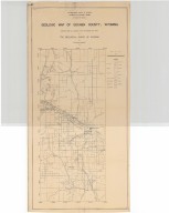
Goshen County Geologic Map
Date
1936
Description
Goshen County Geologic Map by Geological Survey of WY, Arthur M Morgan, from WY State Planning Board/WY State Planning & Water Conservation Board records, includes townships & ranges, cities & towns, rivers & creeks, highway, railroad, formations, 1 set with 1 sheet blueline paper
Category - Type
Map-County/Goshen
Title
Platte County Geologic Map
Date
1937
Description
Platte County Geologic Map by Geological Survey of WY, from WY State Planning Board/WY State Planning & Water Conservation Board records, includes townships & ranges, cities & towns, rivers & creeks, highway, railroad, formations, 1 set with 1 sheet blueline paper
Category - Type
Map-County/Platte
1-5 of 5
|


