|
REFINE
Browse All : Images of Cheyenne and 2 and Wyoming and Laramie County
1-7 of 7
Title
Cheyenne Birds Eye View Map
Date
1882
Description
Cheyenne Birds Eye View Map by Beck & Pauli, JJ Stoner includes streets, avenues, buildings, railroads, 4 building images, index to some buildings 5 copies
Category - Type
Map-Birds Eye View/Cheyenne
Title
Cheyenne Birds Eye View Map
Date
1882
Description
Cheyenne Birds Eye View Map by Beck & Pauli, JJ Stoner includes streets, avenues, buildings, railroads, 4 building images, index to some buildings 5 copies
Category - Type
Map-Birds Eye View/Cheyenne
Title
Cheyenne Experiment Farm Map
Date
1907
Description
Cheyenne Experiment Farm Map, by US Dept of Agriculture, Office of Experiment Stations, includes, types of crops, locations of wells, evaporation tanks, reservoir, roads, railroad, 1 set with 1 sheet blueprint
Category - Type
Map-Site
Title
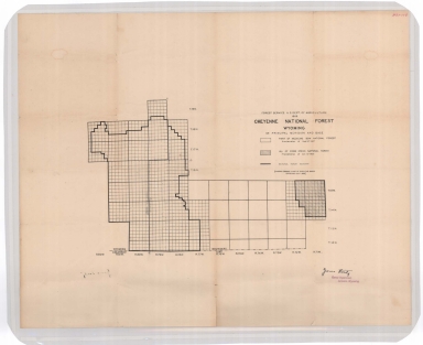
Cheyenne National Forest map
Date
1908
Description
Cheyenne National Forest by US Dept of Agriculture, US Forest Service, includes Crow Creek National Forest boundaries, townships, ranges, sections
Category - Type
Map-Forest/Cheyenne
Title
Cheyenne Birds Eye View Map
Date
1974
Description
Cheyenne Birds Eye View Map by Beck & Pauli, JJ Stoner includes streets, avenues, buildings, railroads, 4 building images, index to some buildings 4 copies of a 1974 reprint of 1882 map by Historic Urban Plans from a Library of Congress lithograph #1,
Category - Type
Map-Birds Eye View/Cheyenne
Title
Wyoming State Childrens Home Floor Plan, Cheyenne plan
Date
Undated
Description
WY State Childrens Home Floor Plan, Cheyenne, 1 set with 4 sheets paper
Category - Type
Plan/Specification
Title
Wyoming Supreme Court Building plan, Cheyenne, WY
Date
Undated
Description
Supreme Court Building, (9 sheets), Cheyenne, WY, (Not with contents pulled from AS FF, probably transferred to State Building Plan Collection)
Category - Type
Plan/Specification
1-7 of 7
|


