|
REFINE
Browse All : Images of Cheyenne and Wyoming and Laramie County and AS Map Case E
1-3 of 3
Title
Frontier Park Grandstand untitled plans-exterior drawings, Cheyenne, WY
Date
1956
Description
Frontier Road Map of WY & Southern ID, by Rand McNally & Co, two-sided map, includes UT, CO, NE, SD, KS, portions of ND, MT, MO, IA, MN, AZ, NM, NV, CA, AR, OK, WA, OR, mileage chart for West US, City & Town index, Frontier Refining Co ads, highways & interstates, radio stations, national parks, fish hatcheries, lakes & reservoirs, mountains, airports, camping, recreational & historical sites, rivers, 1 set with 1 sheet colored paper
Category - Type
Map-State
Title
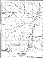
Hat Creek, Cheyenne Deadwood Stage Road Map
Date
1960
Description
10 Hat Creek, Cheyenne Deadwood Stage Road Map by LC Bishop, includes townships, ranges, rivers, creeks, roads, trails, pony express stations, graves, 1 sheet vellum, 15 paper copies
Category - Type
Map-Trail or Road
1-3 of 3
|


