|
REFINE
Browse All : Images of Digital from Undated
1-10 of 10
Title
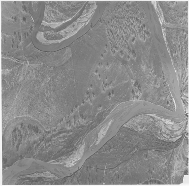
Aerial Photo of Military Site, possibly Fort Reno
Date
Undated
Description
Aerial Photo of Military Site, possibly Fort Reno
Category - Type
Military-Fort Reno
Title
Cody Canal - WY
Date
Undated
Description
Cody Canal - WY from WY Department of Public Land's Carey Act project file, includes Townships 100, 101, 102 & 103, Ranges 51, 52, 53, Shoshone River, location of canal, lateral, creeks, town of Cody, 1 set with 1 sheet paper
Category - Type
Map-Water
Title
Fort Fetterman Vicinity Map
Date
Undated
Description
Fort Fetterman Vicinity Index Map showing location, owner, & brand of ranches during frontier town--a settlement pattern
Category - Type
Military-Fort Fetterman
Title
Pony Express Route Map
Date
Undated
Description
Pony Express Route Map, includes only route, stops, distance between stops, two unnamed rivers, possibly by LC Bishop
Category - Type
Map-Trail or Road
Title
Pony Express, Trails & Outposts route
Date
Undated
Description
Route of the Pony Express, Trails & Outposts established by soldiers, traders, trappers & homeseekers in ther great task of opening the last American frontier, by Geroge Gray, Pony Express Barn, Hotel Robidoux, American Hotels Corp, includes narrative throughout
Category - Type
Map-Trail or Road
Title
Reed's Towns Tales of Laramie, WY
Date
Undated
Description
Reed's Towns Tales of Laramie, WY, It's history & progress as we have heard it told, inlcudes drawings and commentary (no map)
Category - Type
Map-Pictorial
Title
Summertime in Wyoming poster
Date
Undated
Description
Summertime in WY, An Acryclic Painting of one of the Scenic Wonders of The West?Ǫ, scan only inlcudes page with outlines of numbered butterfiles with corresponding identification & description by William H Howe, also includes an advertisement line "When In Jackson see 'The Moths' of Wyoming" at the Granite Granch, Mrs Larry Moore, prop
Category - Type
Poster-Advertisement
Title
Survey Map Township 12 - Township 37, Range 75 - Range 91
Date
Undated
Description
Survey Map, Township 12 - Township 37, Rnage 75 - Range 91, includes sections, rivers, creeks, lakes, roads, 1 set with 1 sheet blueline paper
Category - Type
Map-Survey
Title
Wyoming State Historical Society/Chapters Logos, hand drawn
Date
Undated
Description
Wyoming State Historical Society/Chapters Logos, hand drawn
Category - Type
Poster-Advertisement
1-10 of 10
|


