|
REFINE
Browse All : Images of Fort DA Russell
1-29 of 29
Title
Fort DA Russell Military Reservation plat
Date
1867
Description
Fort DA Russell Military Reservation plat, includes boundary line, legal description, type of land, roads, creeks, railroad switch, Cheyenne city corner
Category - Type
Military-Fort DA Russell
Title
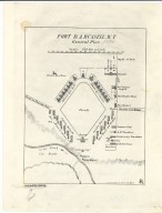
Fort DA Russell General Plan
Date
1875
Description
Fort DA Russell General Plan
Category - Type
Military-Fort DA Russell
Title
Fort D.A. Russell & Vicinity Topographic Map
Date
1875 Circa
Description
Topographic Map of Fort D.A. Russell & Vicinity. Ordered drawn by Col. James J. Van Horn, 8th Infantry. 4512 acres. includes topo, water courses, boundries, Range/Township/Section Numbers, railroad lines, Cheyenne street layout, numbered legend of buildings by location & type of use, roads, telegraph, windmill, lakes, map scales, named vicinity ranches elevations, Latitude 41 degrees 8' N, Longitude 104 degrees 50 W, land use on reservation lands. 2 copies.
Category - Type
Military-Fort DA Russell
Title
Fort DA Russell - Cheyenne Depot plat
Date
1884
Description
Fort DA Russell - Cheyenne Depot plat, includes building locations and railroad tracks
Category - Type
Military-Fort DA Russell
Title
Fort DA Russell General Plan
Date
1885
Description
Fort DA Russell General Plan
Category - Type
Military-Fort DA Russell
Title
Fort DA Russell & Cheyenne & Northern Railway Map
Date
1886
Description
Fort DA Russell & Cheyenne & Northern Railway Map, 2 partial sheets
Category - Type
Military-Fort DA Russell
Title
Fort DA Russell & Cheyenne & Northern Railway Map
Date
1886
Description
Fort DA Russell & Cheyenne & Northern Railway Map, 2 partial sheets
Category - Type
Military-Fort DA Russell
Title
Fort DA Russell & Cheyenne & Northern Railway Map
Date
1886
Description
Fort DA Russell & Cheyenne & Northern Railway Map, 2 partial sheets
Category - Type
Military-Fort DA Russell
Title
Fort DA Russell & Cheyenne & Northern Railway Map
Date
1886
Description
Fort DA Russell & Cheyenne & Northern Railway Map, 2 partial sheets
Category - Type
Military-Fort DA Russell
Title
Fort DA Russell plan-site map
Date
1888
Description
Fort DA Russell plan-site map includes building locations & names, roads, creek
Category - Type
Military-Fort DA Russell
Title
Fort DA Russell Map
Date
1903
Description
Fort DA Russell Map compiled from existing maps with additions, platted & drawn by Capt Guy HB Smith, 4th Inf, includes building locations & types, fences, telegraph & telephone line, reservoir, railroad, 2 sets (1 set with 1 sheet vellum, 1 set with 1 sheet blueline paper)
Category - Type
Military-Fort DA Russell
Title
Mounted Reconnaissance from Fort DA Russell through Crow Creek Timber Reservation
Date
1903
Description
Mounted Reconnaissance from Fort DA Russell through Crow Creek Timber Reservation, WY; by 1st Lieut. HB Farrar, Artillery Corps Engineer Officer; includes railroad tracks & station designations, boundary of reservation, towns, ranches, roads, mountains, creeks, 1 set with 1 sheet encapsulated blueprint
Category - Type
Military-Fort DA Russell
Title
Fort DA Russell reservation map
Date
1909
Description
Fort DA Russell reservation map showing proposed location for Cheyenne water pipe line
Category - Type
Military-Fort DA Russell
Title
Fort DA Russell Partial Plat,
Date
1910
Description
Fort DA Russell Partial Plat, showing Proposed Sidewalks, Roads & Grading, by the Constructing Quartermaster Office, includes building designations & names, grades, crossing types, proposed building sites, culverts, 1 set with 1 sheet blueprint
Category - Type
Military-Fort DA Russell
Title
Fort DA Russell blueprint of grounds & buildings
Date
1917
Description
Fort DA Russell blueprint of grounds & buildings. Framed buildings are numbered but rarely named. Includes utilities, drainages by structure type, walks, roadway, water courses, railroads, fences, map scale.
Category - Type
Military-Fort DA Russell
Title
Fort DA Russell & Vicinity Training Map, Grid Zone E
Date
1928
Description
Fort DA Russell & Vicinity Training Map, Grid Zone E., Advance Sheet, Harriman Index 1685:6426/7050 . Topography, elevation, US Bureau of Ag. Experimental Station, ranch names, hill names, lakes, roads, water courses, railroad, boundaries, longitude & latitude, city of Cheyenne streets, fort grounds & building locations, scale, gravel pits, municipal campgrounds, Cheyenne Country Club Golf Course
Category - Type
Military-Fort DA Russell
Title
Fort DA Russell Map
Date
1959-1960
Description
06 Fort DA Russell Map, by LC Bishop, includes townships, ranges, rivers, creeks, roads, trails, pony express stations, graves, drawing of Camp Walbach, drawing of Pedestal Rock by Brt Major Williams, 2 paper copies
Category - Type
Military-Fort DA Russell
Title
Fort DA Russell/FE Warren AFB, Basic Mission Plan
Date
1967
Description
Fort DA Russell/FE Warren AFB, Basic Mission Plan 3 sheets blueprints
Category - Type
Military-Fort DA Russell
Title
Fort DA Russell Map
Date
Undated
Description
Fort DA Russell Map by Captain WS Scott, includes locations & names of buildings, railroad, streets, wells, sewer lines, manholes, fire hydrants pipelines, Photostat
Category - Type
Military-Fort DA Russell
Title
Fort DA Russell site map
Date
Undated
Description
Fort DA Russell site map includes building locations & names, building roads, creek
Category - Type
Military-Fort DA Russell
Title
Fort DA Russell, Outline Map of Military Reservation
Date
Undated
Description
Fort DA Russell, Outline Map of Military Reservation with Plat Land ownership surrounding
Category - Type
Military-Fort DA Russell
Title
Fort DA Russell/FE Warren Air Force Base US Air Force Preliminary Master Plan
Date
Undated
Description
Fort DA Russell/FE Warren AFB US Air Force Preliminary Master Plan, 18 sheets blueprints
Category - Type
Military-Fort DA Russell
Title
Fort DA Russell/FE Warren AFB, Building Plans Repair of Commissary
Date
1983
Description
Fort DA Russell/FE Warren AFB, Building Plans Repair of Commissary 3 sheets blueprints
Category - Type
Military-Fort DA Russell
Title
Fort Russell Map
Date
1858-1959
Description
Fort Russell Map
Category - Type
Military-Fort DA Russell
Title
Fort DA Russell Military Reservation plat
Date
1867
Description
Fort DA Russell Military Reservation plat, includes boundary line, legal description, type of land, roads, creeks, railroad switch, Cheyenne city corner
Category - Type
Military-Fort DA Russell
Title
Fort DA Russell Military Reservation Map
Date
1869
Description
Fort DA Russell Military Reservation Map, facsimiles
Category - Type
Military-Fort DA Russell
Title
Fort DA Russell Military Reservation Survey Map Township 14, Range 67
Date
1869
Description
Fort DA Russell Military Reservation Survey Map, by US Army Office of General William Myers, CQM, Department of the Platte, includes Township 14, Range 67, topo info railroad, creeks, fort, Quartermaster depot, stables, roads, description of land, 1 set with 1 sheet paper
Category - Type
Military-Fort DA Russell
1-29 of 29
|


