|
REFINE
Browse All : Images of Wyoming and 7
1-36 of 36
Title
Wyoming National Forest Map
Date
1936
Description
WY National Forest Map by US Dept of Agriculture, US Forest Service, includes boundaries, townships, ranges, sections, roads, trails, railroads, telephone lines, ranger stations, building, rivers, creeks
Category - Type
Map-Forest/WY
Title
Fremont County Map
Date
1936-1951
Description
Fremont County Map by State Mineral Supervisor Pierre LaFleiche, drafted by HG Lowman includes oil & gas fields, drainage, township, range, state land, primary & secondary roads WPA Project 109, 7/1936, rev 1951 Blueline
Category - Type
Map-County/Fremont
Title
Sweetwater County Map
Date
1937
Description
Sweetwater County Map by State Mineral Supervisor Pierre LaFleiche, Drafted by HG Lowman includes oil & gas fields, drainage, township, range, state land, primary & secondary roads WPA Project 6/1937 Blueline, 2 sets, 1 set is taped & cracking
Category - Type
Map-County/Sweetwater
Title
Fremont County Map
Date
1947
Description
Fremont County Map by WY Highway Dept includes township, range, towns, schools post offices, radio stations, oil & gas wells, mines, farms, cemeteries, airfields, drainage, rivers, creeks
Category - Type
Map-County/Fremont
Title
Fremont County Map
Date
1947
Description
Fremont County Map by WY Highway Dept includes township, range, towns, schools post offices, radio stations, oil & gas wells, mines, farms, cemeteries, airfields, drainage, rivers, creeks
Category - Type
Map-County/Fremont
Title
Fremont County Map
Date
1947
Description
Fremont County Map by WY Highway Dept includes township, range, towns, schools post offices, radio stations, oil & gas wells, mines, farms, cemeteries, airfields, drainage, rivers, creeks
Category - Type
Map-County/Fremont
Title
Sweetwater County Map
Date
1947
Description
Sweetwater County Map by WY Highway Dept Planning & Research Div, US Dept of Commerce, Bureau of Public Roads includes buildings, air routes, township, range, roads, natural features, drainage, railroads, towns 2 sheets, 2 sets, 1 incomplete
Category - Type
Map-County/Sweetwater
Title
Fremont County Map
Date
1955
Description
Fremont County Map by WY Highway Dept, Planning & Research Div, with US Dept of Commence, Bureau of Public Roads includes township, range, roads, drainage, railroads, post offices, schools, Ag exp stations, pipe lines, dwellings, towns, 1950 Co population, 1954 aerial photo 8 sheets
Category - Type
Map-County/Fremont
Title
Airport Zoning Map
Date
1974
Description
Airport Zoning Map for Cheyenne Municipal Airport - 1 sheet
Category - Type
Plan
Title
Sweetwater County Map
Date
Undated
Description
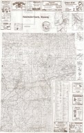
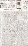
Sweetwater County Map. Advertisers, includes roads & roadway features, structures, railroads, drainages, natural features, boundaries, city & town centers, airways, public service & educational facilities, farm units, dwellings, forts, armory, pack or foot trail historic trail with name, coordinate points, triangulation stations, industrial sites, conservation & recreations sites, water bodies, river/stream drainages, 1/2 county map on each side.
Category - Type
Map-County/Sweetwater
Title
Cheyenne Horticultural Field Station Laboratory Building - preliminary sketches, Cheyenne, WY
Date
1939
Description
Cheyenne Horticultural Field Station Laboratory Building - preliminary sketches, Cheyenne, WY 1 set with 6 sheets vellum (plan 7 A)
Category - Type
Plan/Specification
Title
Cheyenne Horticultural Field Station Laboratory Building - preliminary sketches, Cheyenne, WY
Date
1939
Description
Cheyenne Horticultural Field Station Laboratory Building - preliminary sketches, Cheyenne, WY 1 set with 6 sheets vellum (plan 7 A)
Category - Type
Plan/Specification
Title
Cheyenne Horticultural Field Station Residences-Proposed - preliminary sketches, Cheyenne, WY - (plan 7 B)
Date
1939
Description
Cheyenne Horticultural Field Station Residences-Proposed - preliminary sketches, Cheyenne, WY 1 set with 3 sheets vellum (plan 7 B)
Category - Type
Plan/Specification
Title
Laramie County School District 1, Corlett School, Cheyenne, WY
Date
1940
Description
Laramie County School District 1, Corlett School blueprint, Cheyenne, WY
Category - Type
Plan/Specification
Title
Wyoming Game & Fish Commission-Metal Building plans, Lander, WY
Date
1958
Description
WY Game & Fish Commission-Metal Building plans, Lander, WY, plan 376, 1 set with 3 sheets tissue paper
Category - Type
Plan/Specification
Title
Wyoming Territorial Prison Park Area-Topographic Plans
Date
1990
Description
WY Territorial Park Area-Topographic Plans, by Banner Assoc, Mar 1990, 1 set with 9 sheets blueline paper
Category - Type
Plan/Specification
Title
Cheyenne Horticultural Field Station Greenhouses Addition- - preliminary sketches, Cheyenne, WY
Date
Undated
Description
Cheyenne Horticultural Field Station Greenhouses Addition- - preliminary sketches, Cheyenne, WY 1 set with 1 sheets vellum (plan 7 C)
Category - Type
Plan/Specification
Title
First National Bank Office Building, Cheyenne, WY
Date
Undated
Description
First National Bank Office Building, Cheyenne, WY, 2 sheets vellum, 1 blueprint, 3 sheets paper
Category - Type
Plan/Specification
Title
University of Wyoming Womens Hall plan
Date
Undated
Description
University of WY Womens Hall, Laramie, WY, 3 sheets vellum
Category - Type
Plan/Specification
Title
Map of portion of City of Cheyenne showing building heights
Date
1938
Description
Map of portion of City of Cheyenne showing building heights - 2 sheets
Category - Type
Plan
Title
Cheyenne Airport - Modification Center No. 10
Date
1942
Description
Cheyenne Airport - Modification Center No. 10, floor plans and exterior - 3 sheets
Category - Type
Plan
Title
Cheyenne Airport - Modification Center No. 10
Date
1942
Description
Cheyenne Airport - Modification Center No. 10,cafeteria, air and heating unit, nose hangar, and miscellaneous details - 9 sheets
Category - Type
Plan
Title
Plan - Cheyenne Airport Control Surfaces
Date
1974
Description
Cheyenne Airport Control Surfaces plan - 1 sheet, 1974
Category - Type
Plan
Title
Cheyenne Airport Topographic Map
Date
Undated
Description
Cheyenne Airport Topographic Map - 1 sheet
Category - Type
Plan
Title
Sweetwater County Map
Date
1937-1946
Description
Sweetwater County Map by State Mineral Supervisor Pierre LaFleiche, Drafted by H.G. Lowman includes oil & gas fields, drainage, township, range, state Land, primary & secondary roads WPA Project 1937, 1946, Blueline
Category - Type
Map-County/Sweetwater
1-36 of 36
|


