|
Title
Frontier Park Building Plans Frontier Pavillion Remodel Cheyenne
Date
Undated
Description
Frontier Park Building Plans Frontier Pavillion Remodel Cheyenne by Douglas Coates, architect 1sheet: first floor plan, includes display information in pencil
Category - Type
Plan/Specification
Title
Fort Laramie to Cheyenne Pass Route
Date
1858
Description
Route from Fort Laramie to Cheyenne Pass by BVT Major Williams with orders to establish a post, includes sketch of Camp Walbach and Pedistal Rock
Category - Type
Military-Camp Walbach
Title
Fort DA Russell Military Reservation plat
Date
1867
Description
Fort DA Russell Military Reservation plat, includes boundary line, legal description, type of land, roads, creeks, railroad switch, Cheyenne city corner
Category - Type
Military-Fort DA Russell
Title
Cheyenne Plat
Date
1868
Description
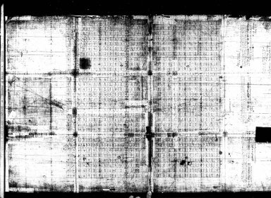
Cheyenne Plat by Cheyenne City Council & SH Winsor, surveyor includes lots, blocks, streets, drawings of some buildings, railroad, creek, 1 set with 1 sheet negative paper
Category - Type
Map-City/Cheyenne
Title
Dodge Plat of Cheyenne
Date
1868 Circa
Description
Dodge Plat of Cheyenne, poor quality original
Category - Type
Map-City/Cheyenne
Title
Woman's Suffrage Session Law, Woman's Suffrage Act, Council Journal entry
Date
1869
Description
Woman's Suffrage Session Law, Woman's Suffrage Act, Council Journal entry
Category - Type
Misc
Title
Certificate Notary Public, Laramie County, Edward Johnson
Date
1870
Description
Certificate Notary Public, Laramie County, Edward Johnson
Category - Type
Certificate-Appointment
Title
Cheyenne Birds Eye View Map
Date
1870
Description
Cheyenne Birds Eye View Map includes buildings railroad, creek, fort (1 reprint, compliments of North Cheyenne Development Co) 3 copies
Category - Type
Map-Birds Eye View/Cheyenne
Title
Cheyenne Birds Eye View Map
Date
1870
Description
Cheyenne Birds Eye View Map includes buildings railroad, creek, fort (1 reprint, compliments of North Cheyenne Development Co) 3 copies
Category - Type
Map-Birds Eye View/Cheyenne
Title
Cheyenne Plat
Date
1870
Description
Cheyenne Plat by August Koch includes lots, blocks, creeks, dedication 1 Xerox copy
Category - Type
Map-City/Cheyenne
Title
Cheyenne Plat
Date
1870
Description
Cheyenne Plat by August Koch includes lots, blocks, creeks, dedication 1 Xerox copy
Category - Type
Map-City/Cheyenne
Title
Fort DA Russell General Plan
Date
1875
Description
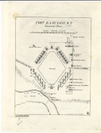
Fort DA Russell General Plan
Category - Type
Military-Fort DA Russell
Title
Fort D.A. Russell & Vicinity Topographic Map
Date
1875 Circa
Description
Topographic Map of Fort D.A. Russell & Vicinity. Ordered drawn by Col. James J. Van Horn, 8th Infantry. 4512 acres. includes topo, water courses, boundries, Range/Township/Section Numbers, railroad lines, Cheyenne street layout, numbered legend of buildings by location & type of use, roads, telegraph, windmill, lakes, map scales, named vicinity ranches elevations, Latitude 41 degrees 8' N, Longitude 104 degrees 50 W, land use on reservation lands. 2 copies.
Category - Type
Military-Fort DA Russell
Title
Cheyenne Birds Eye View, "Cheyenne, the Gateway to the Land of Gold"
Date
1876
Description
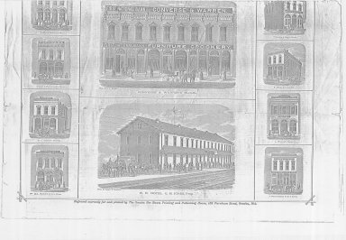
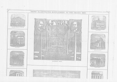
Cheyenne Birds Eye View, "Cheyenne, the Gateway to the Land of Gold", illustrated from the Omaha Daily Bee includes drawings of buildings, & map of Black Hills Gold region 2 pages (Xeroxes, pages split in half--total of 4 )
Category - Type
Map-Birds Eye View/Cheyenne
Title
Laramie County Plat of Southeastern Portion of WY
Date
1878
Description
Laramie County Plat of Southeastern Portion of WY
Category - Type
Map-Site
Title
Cheyenne Birds Eye View Map
Date
1878 Circa
Description
Cheyenne Birds Eye View Map of business quarter by R Laughey includes streets, avenues, buildings, railroads (newspaper print) 2 copies
Category - Type
Map-Birds Eye View/Cheyenne
Title
Certificate Notary Public, Laramie County, Edward Johnson
Date
1875
Description
Certificate Notary Public, Laramie County, Edward Johnson
Category - Type
Certificate-Appointment
Title
Yellow Pages (first), produced by Wyoming Telephone and Telegraph Company
Date
1881
Description
Copies--First Yellow Pages, produced by Wyoming Telephone and Telegraph Company (for sale duplicates)
Category - Type
Poster-Advertisement
Title
Cheyenne Birds Eye View Map
Date
1882
Description
Cheyenne Birds Eye View Map by Beck & Pauli, JJ Stoner includes streets, avenues, buildings, railroads, 4 building images, index to some buildings 5 copies
Category - Type
Map-Birds Eye View/Cheyenne
Title
Cheyenne Birds Eye View Map
Date
1882
Description
Cheyenne Birds Eye View Map by Beck & Pauli, JJ Stoner includes streets, avenues, buildings, railroads, 4 building images, index to some buildings 5 copies
Category - Type
Map-Birds Eye View/Cheyenne
Title
Cheyenne Plat
Date
1882
Description
Cheyenne Plat by William G Provines, Cheyenne City Engineer includes lots, blocks, streets, railroad, lake, building indicators, creek, business advertisements, blueline
Category - Type
Map-City/Cheyenne
Title
Cheyenne Plat
Date
1883
Description
Cheyenne Plat of Property Abutting 17th Street Sewer, includes proposed sewer location, alley , streets, owners names, oversized linen
Category - Type
Map-City/Cheyenne
Title
Camp Carlin, Cheyenne Depot Plats
Date
1884
Description
Plats Camp Carlin, Cheyenne Depot 3 negative copies
Category - Type
Military-Camp Carlin
Title
Camp Carlin, Cheyenne Depot Plats
Date
1884
Description
Plats Camp Carlin, Cheyenne Depot 3 negative copies
Category - Type
Military-Camp Carlin
Title
Cheyenne City Cemetery Plat
Date
1884
Description
Cheyenne City Cemetery Plat by W.G. Provines, Cheyenne City Engineer includes lot numbers Xerox copy, lost color coding
Category - Type
Map-City/Cheyenne
Title
Fort DA Russell - Cheyenne Depot plat
Date
1884
Description
Fort DA Russell - Cheyenne Depot plat, includes building locations and railroad tracks
Category - Type
Military-Fort DA Russell
Title
Cheyenne Plat
Date
1885
Description
Cheyenne Plat Cheyenne yard & tracks to Fort Russell, Union Pacific Railroad, Paper
Category - Type
Map-City/Cheyenne
Title
Cheyenne Sanborn Map
Date
1885
Description
Cheyenne Sandborn Map by Frank Bond includes streets, building indicators, 18 building index, lake railroad, creek (similar format to Sandborn maps) 2 originals, 2 blueline copies
Category - Type
Map-Sandborn/Cheyenne
Title
Fort DA Russell General Plan
Date
1885
Description
Fort DA Russell General Plan
Category - Type
Military-Fort DA Russell
Title
Cheyenne Club Mortgage Bond
Date
1886
Description
Cheyenne Club Mortgage Bond, red on white with border, Bond Number 109. Bond shows $50.00 amount, sold to Truman B. Hicks & Nathaniel R. Davis, describes mortgage indenture agreement, signed by the President & Treasurer of the Cheyenne Club.
Category - Type
Certificate-Certificate
Title
Fort DA Russell & Cheyenne & Northern Railway Map
Date
1886
Description
Fort DA Russell & Cheyenne & Northern Railway Map, 2 partial sheets
Category - Type
Military-Fort DA Russell
Title
Fort DA Russell & Cheyenne & Northern Railway Map
Date
1886
Description
Fort DA Russell & Cheyenne & Northern Railway Map, 2 partial sheets
Category - Type
Military-Fort DA Russell
Title
Fort DA Russell & Cheyenne & Northern Railway Map
Date
1886
Description
Fort DA Russell & Cheyenne & Northern Railway Map, 2 partial sheets
Category - Type
Military-Fort DA Russell
Title
Fort DA Russell & Cheyenne & Northern Railway Map
Date
1886
Description
Fort DA Russell & Cheyenne & Northern Railway Map, 2 partial sheets
Category - Type
Military-Fort DA Russell
Title
Cheyenne Guide Map
Date
1887
Description
Cheyenne Guide Map by Riner & Johnson includes lots, blocks, streets, avenues, some building drawings, general information 6 original maps, 1 blueprint, 1 original, 2 copies
Category - Type
Map-City/Cheyenne
Title
Cheyenne Guide Map
Date
1887
Description
Cheyenne Guide Map by Riner & Johnson includes lots, blocks, streets, avenues, some building drawings, general information 6 original maps, 1 blueprint, 1 original, 2 copies
Category - Type
Map-City/Cheyenne
Title
Cheyenne Weekly Sun, newspaper, 5/7/1887, p 1 - 4
Date
1887 May 07
Description
Cheyenne Weekly Sun, newspaper, 5/7/1887, p 1 - 4
Category - Type
Newspaper
Title
Cheyenne Weekly Sun, newspaper, 5/7/1887, p 1 - 4
Date
1887 May 07
Description
Cheyenne Weekly Sun, newspaper, 5/7/1887, p 1 - 4
Category - Type
Newspaper
Title
Cheyenne Weekly Sun, newspaper, 5/7/1887, p 1 - 4
Date
1887 May 07
Description
Cheyenne Weekly Sun, newspaper, 5/7/1887, p 1 - 4
Category - Type
Newspaper
Title
Cheyenne Weekly Sun, newspaper, 5/7/1887, p 1 - 4
Date
1887 May 07
Description
Cheyenne Weekly Sun, newspaper, 5/7/1887, p 1 - 4
Category - Type
Newspaper
Title
WY Tribune, Cheyenne newspaper, 5/13/1887, pages 1 - 2
Date
1887 May 13
Description
WY Tribune, Cheyenne newspaper, 5/13//1887, pages 1 - 2
Category - Type
Newspaper
Title
WY Tribune, Cheyenne newspaper, 5/13/1887, pages 1 - 2
Date
1887 May 13
Description
WY Tribune, Cheyenne newspaper, 5/13//1887, pages 1 - 2
Category - Type
Newspaper
|


