|
REFINE
Browse All : Images of Wyoming and Park County
1-47 of 47
Title
Yellowstone National Park Map & Park County Map
Date
1916
Description
Yellowstone National Park Map & Park County by Albert Volk includes boundaries, townships, ranges, sections, rivers, creeks, roads, trails, school houses, churches, ranger stations, houses, wells, mines, cemeteries, irrigable land, mileage chart, 2 copies, 1 blueline, 1 paper
Category - Type
Map-County/Park
Title
Garland Division Settlers-Shoshone Project Wyoming-US Reclamation Service-Department of the Interior
Date
1921
Description
7-Y-1214.02, Garland Division of Shoshone Irrigation Project Wyoming showing ownership of farms by name with farm serial numbers, includes river, irrigation ditches, reservoirs, US townsites including Powell, private townsites, state school sections, US reserves, CB&Q railroad, 1 set with 2 sheets blue line paper, sheet 1 color coded to land classification with key
Category - Type
Map-Water
Title
Shoshone Irrigation Project-Garland Division-US Reclamation Service
Date
1922
Description
Map No. 18988A, Shoshone Irrigation Project Wyoming, J.S. Longwell project manager, Garland Division, US Reclamation Service, may include streams, canals, ditches, irrigation & power projects, water rights & plans, "subdivisions within lots represent farm units, which are shown in detail on farm unit plats", 1 set with 1 sheet paper
Category - Type
Map-Water
Title
Map of Park County Wyoming
Date
1924
Description
Park County Map by Howard F Bell, C.E., County Surveyor, Cody, Wyoming, includes, township, range, sections, latitude and longitude, cities & towns, schoolhouses, school district boundaries, Shoshone National Forest, basins, lakes and reservoirs, mountains and their elevations, creeks, locations and names of ranches and shearing pens, mining regions, 1 sheet blueprint
Category - Type
Map-County/Park
Title
Park County Map
Date
1924
Description
Park County Map by Howard F Bell, includes, township, range, sections, cities & towns, school house locations, school district boundaries, national forest, basins, lakes, mountains, 1 set with 1 sheet blueprint
Category - Type
Map-County/Park
Title
Park County Map
Date
1936
Description
Park County Map by WY Highway Dept in cooperation with US Agriculture Dept, Bureau of Roads, includes townships, ranges, sections, cities, towns, rivers, creeks, highways, roads, railroads, buildings, schools, campgrounds, oil & gas wells, post offices, 1 set, 2 sheets blueline paper
Category - Type
Map-County/Park
Title
Park County Map
Date
1938-1951
Description
Park County Map by State Mineral Supervisor Pierre LaFleiche, Drafted by HG Lowman includes oil & gas fields, drainage, township, range, state land, primary & secondary roads WPA Project 1/1938, rev 1951, 1 set blueline paper, 2 sets vellum
Category - Type
Map-County/Park
Title
Park County Map
Date
1946-1950
Description
Park County Map by WY Highway Dept Planning & Research Div, US Dept of Commerce, Bureau of Public Roads, 1946 rev 1950, includes buildings, air routes, township, range, roads, natural features, drainage, railroads, towns 2 sheets
Category - Type
Map-County/Park
Title
Cody Map & vicinity
Date
1955
Description
Cody Map & vicinity by William H. Greever, Surveyor includes lots, blocks, streets, avenues, lakes, landowners, railroads, river, airport, general information on back
Category - Type
Map-City/Cody
Title
Cody Map & vicinity
Date
1955
Description
Cody Map & vicinity by William H. Greever, Surveyor includes lots, blocks, streets, avenues, lakes, landowners, railroads, river, airport, general information on back
Category - Type
Map-City/Cody
Title
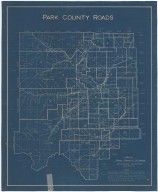
Park County Road Map (portion of Co)
Date
1955 Circa
Description
Park County Road Map (portion of Co) includes Meeteetse Cody Road, Convict Road, Old Dodge Road, Dry Creek Stage Station & Arland
Category - Type
Map-Trail or Road
Title
Park County Map
Date
1961
Description
Park County Map by WY Highway Dept, Planning & Research Div, with US Dept of Commence, Bureau of Public Roads includes township, range, roads, drainage, railroads, post offices, schools, Ag exp station, pipe lines, dwellings, towns, 1950 Co population, 1954 aerial photo 6 sheets
Category - Type
Map-County/Park
Title
Discovery Map of Cody WY and Vicinity
Date
1999
Description
Discovery Map of Cody WY and Vicinity, illustrated map & business guide. Side 1 is a "yellow pages" business listing bordered by business ads. Side 2 includes-color map of Cody & Wapiti Valley East Gate to Yellowstone. Includes streets, airport, named buildings, river, mountains
Category - Type
Map-City/Cody
Title
Powell, WY, Pictorial Map
Date
1999
Description
Powell, WY, Pictorial Map, includes streets, avenues, river, railroad, depictions of buildings and businesses, 1 colored map, by Town Square Graphics
Category - Type
Map-Pictorial
Title
Cody Canal - WY
Date
Undated
Description
Cody Canal - WY from WY Department of Public Land's Carey Act project file, includes Townships 100, 101, 102 & 103, Ranges 51, 52, 53, Shoshone River, location of canal, lateral, creeks, town of Cody, 1 set with 1 sheet paper
Category - Type
Map-Water
Title
Cody Map
Date
Undated
Description
Cody Map by Provident Federal Savings & Loan includes streets, index to building markers, highway, lakes, general information on back
Category - Type
Map-City/Cody
Title
Cody Map
Date
Undated
Description
Cody Map by Provident Federal Savings & Loan includes streets, index to building markers, highway, lakes, general information on back
Category - Type
Map-City/Cody
Title
Pioneer School Building Plan
Date
1906
Description
Pioneer School Building Plan by Vernon L. Drake, 5507, 1 set with 6 sheets blueline paper
Category - Type
Plan/Specification
Title
Park County School District 6 Grade School Building, Cody, WY
Date
1937
Description
Park County School District #6 Grade School, (15 Sheets), Cody, WY
Category - Type
Plan/Specification
Title
Wyoming Game & Fish Dept - Sunlight, Deputy Game Warden Station plan
Date
1955
Description
WY Game & Fish Dept - Sunlight, Deputy Game Warden Station
Category - Type
Plan/Specification
Title
Wyoming Game & Fish Dept Sunlight Basin plan
Date
1955
Description
WY Game & Fish Dept Sunlight Basin
Category - Type
Plan/Specification
Title
Wyoming Game & Fish Commission-District Office Building plan, Cody, WY
Date
1960
Description
WY Game & Fish Commission-District Office Building plan, Cody, WY, plan 399, by Morris D. Kemper, 1 set with 5 sheets vellum
Category - Type
Plan/Specification
Title
Cody Municipal Airport Location & Sections of Proposed Building to House Aircraft Fire & Rescue Truck
Date
1973
Description
Cody Municipal Airport Location & Sections of Proposed Building to House Aircraft Fire & Rescue Truck by Graham & Assoc, Project #218, 1 sheet paper
Category - Type
Plan/Specification
Title
Cody Municipal Airport Terminal Building Addition plan
Date
1973
Description
Cody Municipal Airport Terminal Building Addition by George W. Tresler, 1 sheet paper
Category - Type
Plan/Specification
Title
Cody Municipal Airport Layout Plan
Date
1975
Description
Cody Municipal Airport Layout Plan by Graham & Assoc, Project 353, 1 sheet paper
Category - Type
Plan/Specification
Title
Cody Municipal Airport Layout Plan
Date
1977
Description
Cody Municipal Airport Layout Plan by Graham & Assoc, 3 sheets blueline paper
Category - Type
Plan/Specification
Title
Cody Municipal Airport General Plan
Date
1978
Description
Cody Municipal Airport General Plan by Graham, Dietz & Assoc, Project 6-56-0006-04, 4 sheets paper
Category - Type
Plan/Specification
Title
Cody Municipal Airport Perimeter Fencing Layout Plan
Date
1978
Description
Cody Municipal Airport Perimeter Fencing Layout Plan by Graham & Assoc, Project #265, 7 sheets paper
Category - Type
Plan/Specification
Title
Cody Municipal Airport, Exhibit A
Date
1978
Description
Cody Municipal Airport, Exhibit A by Graham & Assoc, Project #273, 5 sheets paper
Category - Type
Plan/Specification
Title
Powell Municipal Airport Administrative Area Layout Plan
Date
1978
Description
Powell Municipal Airport Administrative Area Layout Plan by Graham, Dietz & Assoc, Project 322, 14 sheets paper
Category - Type
Plan/Specification
Title
Powell Municipal Airport General Plan
Date
1982
Description
Powell Municipal Airport General Plan by Graham, Dietz & Assoc, Project 458, 3 sheets blueline paper
Category - Type
Plan/Specification
Title
EE Faust Regional Airport, Cody, Exhibit A & General Layout Plan
Date
1983
Description
EE Faust Regional Airport, Cody, Exhibit A & General Layout Plan by Graham Dietz & Assoc, 2 sheets paper
Category - Type
Plan/Specification
Title
Frannie Port of Entry, Remodeling for the Physically Handicapped of Wyoming State facilities
Date
1983 Circa
Description
Frannie Port of Entry, Remodeling for the Physically Handicapped of WY State facilities, includes Frannie Port of Entry by Noel Griffith Jr. & Assoc, Gust Johnson, 1 set with 4 sheets blueline paper
Category - Type
Plan/Specification
Title
Park County Map
Date
1938
Description
Park County Map by State Mineral Supervisor Pierre LaFleiche, Drafted by HG Lowman includes oil & gas fields, drainage, township, range, state land, primary & secondary roads WPA Project, 2 sets
Category - Type
Map-County/Park
1-47 of 47
|