|
REFINE
Browse All : Images of Wyoming from 1967
1-49 of 49
Title
East-West Runway Improvements
Date
1967
Description
Plans for East-West runway improvements for Cheyenne Municipal Airport
Category - Type
Plan
Title
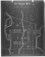
Fort Bridger, 1871-1881
Date
1967
Description
Fort Bridger, 1871-1881 3 Photostats
Category - Type
Military-Fort Bridger
Title
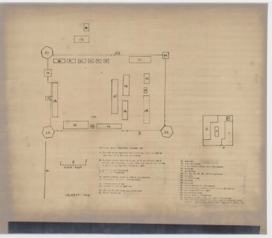
Fort Bridger, 1871-1881
Date
1967
Description
Fort Bridger, 1871-1881 3 Photostats
Category - Type
Military-Fort Bridger
Title
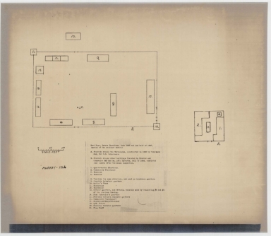
Fort Bridger, 1871-1881
Date
1967
Description
Fort Bridger, 1871-1881 3 Photostats
Category - Type
Military-Fort Bridger
Title
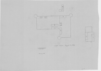
Fort Bridger, 1871-1881
Date
1967
Description
Fort Bridger, 1871-1881 3 Photostats
Category - Type
Military-Fort Bridger
Title
Fort DA Russell/FE Warren AFB, Basic Mission Plan
Date
1967
Description
Fort DA Russell/FE Warren AFB, Basic Mission Plan 3 sheets blueprints
Category - Type
Military-Fort DA Russell
Title
Fort Phil Kearny and Related Sites General Development Plan
Date
1967
Description
Fort Phil Kearny & related sites, General Development Plan 2 copies
Category - Type
Military-Fort Kearny
Title
Fort Reno Plans
Date
1967
Description
Fort Reno Plan 4 sheets, 3 copies NOTE: Access to building plans is restricted.
Category - Type
Military-Fort Reno
Title
Fort Reno Plans
Date
1967
Description
Fort Reno Plan 4 sheets, 3 copies NOTE: Access to building plans is restricted.
Category - Type
Military-Fort Reno
Title
Fort Reno Plans
Date
1967
Description
Fort Reno Plan 4 sheets, 3 copies NOTE: Access to building plans is restricted.
Category - Type
Military-Fort Reno
Title
Fort Reno Plans
Date
1967
Description
Fort Reno Plan 4 sheets, 3 copies NOTE: Access to building plans is restricted.
Category - Type
Military-Fort Reno
Title
Fort Reno Plans
Date
1967
Description
Fort Reno Plan 4 sheets, 3 copies NOTE: Access to building plans is restricted.
Category - Type
Military-Fort Reno
Title
Platte County Map
Date
1967
Description
Platte County Map by WY Highway Dept, Planning & Research Div, with US Dept of Commence, Bureau of Public Roads includes township, range, roads, drainage, railroads, post offices, schools, Ag exp station, pipe lines, dwellings, towns, 1950 Co population, 1956 aerial photo 16-2
Category - Type
Map-County/Platte
Title
Traffic Flow Map of Wyoming
Date
1967
Description
Traffic Flow Map of WY by WY Highway Dept, Planning & Research in cooperation with US Dept of Transportation, Federal Highway Administration, Bureau of Public Roads includes state & US highways, interstates, counties, airfields 2 copies
Category - Type
Map-State
Title
Wyoming Highway Map
Date
1967
Description
Highway Map by WY State Highway Dept, 3 copies
Category - Type
Map-State
Title
Wyoming Highway Map
Date
1967
Description
Highway Map by WY State Highway Dept, 3 copies
Category - Type
Map-State
Title
Big Horn County Greybull Museum and Branch Library preliminary scheme plans and specifications
Date
1967
Description
Big Horn County Museum and Big Horn County Library / Greybull Museum and Greybull Library - Branch preliminary scheme plans and specifications, Big Horn County by John E Toohey, 2 sets
Category - Type
Plan/Specification
Title
Johnson County Library, Kaycee Branch plans and specifications
Date
1967
Description
Johnson County Library, Kaycee Branch plans and specifications, by Richard L Hume, 4 sheets
Category - Type
Plan/Specification
Title
Laramie County Sheriff Department & Jail & Cheyenne Civil Defense Emergency Operatiing Center/Laramie County Courthouse plans, Cheyenne, WY
Date
1967
Description
Laramie County Sheriff Department & Jail & Cheyenne Civil Defense Emergency Operatiing Center/Laramie County Courthouse plans, Cheyenne, WY, by Robert W. Postin & Associates, 1 incomplete set with 7 sheets paper
Category - Type
Plan/Specification
Title
University Pharmacy Building work flow chart & floor plans, location unknown
Date
1967
Description
University Pharmacy Building work flow chart & floor plans, location unknown, by Robert W. Postin, 1 set with 4 sheets paper
Category - Type
Plan/Specification
Title
Upton School Gymnasium, Weston County School Dist 7, Upton, WY
Date
1967
Description
Upton School Gymnasium, Weston County School Dist 7, Upton, WY, by Robert W. Postin & Assoc, comm 1-67, 1 set with 15 sheets blueline paper
Category - Type
Plan/Specification
Title
Veterans Administration Center (VA) Second Floor Plan-Unit A, proposed alterations to building 1-Intensive Care Unit, Cheyenne, WY
Date
1967
Description
Veterans Administration Center (VA) Second Floor Plan-Unit A, proposed alterations to building 1-Intensive Care Unit, Cheyenne, WY, by Robert W. Postin, 1 set with 1 sheet blueline paper
Category - Type
Plan/Specification
Title
Weston Library, Upton Branch specifications, proposed addition plans and plans
Date
1967
Description
Weston County Library, Upton Branch specifications, proposed plans and plans by Adrian Malone & Assoc, proposed-3 sets with 2 sheets, plans-10 sheets
Category - Type
Plan/Specification
Title
Wyoming Game & Fish Commission-Como Bluffs Fish Hatchery Apartment addition & remodeling plan, Rock River, WY
Date
1967
Description
WY Game & Fish Commission-Como Bluffs Fish Hatchery Apartment addition & remodeling plan, Rock River, WY, no plan number, drawn by Morris D. Kemper, 1 set with 2 sheets tissue paper
Category - Type
Plan/Specification
Title
Wyoming Game & Fish Commission-Como Bluffs Fish Hatchery plan, Rock River, WY
Date
1967
Description
WY Game & Fish Commission-Como Bluffs Fish Hatchery plan, Rock River, WY, plan 510, drawn by AS Pappas, 1 set with 5 sheets tissue paper
Category - Type
Plan/Specification
Title
Wyoming Game & Fish Commission-District Office Building plan, Casper, WY, plan 500
Date
1967
Description
WY Game & Fish Commission-District Office Building plan, Casper, WY, plan 500, drawn by Morris D. Kemper, 1 set with 2 sheets vellum
Category - Type
Plan/Specification
Title
Wyoming State Boys School/Industrial Institute Roof Replacement Plan
Date
1967
Description
WY State Boys School/Industrial Institute Roof Replacement Plan by George W Tresler & Assoc, commission 377, 1 set with 1 sheet blueline paper
Category - Type
Plan/Specification
Title
Cheyenne Block 394, Lot 5 and West 34' Lot 6
Date
1967
Description
Cheyenne Block 394, Lot 5 and West 34' Lot 6
Category - Type
Map-City/Cheyenne
Title
Cole School Drainage
Date
1967
Description
Cole School Drainage
Category - Type
Map-City/Cheyenne
Title
Husky Industrial Addition plat
Date
1967
Description
Husky Industrial Addition plat
Category - Type
Map-City/Cheyenne
Title
Husky Industrial Addition plat
Date
1967
Description
Husky Industrial Addition plat
Category - Type
Map-City/Cheyenne
Title
Kornegay Homesites 2nd Filing, Tract 9 Storey Acres plat
Date
1967
Description
Kornegay Homesites 2nd Filing, Tract 9 Storey Acres
Category - Type
Map-City/Cheyenne
Title
Survey Map Township 13 Range 66, Section 9 s/2 Laramie County Community College
Date
1967
Description
Township 13 Range 66, Section 9 s/2 LCCC
Category - Type
Map-City/Cheyenne
Title
MooreHaven Heights Block 10, Lot 2 Block 3, Pershing Heights Addition
Date
1967
Description
MooreHaven Heights Block 10, Lot 2 Block 3, Pershing Heights Addition
Category - Type
Map-City/Cheyenne
Title
MooreHaven Heights Block 10, Lot 2 Block 3, Pershing Heights Addition
Date
1967
Description
MooreHaven Heights Block 10, Lot 2 Block 3, Pershing Heights Addition
Category - Type
Map-City/Cheyenne
Title
MooreHaven Heights Block 10, Lot 2 Block 3, Pershing Heights Addition
Date
1967
Description
MooreHaven Heights Block 10, Lot 2 Block 3, Pershing Heights Addition
Category - Type
Map-City/Cheyenne
Title
MooreHaven Heights Block 10, Lot 2 Block 3, Pershing Heights Addition plat
Date
1967
Description
MooreHaven Heights Block 10, Lot 2 Block 3, Pershing Heights Addition plat
Category - Type
Map-City/Cheyenne
Title
MooreHaven Heights Block 10, Lot 2 Block 3, Pershing Heights Addition plat
Date
1967
Description
MooreHaven Heights Block 10, Lot 2 Block 3, Pershing Heights Addition plat
Category - Type
Map-City/Cheyenne
Title
MooreHaven Heights Block 10, Lot 2 Block 3, Pershing Heights Addition plat
Date
1967
Description
MooreHaven Heights Block 10, Lot 2 Block 3, Pershing Heights Addition plat
Category - Type
Map-City/Cheyenne
Title
Mountain States T&T Co. Section 27 Township Range 65
Date
1967
Description
Mountain States T&T Co. Section 27 Township Range 65
Category - Type
Map-City/Cheyenne
Title
Survey Map Township 13 Range 66, Section SW/4 SW/4 Fort Cheyenne Development Co. and Highway right of way Sketch
Date
1967
Description
Township 13 Range 66, Section SW/4 SW/4 Fort Cheyenne Development Co. and Highway R/W. Sketch
Category - Type
Map-City/Cheyenne
Title
MooreHaven Heights Block 1, Lot 2, Block 3, Lot 7, property survey, Pershing Heights Addition
Date
1967
Description
MooreHaven Heights Block 1, Lot 2, Block 3, Lot 7, property survey, Pershing Heights Addition
Category - Type
Map-City/Cheyenne
Title
Wyoming Land Status Map
Date
1967
Description
WY Land Status Map, Paper
Category - Type
Map-State
Folder or Collection Name
Forts & Camps - Fort Bridger - Carter Complex
Image Title
POST TRADER'S STORE, MESS HOUSE (RIGHT), SCHOOLHOUSE( LEFT) - FORT BRIDGER, WY( STONE BUILDINGS W/ RED ROOFS, TREES IN YARD, SNOW ON GROUND), 1967
Coverage or Location
Wyoming
Date
1967
Folder or Collection Name
Forts & Camps - Fort Bridger - General View #3 of 5
Image Title
OIL HOUSE, AHLQUIST PROPERTY - FORT BRIDGER, WY ( STONE BUILDING W/ WOODEN ADDITION AND RED ROOF), 1967, COLORED PHOTO BY DENNIS LOOSE
Coverage or Location
Wyoming
Date
1967
Folder or Collection Name
Forts & Camps - Fort Bridger - General View #3 of 5
Image Title
SCHOOL HOUSE - FORT BRIDGER STATE HISTORIC SITE, WY ( 2 SMALL, DIFFERENT HIGHT BUILDIGS, ONE MADE OF STONE AND ANOTHER MADE OF WOOD, SNOW ON GROUND, OTHER BUILDIGS IN BACKGROUND), 1967, COLORED PHOTO BY DENNIS LOOSE
Coverage or Location
Wyoming
Date
1967
Folder or Collection Name
Forts & Camps - Fort Bridger - General View #3 of 5
Image Title
OIL HOUSE, PROPERTY OF DAHLQUIST - FORT BRIDGER, WY( CLOSE UP,SIDE OF STONE BUILDING W/ ENTRANCE, RED ROOF, PATCHES OF SNOW ON GROUND), 1967, PHOTO BY DENNIS LOOSE
Coverage or Location
Wyoming
Date
1967
Folder or Collection Name
Forts & Camps - Fort Bridger #1 of 3
Image Title
QUARTERS ORIGINALLY AT FORT BRIDGER, WY ( 2-STORY HOUSE W/ COUPLE OF TREES AND CROOKED FENCE IN FRONT), 1967,COLORED PHOTO BY DENNIS LOOSE, SEE ALSO BLACK AND WHITE COPY
Coverage or Location
Wyoming
Date
1967
Folder or Collection Name
Forts & Camps - Fort Bridger #1 of 3
Image Title
RESTORED OFFECERS' QUARTERS - FORT BRIDGER, WY ( WOMAN,MRS. LOOSE, STANDING IN FRONT OF A HOUSE W/ HUGE TREES IN YARD AND FENCE, LOTS OF SNOW ON GROUND), 1967, COLORED PHOTO BY D. LOOSE
Coverage or Location
Wyoming
Date
1967
1-49 of 49
|


