|
REFINE
Browse All : Images by LC Bishop from 1959-1960
1-7 of 7
Title
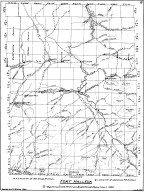
Fort Bridger Map
Date
1959-1960
Description
04 Fort Bridger Map by LC Bishop, includes townships, ranges, rivers, creeks, roads, trails, pony express stations, graves, 2 paper copies
Category - Type
Military-Fort Bridger
Title
Fort DA Russell Map
Date
1959-1960
Description
06 Fort DA Russell Map, by LC Bishop, includes townships, ranges, rivers, creeks, roads, trails, pony express stations, graves, drawing of Camp Walbach, drawing of Pedestal Rock by Brt Major Williams, 2 paper copies
Category - Type
Military-Fort DA Russell
Title
Fort Halleck Map
Date
1959-1960
Description
08 Fort Halleck Map, by LC Bishop, includes townships, ranges, rivers, creeks, roads, trails, pony express stations, graves, stage stations, abandoned railroad stations, 2 copies-1 sheet vellum, 1 sheet paper
Category - Type
Military-Fort Halleck
Title
Fort Halleck Map
Date
1959-1960
Description
08 Fort Halleck Map, by LC Bishop, includes townships, ranges, rivers, creeks, roads, trails, pony express stations, graves, stage stations, abandoned railroad stations, 1 sheet vellum, 4 paper copies
Category - Type
Military-Fort Halleck
Title
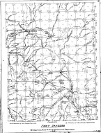
Fort Sanders Map
Date
1959-1960
Description
07 Fort Sanders Map by LC Bishop, includes townships, ranges, rivers, creeks, roads, trails, pony express stations, graves, stage stations, abandoned railroad stations
Category - Type
Military-Fort Sanders
Title
Landers Cut Off, East & West Section Map
Date
1959-1960
Description
05 Landers Cut Off, East & West Section Map by LC Bishop, includes townships, ranges, rivers, creeks, roads, trails, pony express stations, graves, 2 copies
Category - Type
Map-Trail or Road
Title
Landers Cut Off, East & West Section Map
Date
1959-1960
Description
05 Landers Cut Off, East & West Section Map by LC Bishop, includes townships, ranges, rivers, creeks, roads, trails, pony express stations, graves, 1 sheet vellum, 6 paper copies
Category - Type
Map-Trail or Road
1-7 of 7
|


