|
REFINE
Browse All : Images of RR Map Case 02 Drawer 01 and 1
1-13 of 13
Title
Cheyenne Birds Eye View Map
Date
1870
Description
Cheyenne Birds Eye View Map includes buildings railroad, creek, fort (1 reprint, compliments of North Cheyenne Development Co) 3 copies
Category - Type
Map-Birds Eye View/Cheyenne
Title
Cheyenne Birds Eye View Map
Date
1870
Description
Cheyenne Birds Eye View Map includes buildings railroad, creek, fort (1 reprint, compliments of North Cheyenne Development Co) 3 copies
Category - Type
Map-Birds Eye View/Cheyenne
Title
Johnson County Map
Date
1936-1951
Description
Johnson County Map by State Mineral Supervisor Pierre LaFleiche, drafted by H.G. Lowman includes oil & gas fields, drainage, township, range, state land, primary & secondary roads WPA Project 109, 9/1936, rev 1951, 1 set blueline paper, 2 sets vellum
Category - Type
Map-County/Johnson
Title
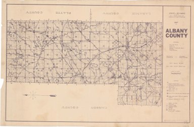
Albany County Map
Date
1937-1946
Description
Albany County Map by State Mineral Supervisor Pierre LaFleiche, drafted by HG Lowman includes oil & gas fields, drainage, township, range, state land, primary & secondary roads WPA Project #6008 1/1937, 1946 Blueline
Category - Type
Map-County/Albany
Title
Johnson County Map
Date
1946
Description
Johnson County Map by WY Highway Dept Planning & Research Div, US Dept of Commerce, Bureau of Public Roads includes buildings, air routes, township, range, roads, natural features, drainage, railroads, towns
Category - Type
Map-County/Johnson
Title
Natrona County Map
Date
1946
Description
Natrona County Map by WY Highway Dept Planning & Research Div, US Dept of Commerce, Bureau of Public Roads includes buildings, air routes, township, range, roads, natural features, drainage, railroads, towns 2 sheets, 2 sets
Category - Type
Map-County/Natrona
Title
BLM Public Lands Guide, Natrona Unit, WY
Date
1968
Description
BLM Public Lands Guide, Natrona Unit, WY. Side 1 inc Casper and vicinity, land ownership boundaries, towns & cities, railroad lines buildings, air fields, oil and gas wells, mines or quarries, power line, pipe line, reservoirs, rivers lakes, habitat for native wildlife, information guide contacts. Side 2 inc Yellowstone N.P., Grand Teton N.P., Wind River Indian Reservation, National Forest Lands, BLM & private, country boundaries, roads, rivers, cities.
Category - Type
Map-Regional
Title
Albany County Map
Date
1970
Description
Albany County Map by Laramie\Albany County Planning Office includes roads, railroads, ditches, gravel pits, index to landowners, township, range, towns
Category - Type
Map-County/Albany
Title
Albany County Map
Date
1970
Description
Albany County Map by Laramie\Albany County Planning Office includes roads, railroads, ditches, gravel pits, index to landowners, township, range, towns
Category - Type
Map-County/Albany
1-13 of 13
|


