|
|
REFINE
Search Results: All Fields similar to 'Mineral supervisor' and Where equal to '1'
1-8 of 8
Title
Natrona County Map
Date
1936-1947
Description
Natrona County Map by State Mineral Supervisor Pierre LaFleiche, Drafted by H.G. Lowman includes oil & gas fields, drainage, township, range, state land, primary & secondary roads WPA Project 109 8/1936, 1947
Category - Type
Map-County/Natrona
Title
Natrona County Map
Date
1936-1947
Description
Natrona County Map by State Mineral Supervisor Pierre LaFleiche, Drafted by H.G. Lowman includes oil & gas fields, drainage, township, range, state land, primary & secondary roads WPA Project 109 8/1936, 1947
Category - Type
Map-County/Natrona
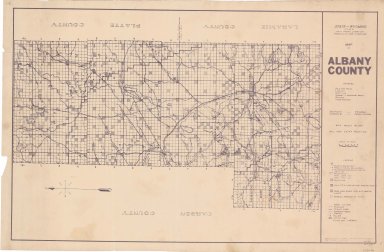
Title
Albany County Map
Date
1937-1946
Description
Albany County Map by State Mineral Supervisor Pierre LaFleiche, drafted by HG Lowman includes oil & gas fields, drainage, township, range, state land, primary & secondary roads WPA Project #6008 1/1937, 1946 Blueline
Category - Type
Map-County/Albany
Title
Albany County Map
Date
1937-1951
Description
Albany County Map by State Mineral Supervisor Pierre LaFleiche, drafted by HG Lowman includes oil & gas fields, drainage, township, range, state land, primary & secondary roads WPA Project #6008 1/1937, 1946, 1951, 1 set blueline paper, 2 sets vellum, 1 set mylar
Category - Type
Map-County/Albany
Title
Johnson County Map
Date
1936-1951
Description
Johnson County Map by State Mineral Supervisor Pierre LaFleiche, drafted by H.G. Lowman includes oil & gas fields, drainage, township, range, state land, primary & secondary roads WPA Project 109, 9/1936, rev 1951, 1 set blueline paper, 2 sets vellum
Category - Type
Map-County/Johnson
Title
Natrona County Map
Date
1936-1951
Description
Natrona County Map by State Mineral Supervisor Pierre LaFleiche, Drafted by HG Lowman includes oil & gas fields, drainage, township, range, state land, primary & secondary roads WPA Project 109 8/1936, 1947, 1951, 1 set blueline paper, 1 set vellum
Category - Type
Map-County/Natrona
1-8 of 8
|