Who What Where WhenREMOVE |
REFINE
Search Results: All Fields similar to 'Mineral supervisor' and Where equal to 'Niobrara County'
1-4 of 4
Title
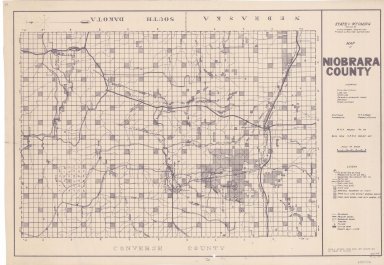
Niobrara County Map
Date
1936-1945
Description
Niobrara County Map by State Mineral Supervisor Pierre LaFleiche, Drafted by HG Lowman includes oil & gas fields, township, range, state land, primary & secondary roads WPA Project 6008 1936, 1945
Category - Type
Map-County/Niobrara
Title
Niobrara County Map
Date
1936-1951
Description
Niobrara County Map by State Mineral Supervisor Pierre LaFleiche, Drafted by HG Lowman includes oil & gas fields, drainage, township, range, state land, primary & secondary roads WPA Project 109, 6/1936, rev 1945, rev 1951, 1 set blueline paper, 2 sets vellum
Category - Type
Map-County/Niobrara
Title
Niobrara County Map
Date
1936
Description
Niobrara County Map by State Mineral Supervisor Pierre LaFleiche, Drafted by HG Lowman includes oil & gas fields, township, range, state land, primary & secondary roads WPA Project #6008, 2 sets, 1 set is taped & cracking
Category - Type
Map-County/Niobrara
1-4 of 4
|